-2")
Does the tropospheric pattern change have staying power?
Winter has arrived. The first shot of arctic air in the young winter season will arrive this week — and it will be brutal, with temperatures in the single digits and teens on both Monday and Tuesday. This cold air will be short-lived, however, as temperatures will warm to above average late this week, as a mid and upper level atmospheric ridge starts to build back over the Eastern US.
Subtropical jet disturbances will be ejecting out of the Southwest United States later this week as the pattern ramps up in activity. The first of these disturbance arrives Friday and Saturday. At the surface, the primary low tracks into the Great Lakes region, while another secondary low forms over the Mid-Atlantic. A warm antecedent airmass and a lack of high latitude blocking should put a serious cap on any wintry weather potential; although some frozen precipitation remains possible in the far interior and higher elevations.
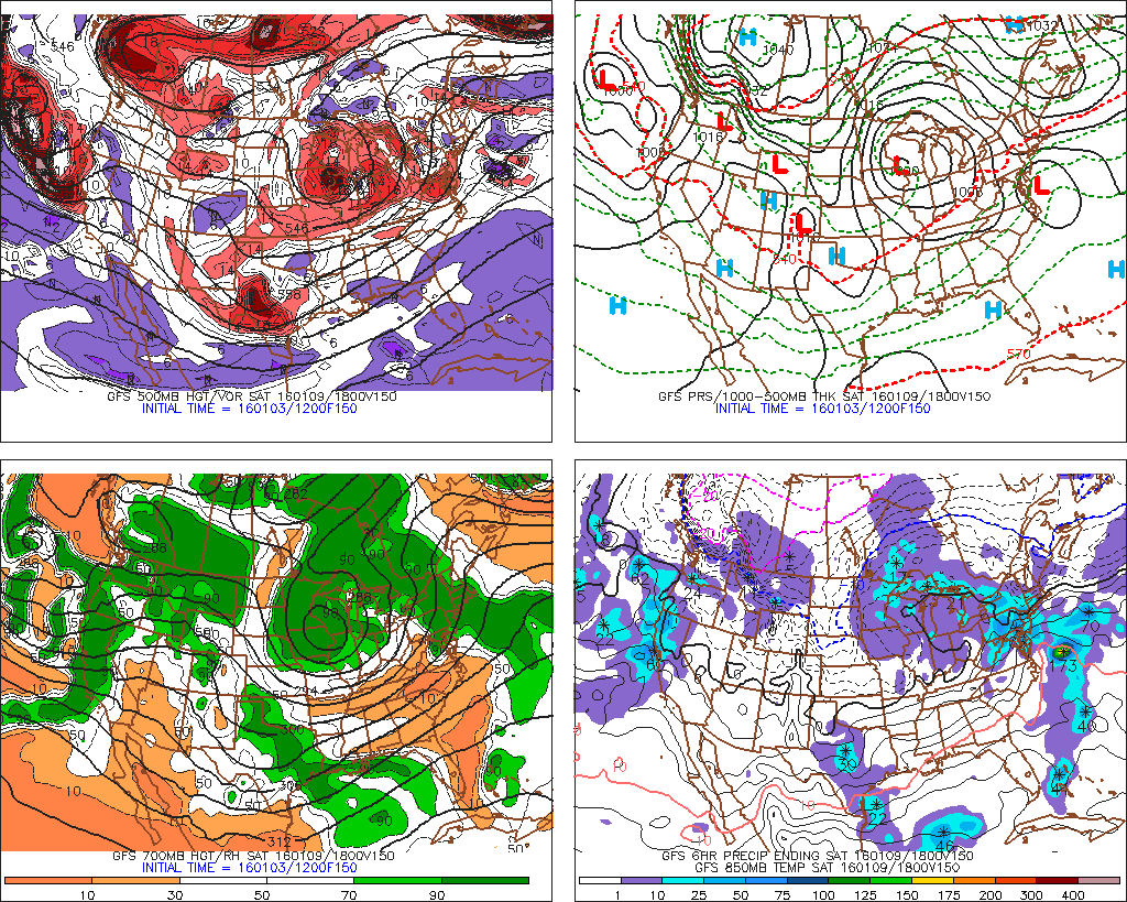
The GFS showing precipitation in region with secondary low for January 9th (Image Credit: PSU Ewall)
A much larger east coast storm is still possible next Sunday and Monday (Jan 10-11th), with another subtropical jet disturbance. Solutions have varied on each model run on this storm threat, which is expected at this range. Individual nuances in how each model handles the associated energy create major differences in their evolutions. A slower to phase or interaction between the subtropical jet and incoming northern stream could mean a storm that skirts seaward.. An earlier phase could result in a much bigger storm impacting the region.
Regardless, the antecedent airmass again remains poor for winter weather. The coldest air remains behind this system — and likely won’t be able to become entrenched in the storm to produce winter weather in our area, unless the modeled pattern evolution changes.
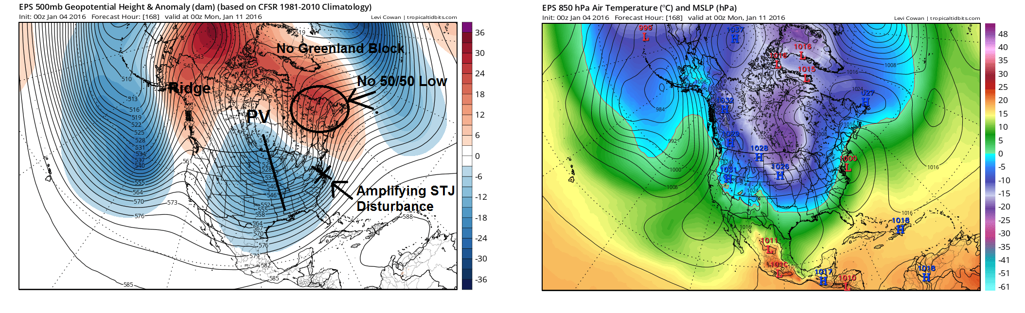
The Euro Ensemble Mean analysis for January 10th-11th. A major snowstorm is very unlikely for the I-95 corridor, without a Greenland Block or 50/50 low.
Much of the uncertainty regarding this storm system relates back to the positioning of a Central US trough. This trough begins to phase with subtropical jet stream energy moving over the Southeast US. As low pressure begins to intensify near the East Coast, the artic boundary is still our west of the region. A Greenland Block or upper-level low over Southeast Canada (also known as 50/50 low) is not currently present on any operational or ensemble guidance. Those features would support more confluence over the Northeast with cold high pressure to the north and would prevent the storm from tracking to our west. Instead, we have a surface high pressure near Newfoundland, causing more easterly or southeasterly winds off the warmer ocean waters.
There have been many various solutions from operational models and ensembles for this storm system. So, clearly, uncertainty is quite high. Temperatures will likely average below normal for the second week in January — and behind the aforementioned storm system, polar and arctic air should pour into the United States. The cold could be historic for parts of the nation.
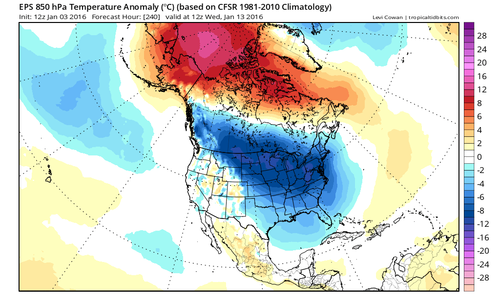
The Euro ensemble mean showing artic air with 850mb temperature negative anomalies invading the much of the United States by January 13th.
The subtropical jet sill looks active for following two weeks thanks to the El Nino and active MJO (Madden Julian Oscillation). The ensemble guidance still indicates some high-latitude blocking will persist and also suggests the polar vortex will be stretched out over Hudson Bay and Southeast Canada. This will support more sustained cold air and possibly anyone of the subtropical disturbances to amplify and phase into a winter storm for parts of the East Coast for Jan 15th-20th period. Specifics remain extremely muted at this time.
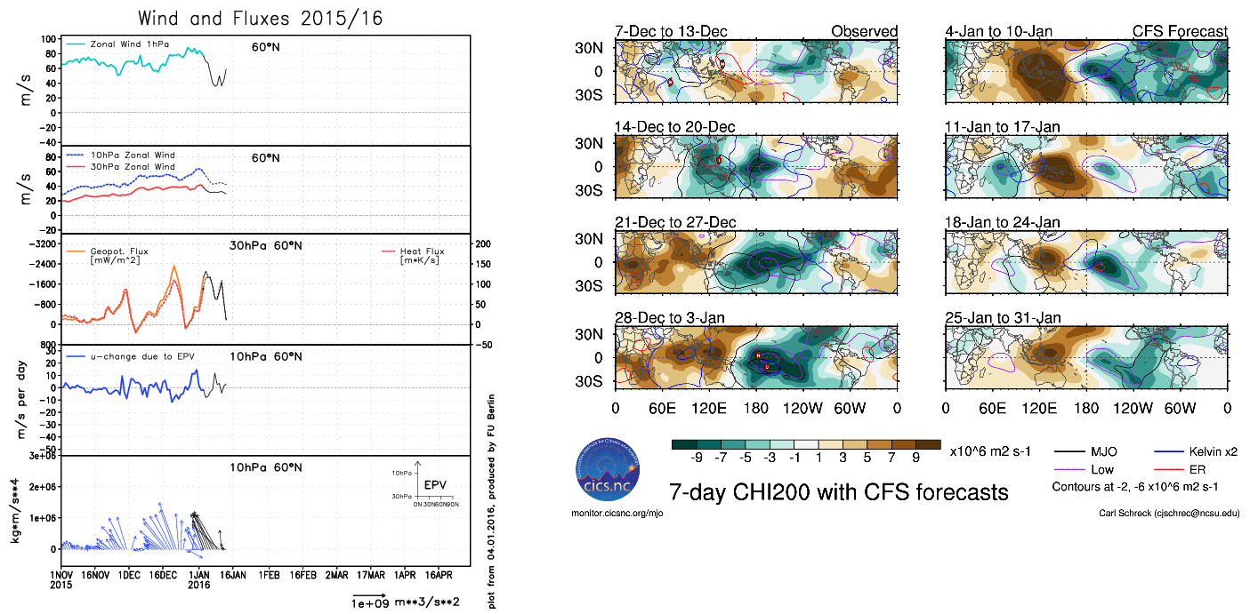
Left image: The ECMWF showing no signifcant decrease zonal winds or more poleward change in EPV during the next 10 days. Right image: CFSv2 showing tropical forcing near the dateline.
What is also becoming increasingly uncertain for us, is how long this high-latitude blocking pattern will last. So far, that atmospheric pattern is being supported and driven by changes occurring in the troposphere –the record-breaking anomalous Kara Sea ridge at 500mb, as well as more favorable MJO or tropical forcing in the Pacific. There are currently no signs from the model guidance of a Sudden Stratospheric Warming occurring over the next few weeks. This would help sustain high-latitude blocking into later this month. However, our moderate-strong Nino with +QBO analogs from our winter forecast, do support more high latitude blocking in February.
So, over the next few weeks, we anticipate that winter will make its arrival, most likely in the form of very cold temperatures later this month. But the longevity of that cold and any snowstorms with it remains extremely questionable. Stay tuned for more premium updates this week; including long range updates and information on any storm threats through January.