-2")
Light accumulating snow possible today and tonight
It appears this weekends coastal storm has a few more tricks up its sleeve. After forecast models indicated the storm had a chance of significantly impacting the area, the trend was decidedly seaward over the past few days. The past 24 hours, however, have seen a steady trend northwestward with the precipitation shield, enough to offer up impacts for our area later today and tonight.
While the center of low pressure will pass hundreds of miles to our south and east, light precipitation associated with the storm system – and the overhead trough – will spread northeastward from the Mid Atlantic into our area today. Thermal profiles will support snow, albeit light, after the atmosphere moistens up enough so that precipitation can reach the ground. Initially, radar may show precipitation, but dry air will win the battle and prevent steady snow.
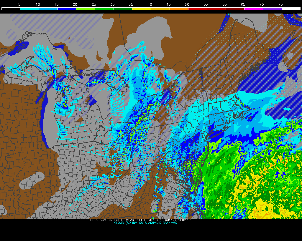
Model show a period of snow later today and tonight as a storm passes by offshore.
The airmass moistens up fastest along Southern and Eastern areas today, and the steadiest precipitation rates are expected there as well. While temperatures are slightly more borderline, it appears those areas will have the best shot for light snow today, with accumulations of 1/2 to 1″ possible. The best chance for this? In parts of Southeast NJ, The NJ Shore, and Long Island.
Closer to the NYC Metro, forecast models are in good agreement that light precipitation will offer up the potential for up to 1/2″ of snow accumulation. But the snow will be more of a nuisance or “conversational” event in those areas. Farther south and east, roads are likely to become slick and slippery for a period of time. If you’re traveling, be careful and do so slowly.
The storm system departs later tonight, with blustery and cold air filtering in to the area. The arctic airmass behind this storm system is associated with a piece of the Polar Vortex over Southeast Canada, and temperatures will fall into the teens and 20’s with a stiff west/northwest wind on Monday.