-2")
Large, Complex Storm Shaping up for Monday and Tuesday
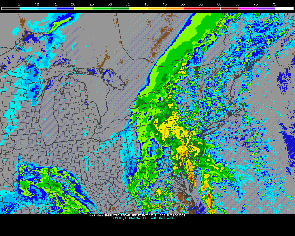
After bitter and record-breaking cold this weekend, attention turns to another storm for tomorrow. This will be a large, complex storm system that will impact the region starting at around Noon. Low pressure will organize over the Southeast United States on Monday, as high pressure slides out to sea. This combination will push a warm front northward through the Mid-Atlantic region during the day tomorrow. Light snow is likely to spread from southwest to northeast during the afternoon hours.
The NAM model showing light snow overspreading for region tomorrow afternoon (PSU E-Wall)
Snow will fall lightly to moderately at times. Generally, 1-3″ of snow is expected between Noon and 4-6pm (perhaps lasting as long as 7pm for NW NJ where locally 3-4″ is possible), before a mix with and changeover to freezing rain and then rain is likely to occur over the region, with lesser amounts in Suffolk County and the NJ Coast (see the map below). This is because southeast winds will cause temperatures to rise above freezing into the middle 30s. Freezing rain may still last for about an hour or so, given that waters are quite cold, so onshore flow won’t warm us up as quickly as usual. Additionally, roads are quite cold, so 33F and plain rain falling could then freeze on the roadways. Further north and west, the aforementioned effects are amplified. A changeover to freezing rain is more likely to occur and be sustained tomorrow evening, as cold air near the surface will be slower to leave. In these areas, temperatures will likely remain at or below freezing until later in the evening or the overnight hours. Roadways will be slick with icing likely for the interior locations, and even somewhat for coastal areas as well, though not the same extent as the interior. The worst of the snow and ice could be during the PM Rush-Hour, so leaving extra time and having ice scrapers may be wise.
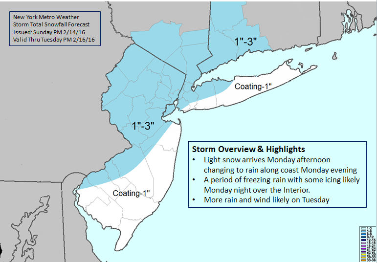
Our snowfall totals forecast with a brief storm overview and highlights
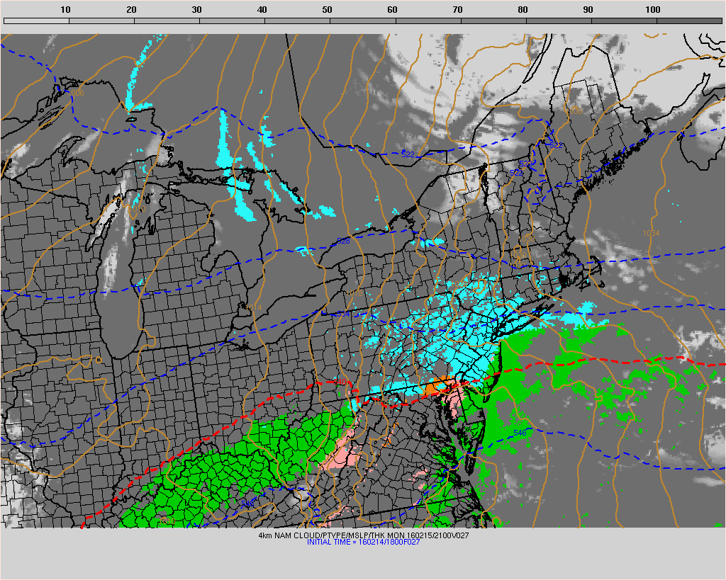
A changeover to plain rain is expected for most of the region by early Tuesday morning. As the warm front lifts northward through the region, temperatures might soar into the low to mid 50s tomorrow (a bit cooler in the interior), which will be an over 50-degree temperature change in about a 48-hour period! Low pressure will then move north and track west of the region on Tuesday afternoon. A strengthening southerly low-level jet will cause more rain to develop by the afternoon hours, after an initial dry-slot. Precipitable values over 1.00″ support this rainfall to be heavy at times. Rainfall totals of 1 to 3 inches are possible for parts of the area. Flash flooding of low-lying or poor drainage areas are possible.
The NAM showing strong southeast surface winds into and along the coastline Tuesday evening (PSU E-Wall)
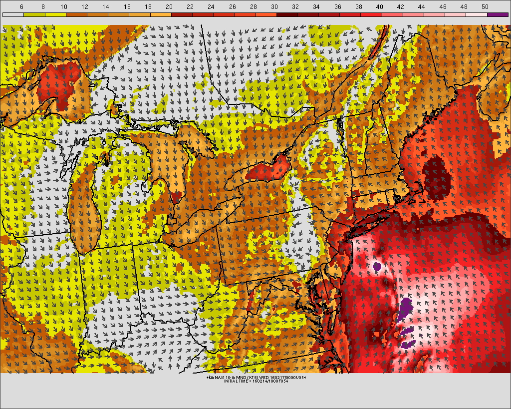
Latest models are showing winds at 950mb-975mb of 50kts. These winds are just 1000-2000 feet above surface. Models show a low-level inversion or stable temperature profile, that will likely keep these winds from mixing frequently down to the surface. However, heavy rain could cause help bring winds with gusts near or over 40mph for isolated areas, especially near the coast. This will be monitored as we get closer. This storm will be moving out of the region on Tuesday night with leftover rain or wet snow showers into Wednesday.
This article was written and edited by Miguel Pierre and Doug Simonian