-2")
(Premium) Will High-Latitude Blocking Bring Chilly Temperatures and More Rain Next Week?
Since the breakdown of stratospheric polar vortex more high-latitude blocking has become common the last few weeks. Model and ensemble guidance are again showing blocking returning again for next week. But will it give pattern change featuring just below average temperatures? Or will a parade of systems coming out the Pacific, cause the Southeast ridge to build more?
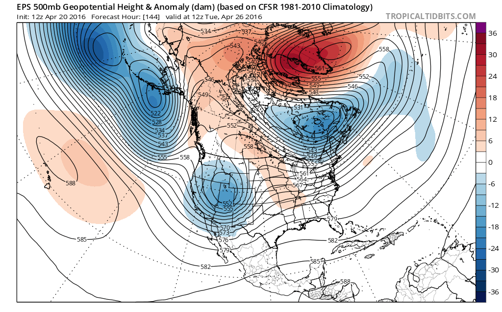
The current guidance has a very impressive -NAO block near Greenland and the Davis Strait. A ridge over Western Canada is also forecast with a split flow out West. This pattern will lead to large, anomalous upper-level low to come together over Southeast Canada. Near the surface, confluence underneath this upper-level low, will support a frontal boundary to move south from over Northern New York State and New England early next week. High temperatures behind this front are in the 50s and 40s, well below average for this time of year.
The GEFS showing blocking over Greenland with and upper-level over Southeast Canada.
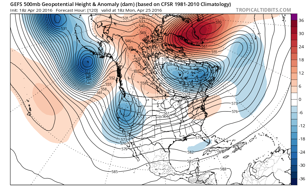
As the -NAO ridge retrogrades into the Hudson Bay region, this will force the upper-level low over Southeast Canada to dive south during the middle of next week. At the same the Southeast ridge will be building through next week. There is some uncertainty where the front will be each day next week. Temperatures ahead of this front may rise to above average early next week. However, currently ensemble guidance seem to support the front further south, sometime during the middle of next week, with below normal temperatures. However, the ensemble guidance shows some moderation with temperatures occurs with -NAO weakening later in the week.
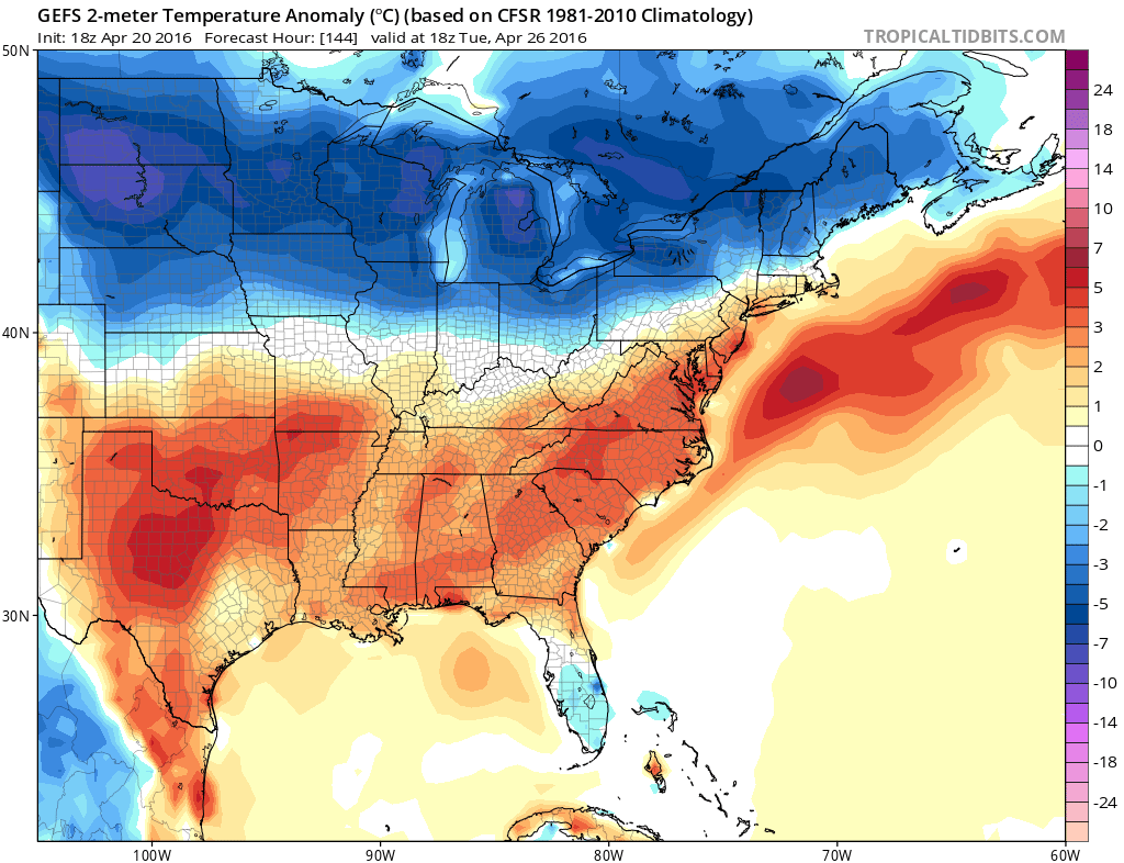
The GEFS showing below normal temperatures next Tuesday with backdoor cold front just north of region.
In addition, there will be number of waves of low pressure running west to east along this boundary over next few weeks. These waves could much need rainfall to region depending on the exact track of these waves. The first of these waves may arrive by Monday night and Tuesday. These waves could also force the front lift back north and south a number of times next week. An active subtropical jet will result in troughs digging deep over Southwest US. Thus supporting the ridge over the Southeast Ridge to build again towards the end this month and into at least early May. Therefore more above average temperatures appear to have a higher probability of occurring at that period. But we still have to monitor, some confluence with a trough over Southeast Canada, supporting high pressure to the northeast of the region with more onshore winds for a few days.
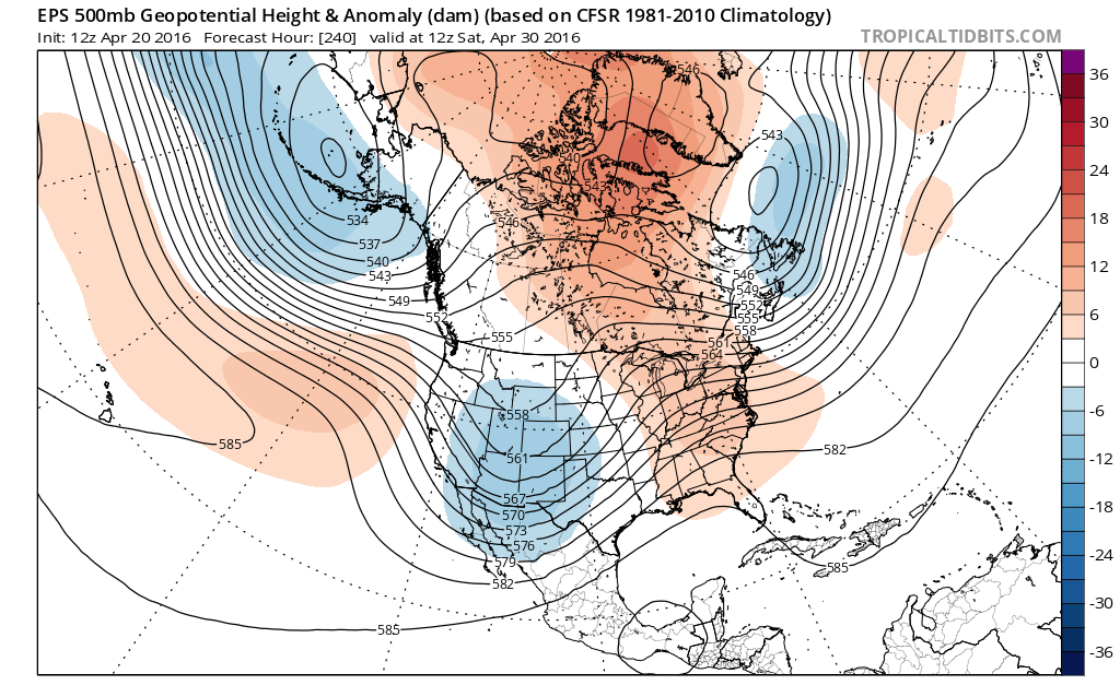
Euro ensembles showing a trough over Western US causing a ridge to build over more the Great Lakes and Northeast by the end of the month
For our long-range forecast we posted late yesterday, we had the first two weeks will be near average for much of the area, closer to New York City. Then we have above average temperatures with low to moderate confidence returning during week 3 in May. Check out the video discussion on the long-range as well.
At this time, we believe that it’s unlikely the Pacific pattern will support any sustained below normal temperatures for much of the region. The high-latitude blocking pattern will likely be forced to breakdown and warmer temperatures may return sporadically. Check back at the long-range forecast page for another update on Friday.