-2")
Premium: Another ULL next week, warm temperatures follow
It’s May 11th, which means it’s getting in the late meteorological Spring season. Many of us often look forward to even warmer weather as we approach Memorial Day weekend and the beginning of meteorological summer. But the seasonal trends with blocking causing cool air intrusions are continuing over the last couple weeks, with omega blocking becoming a dominant presence. Now some high-latitude blocking is returning again for another cooler week of weather. But how cool will it actually be? And when will warmer weather return? We discuss more details on the overall pattern evolution for the rest of this month.
We start with a -EPO blocking ridge over Alaska. Shortwave energy coming downstream of this ridge will phase into a closed upper-level low over the Great Lakes later this week. Initially, this will cause heights to build over the Northeast. At the surface, high pressure will build over the Western Atlantic. More southerly flow around this high pressure will cause temperatures to rise near or slightly above normal for this coming Wednesday and Thursday.
However, a -NAO block near Greenland will be enhanced by an upper-level low currently over Southeast Canada. This -NAO block will be retrograding over the Davis Strait. This will allow the initial upper-level low to lift out of Southeast Canada. But this will force the Great Lakes upper-level low to become anomalously strong and then elongate into the Northeast and Southeast Canada. Just to note, this is the pattern evolution that often leads to snowstorms along the East Coast during the winter season.
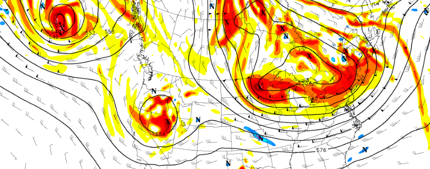
ECMWF Ensemble Mean showing a large upper-level low encompassing much of the Central and Eastern United States with high -latitude blocking
A series of frontal boundaries and shortwaves coming from this upper-level low will move through the region on Friday and Saturday. These systems will provide lift and run into moist and unstable atmosphere, thus bringing a chance of showers and thunderstorms. Then cooler airmasses will follow behind these systems Saturday night. On Sunday, despite more sunshine, high temperatures will likely be in the lower to middle 60s, which is several degrees below normal.
The upper-level low settles into the region early next week. A dry west or northwest flow is likely underneath this upper-level low. Nighttime low temperatures could be lower to middle 40s in New York City and 30s for many of the suburbs. A late-season frost not out of the question for some interior valleys and pine barrens if we see clear skies and calm winds. Daytime high temperatures will be in the lower to middle 60s. These temperatures are much cooler normal for this time year and could come close to record lows over the Northeast.
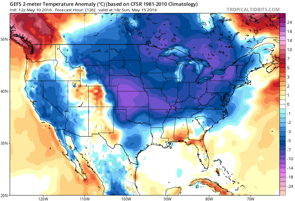
GEFS showing much below normal temperatures for much of the Central and Eastern United States early next week
However, later in the week, the high-latitude blocking begins to break down. The -EPO block retrogrades out of the Alaska region. A trough then starts to dig into Southwest United States and heights start building into the Eastern United States. Initially there is some resistance to high heights returning to the Northeast with an upper-level low in Southeast Canada. But after the -NAO block retrogrades into Central Canada and weakens, this will allow the upper-level low to lift out of Southeast Canada.
This should aid in the development of moderating temperatures as we head into the second half of next week, with above average temperatures toward the end of the month. In previous long-range discussions and articles, we showed how May analogs with decaying strong El Nino event and +PDO supported warmer temperatures for Northeast on average for May. Current ensemble and weeklies appear to be trending in that direction.
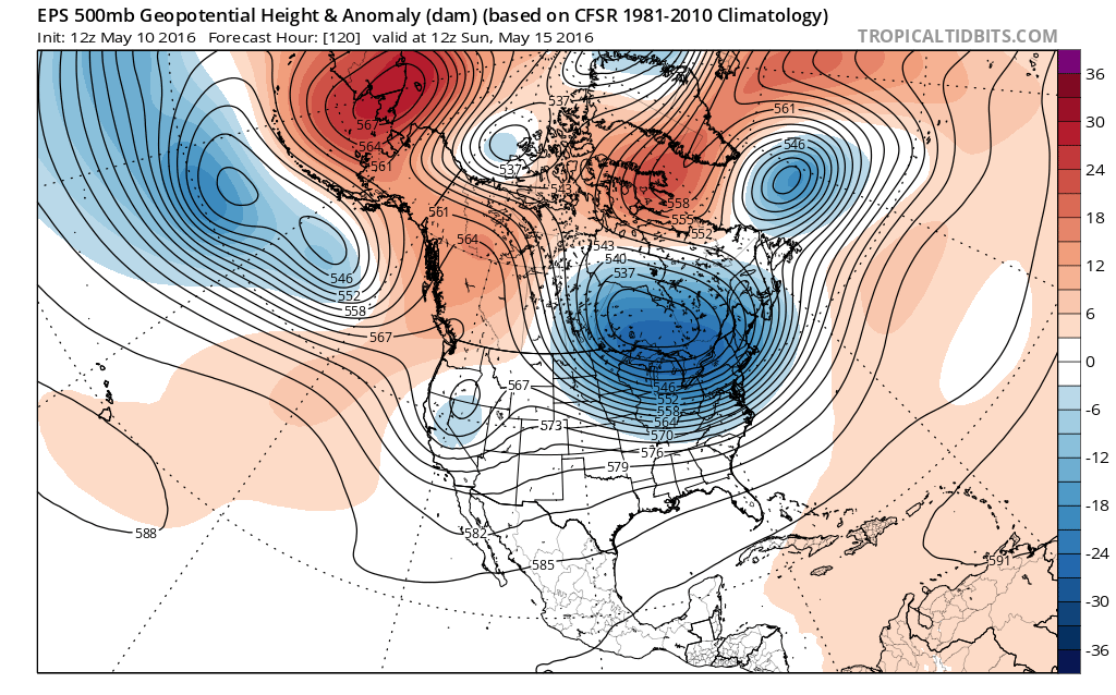
GEFS showing -PNA pattern developing with trough over Southwestern US with height building further east and +AO/NAO after May 20th
As discussed in previous posts, many of those analogs also had a -AO/NAO, which resembles what we’ve seen so far. Additionally, the analogs had a split-flow out west with a trough over the southwest, a ridge in western Canada, and a ridge over the East, which also closely resembles what the medium-range guidance is showing — giving the analogs more validity.
However, what has helped keep us chilly, at least to this point, is that the -AO/NAO pattern has acted a bit differently in keeping plenty of troughs in SE Canada and muting and ridge that tries to build — the analogs did not have the trough in SE Canada. Fortunately, current guidance shows a +AO/NAO returning with a polar vortex over these regions, so troughiness won’t be as profound over the aforementioned areas. This further supports a ridge developing in the East. However, if heights build too much out near the Ohio Valley or the Great Lakes, this may still cause some troughs to dig more in Southeast Canada. This would lead to prolonged very warm temperatures to our west and a more active pattern in the Northeast with even some chances of strong and severe thunderstorms. Such a pattern would still be fairly warm for our area, but not just not the prolonged “torch” that areas to our west would get in that scenario.
So warm-weather lovers don’t fret. There are some signs of more warmth as we get closer to the summer season. We made a long-range forecast update along with a video discussion for next three weeks on Tuesday with some more forecast details and thoughts. Stay tuned for another long-range forecast update on Friday with a look into early June.
This post was written by Miguel Pierre with a few added thoughts from Doug Simonian, edited by John Homenuk.