-2")
Premium: More heat, storm chances on the horizon
The atmospheric pattern so far, for the majority of Spring and now into the first week or two of calendar summer, has been a bit of an enigma. There have been transient bouts of warmth, with showers and thunderstorms, but cooler periods have followed. For the most part, our area has avoided widespread or organized severe weather events as well. Over the next few weeks, that pattern looks to slowly undergo some changes.
While these changes aren’t expected to be sudden or dramatic, the gradual transition will certainly have an impact on the weather that our local area experiences. In todays premium post, we break down what is driving the changes to the pattern, how we anticipate it will evolve, and what the effects on our sensible weather will be — including temperatures, precipitation, and hazardous weather opportunities.
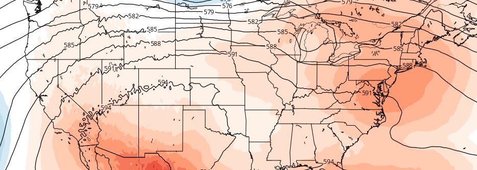
Since the Spring, the pattern has been dominated by a recurring theme of troughiness in Southeast Canada. While ridging has become established over the Central United States, at times, higher latitude blocking — and, often times, an amplified northern jet stream — has allowed for troughs in Southeast Canada to impede the northward extension of that ridging.
GFS model showing a ridge axis near the area during the middle to latter half of next week.
Needless to say, heat and humidity has been unable to establish itself in our area for quite some time. While we have experienced some hot days, they have generally been fleeting. Colder air has followed, as the aforementioned troughs to our north have settled southward. Much of this can, as mentioned, be attributed to the pattern over Southeast Canada and the Northwest Atlantic, with a tendency for “weaknesses” in the upper level pattern allowing troughs to build in.
The general hemispheric pattern is set to undergo some changes over the next few weeks. As tropical forcing shifts, and the high latitude blocking pattern changes, these troughs over Southeast Canada are forecast to become less intense. That is, after a period of troughiness and “near average” weather later this week and weekend. Forecast models have come into better agreement that a ridge over the Central United States will flex its muscles by the end of the first week of July, sending higher atmospheric heights into our area.
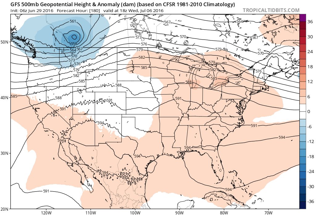
European model showing the periphery of the ridge axis over the Central US which may serve as a boundary for both heat and storms.
The sensible weather result will be a warming trend in temperatures, with the potential for hot weather to continue for a few days as the ridge builds. The active pattern over Southeast Canada, however, is expected to continue. With the ridge building northward toward our area, the result will be increasing frequency of opportunities for severe weather.
Think of it this way: With an active northern stream jet, disturbances will continue to ride the periphery of the building ridge. Teleconnections suggest that this will take disturbances from the International Border in the Northern Plains, through the Great Lakes and eventually into the Northeast or Mid Atlantic States. The amplitude of the ridge building toward our region, obviously, will have a huge impact on the forecast.
To summarize: As July begins, near average weather is expected. But as the first week draws on and the second week approaches, increased opportunities for ridging — with hotter temperatures — are expected. Disturbances riding along this ridge may also provide opportunities for severe weather, but the exact details of such threats won’t be ironed out until the event draws closer.
Make sure to stay tuned for additional premium updates including videos and additional discussions.