-2")
Weekend Overview: Hot, unsettled pattern takes hold
After strong and severe thunderstorms brought fairly widespread wind damage reports to the area on Thursday, many woke up expecting much cooler air this morning. They were wrong: Temperatures remained in the 70’s and even low 80’s in some spots overnight. Hot weather is again expected on Friday, with highs in the middle 90’s, and it may even be warmer than Thursday near the coast. The culprit? West offshore winds, keeping any seabreeze boundaries right near the coast.
The good news is that the ridiculous, nearly tropical airmass with dew points near 75 will be ushered out of the area by these westerly winds. Although high temperatures will reach into the 90’s, dew points closer to the middle 60’s are likely throughout the area, which will feel like a bit of a relief. A few scattered showers are possible Friday afternoon, but overall, calm and hot weather will be in control. The rest of the weekend looks likely to remain transitional and unsettled. We’ve got the highlights below:
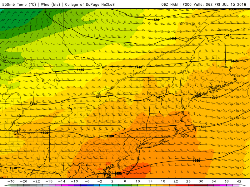
NAM model showing very warm temperatures at the 850mb level (5000ft) on Friday.
- Hot temperatures are expected on Friday, but lower dew points will make it feel less like you are transforming into a bead of sweat.
- Scattered showers and storms are expected on Saturday, with warm weather again. Some of these could contain heavy downpours.
- Warm weather will return on Sunday, with plenty of sunshine expected. Highs will be a bit cooler, in the middle to upper 80’s throughout the area.
For more information on the weather this weekend, and a look ahead to heat and storms expected next week, get over and sign up for our Premium Products. You won’t regret it.