-2")
Surge of cooler air likely to begin the week
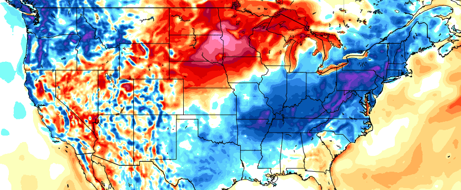
A strong cold front, with an impressive thermal gradient, will push from the Ohio Valley through the Northeast late on Sunday evening. This cold front is associated with a larger mid and upper level system, which features an organized and deep trough emanating from Canada. The cooler air associated with this trough will be most prevalent in the Plains and Mississippi River Valley, but will also be noticeable in our area for a day or two behind the front.
This will be most recognizable on Monday and Tuesday, as atmospheric temperatures significantly cooler than the past several weeks settle overhead. Daytime highs will be cooler — and dew points will be much lower. Overnight lows may fall into the 50’s in the interior and 60’s even in the city and near the coast.
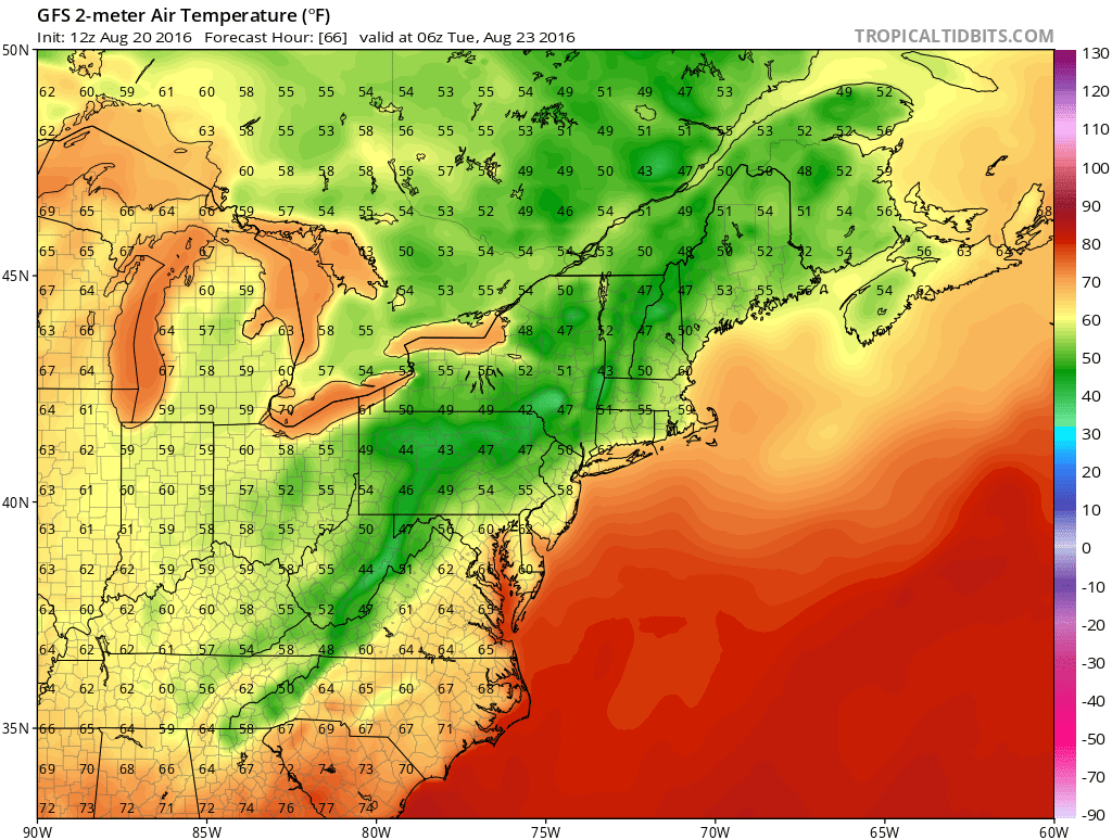
Temperatures will fall several degrees below average on Tuesday morning.
This airmass will come as a great relief to the warmth and humidity of recent weeks. More notably, it will come as the first “hint” of Autumn, which actually begins on the meteorological calendar in less than 13 days. Air masses like the one impacting our area early this week will slowly become more common, and more intense, over the next several weeks as the calendar begins to turn further away from summer.
Nevertheless, this particular shot of cooler than normal air will be short lived. A ridge in the Western Atlantic Ocean will begin to flex its muscles by the middle part of the week, with a southerly flow returning, bringing warmth and humidity back into the forecast. Much of the same is anticipated in the several days that follow.
Medium and long range forecast models are in good agreement that troughiness will become more established over the Central United States – from the Plains to the Ohio Valley – during the end of August and beginning of the month of September. But nearer to the East Coast, that Atlantic Ridging will keep a more warm, humid airmass in place for the foreseeable future, despite the occasional shot of cooler than normal air.
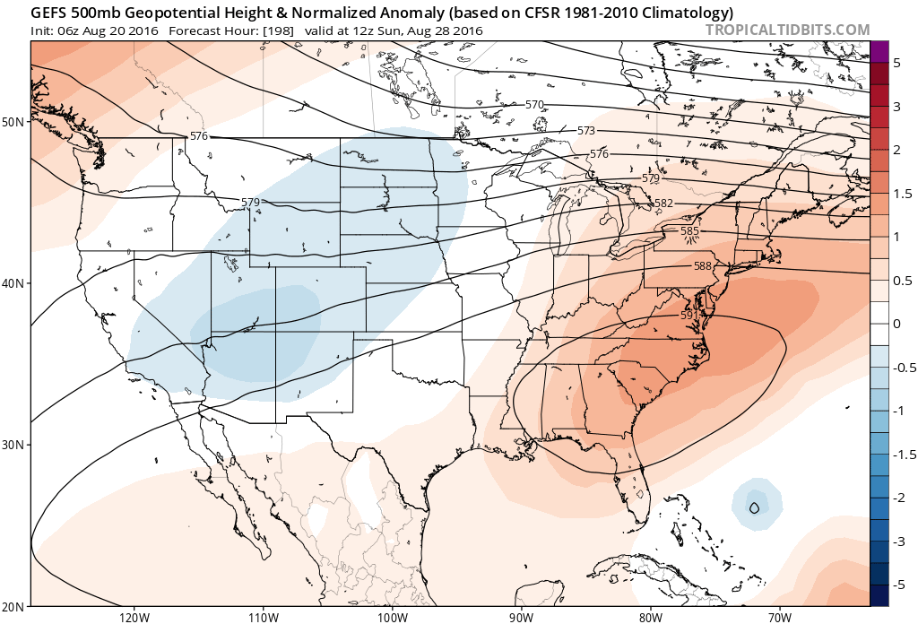
A ridge is expected to keep the Eastern US near or above normal in terms of temperature through early September.
This suggests that near or above normal temperature anomalies will likely continue through the medium range, with any down turn in average temperature likely waiting until at least the middle part of September to take hold.
For more information on the medium and long range pattern, premium members can get a sneak peek at our new Long Range/AGWx dashboard which is available here.