-2")
Hermine strengthens, tropical storm watches for NJ Shore
Hurricane Hermine strengthened in the Gulf of Mexico this evening, and continues to strengthen as it approaches the Florida Panhandle. Impressive satellite and radar imagery showed bursts of convection around the developing eye-wall of the storm, moving northeastward. Hermine is expected to make landfall along the Florida Panhandle before moving northeastward into the Southeast US.
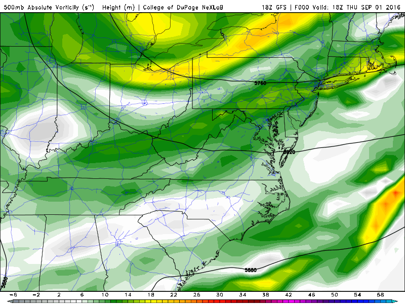
After a short period of time in the Southeast United States, Hermine is expected to move northeastward and eventually re-emerge off the Mid Atlantic coast this weekend. Forecast models are in good agreement that the storm will track off the Mid Atlantic coast while interacting with a disturbance dropping southward over the Ohio Valley, which will eventually phase with Hurricane Hermine and tug the storm back westward toward the East Coast late this weekend.
Exactly how this interaction between the two systems occurs, and where Hermine tracks in the coming 24-36 hours, will have significant implications on the forecast ahead. Only a slight difference in the interaction between the two systems, strength of Hermine, or track of the system itself will greatly affect the weather along much of the Northeast US coast this weekend.
What are the latest models saying and what is the latest information?
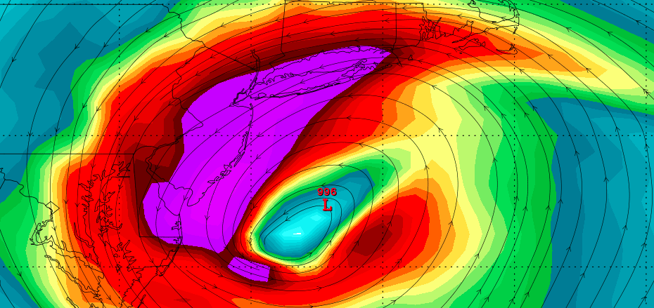
Forecast models on Thursday, for the most part, came into reasonable agreement that Hermine would move off the Mid Atlantic coast this weekend — before interacting with the aforementioned Ohio Valley disturbance and being tugged back westward. The general agreement is that this movement will occur off the coast of Southeast New Jersey.
GFS model showing the evolution of Hermine and her phase with another disturbance over the Ohio Valley.
Such an evolution would cause strong east/northeasterly winds to develop — and be maintained for a prolonged period of time — along the coast of New Jersey and Long Island. The strong storm systems wind field would expand as the interaction occurs, before the storm moves northeast away from the area.
Still, it should be restated that these interactions aloft are very fickle. Positive vorticity advection, latent heat release, and several other very intricate atmospheric processes will be ongoing during this time. Especially when involving a tropical system, forecast models are likely to struggle with the details of the phase.
The “tug” back westward is a byproduct of the phasing disturbances and exactly how they interact. So, inherently, confidence in the area of most severe impacts is low at the present time.
Still, by and large, the “big time” global models (GFS, ECMWF, etc) and their ensembles have come into good agreement on the evolution of the storm system on a regional scale. What remains to be seen are the exact, intricate details of where the worst impacts are felt.
What kind of effects will this storm have on my location?
This is a nearly impossible question to answer, as dramatic variations in weather conditions can be expected over very short differences. However, we can say one thing with confidence at this point: The worst conditions will occur along the area’s eastern facing shores.
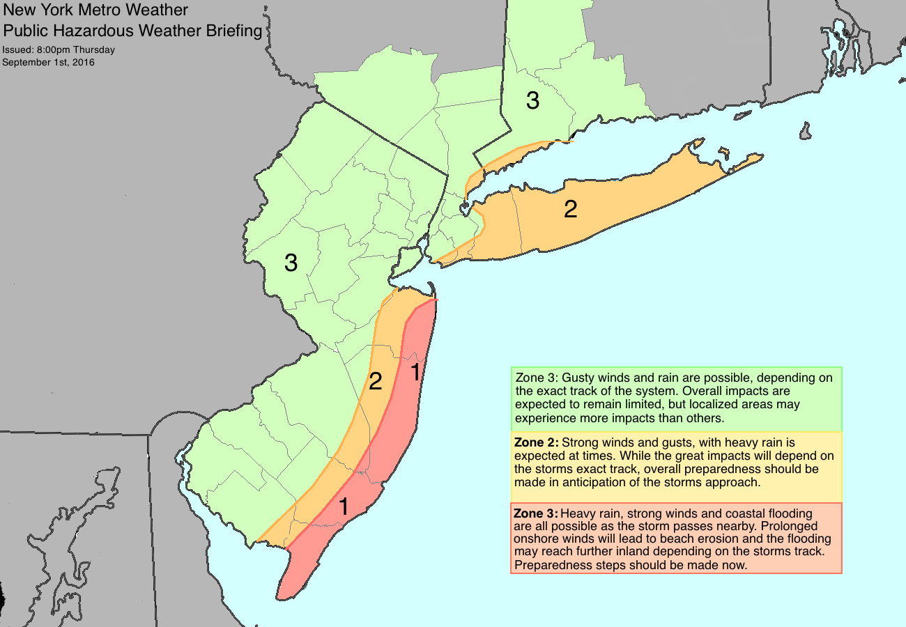
Our latest public briefing map for Hermine. Zones break down the areas of the most severe impacts.
A prolonged onshore flow and strong winds are possible along the New Jersey coast. This would introduce the potential for coastal flooding and beach erosion, as well as localized damage from strong wind gusts. Farther inland, the main threats would come from isolated strong wind gusts and heavy rain.
Currently, confidence is highest that the storm will be impactful right along the immediate coast. These thoughts are likely to be adjusted and refined as the storm approaches and the exact track becomes more clear.
What should I do to prepare now?
If you live along the New Jersey, Long Island, Delaware and Maryland Shore:
- Begin tropical system preparedness steps. Make sure to have all emergency items ready.
- Remind yourself and your residents of your local evacuation plan and coastal evacuation route
- Make preparations for loss of power and/or flooding — especially if your home lies in a flood zone.
- Stay tuned for the latest information from forecasters and emergency management.
If you live elsewhere (NYC, Philly, Interior NJ, etc):
- Begin tropical system preparedness steps. Make sure you have all emergency items ready, just in case.
- Have a plan of action in case of power loss or localized damage.
- If you live in a flood prone area, have a plan in case flooding occurs.
- Stay tuned for the latest information from forecasters and emergency management.
Most importantly: Stay tuned to our forecasting team over the next 24 to 48 hours for the latest information. Premium breakdowns, videos, and technical information will be available and posted several times per day as the storm approaches. Do not hesitate to contact us with any questions.