-2")
Premium Weekly Outlook: Unseasonable warmth bookended by tastes of fall
Another relatively calm and dry week looks to be in-store, as we’ll start off with a taste of fall, moderate to unseasonably warm temperatures, and then again experience a taste of fall. A cold front that moved through on Saturday night has completely cleared the area, giving way to a broad area of high pressure across the region. This has helped dropped humidity substantially, bringing us very comfortable temperatures — we started in the 50s in many locations — as well as a lovely crisp morning. This high pressure will be in-control for today, with light winds, mostly sunny skies, and temperatures rising into the upper 70s to around 80. The weak wind flow may allow for some seabreezes to develop, but without a big difference in temperature between the land and ocean, these seabreezes should not be too strong, nor penetrate too far inland.
Mostly clear skies and calm winds will allow temperatures to cool off nicely tonight, as they should once again fall into the 50s in most suburbs, though low to mid 60s appear likely for urban areas. The area of high pressure will slide eastward somewhat, allowing for a bit of a return flow and slightly warmer temperatures on Tuesday, with highs generally in the low 80s across the region. This return flow and warm air advection will limit radiational cooling on Tuesday night, with a slightly muggier conditions and lows generally in the mid 60s, but around 70 in urban areas.
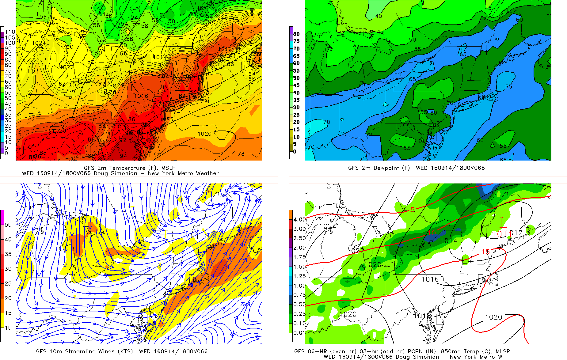
Last night’s GFS valid for Wednesday afternoon shows a return southwest flow, with temperatures rising well into the 80s, with dewpoints generally in the low 60s.
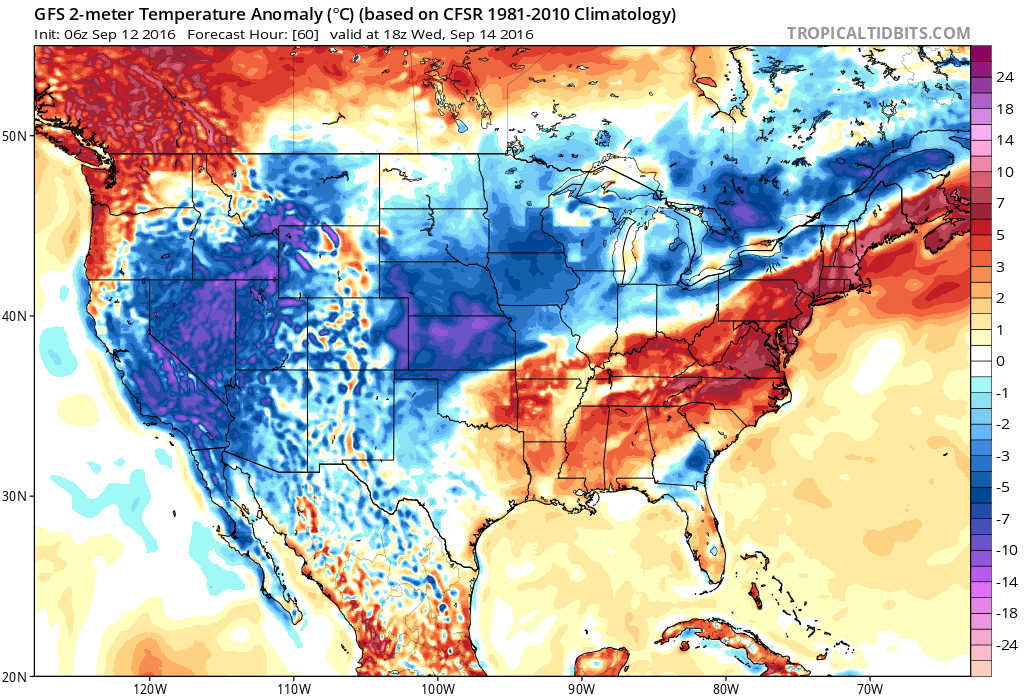
The return flow is out ahead of a cold front and shortwave trough that will be traversing through the Great Lakes and into our region. A ridge in the Southeast will being to build. Once the front gets closer, southwest flow will be enhanced, allowing temperatures to shoot back up into the upper 80s to perhaps around 90 degrees on Wednesday. While it will be more humid, model guidance is still not overly impressive with the dewpoints, so heat indices might not be much higher than the actual air temperature. Wednesday will remain dry, though Wednesday night could have some scattered showers and thunderstorms with this front. The best forcing looks to remain to our north, as the core of the shortwave trough will primarily remain to our north, so we are not expecting any big rains or severe weather — so not much help to our current drought situation.
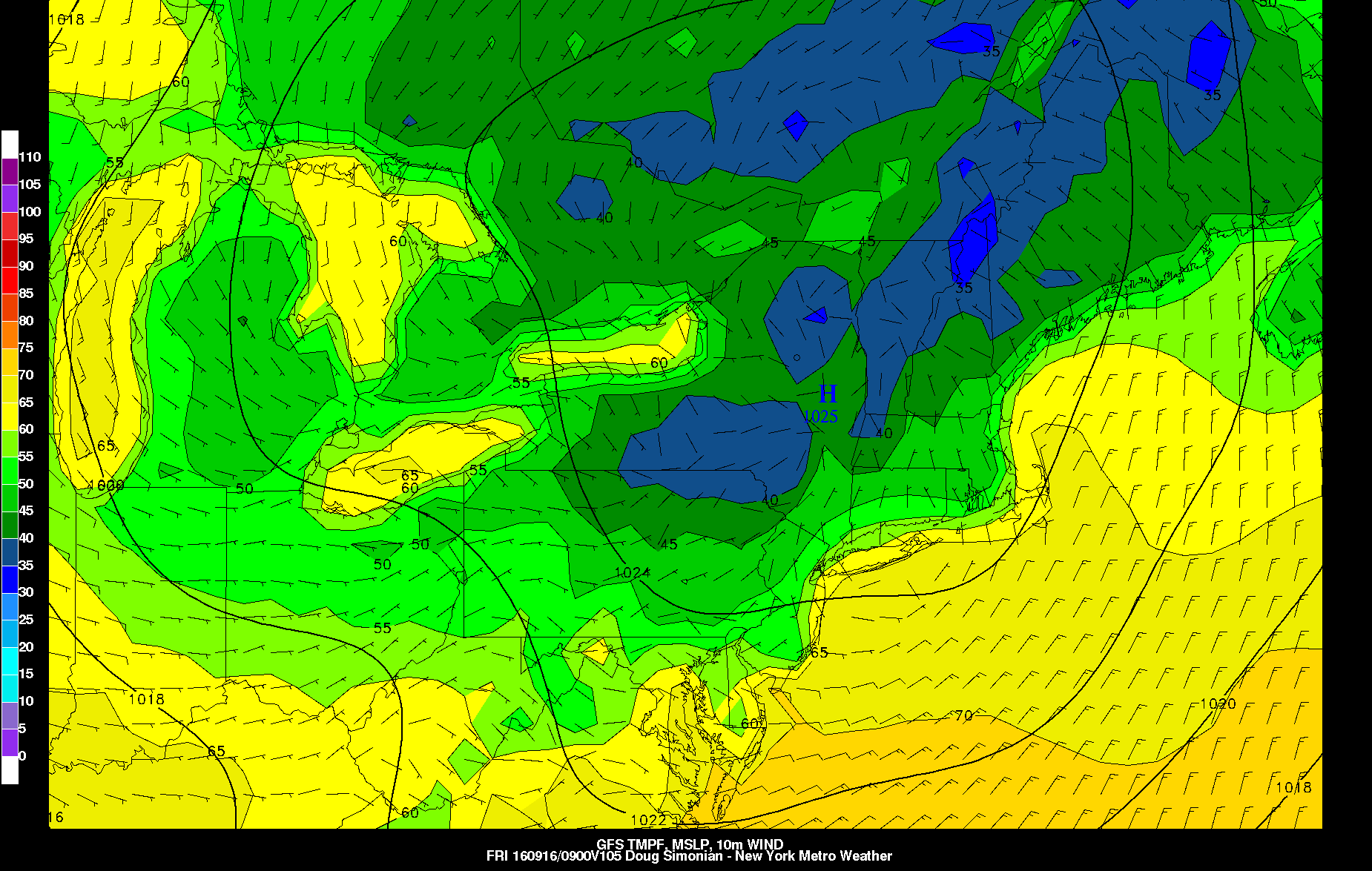
Last night’s GFS valid for 5am on Friday morning shows a preview of fall, with temperatures falling into the 40s in interior locations.
Once this front passes, another taste of fall will be in-store for Thursday and Friday. Lows will fall back into the upper 50s in suburbs on Wednesday night/Thursday morning, with high temperatures in the mid 70s on both Thursday and Friday with low humidity. Thursday night and Friday morning will have ideal radiational cooling conditions, as the high pressure behind the front will settle in, which will give some interior locations a chance to call into the 40s for low temperatures. Most suburbs will fall into the low 50s, with urban areas near 60.
Temperatures will again moderate during the weekend, as this shortwave trough will give way to influence from the building Southeast ridge. This should bring a period of above average temperatures, as we should rise back into the low 80s for this weekend. Another frontal system will arrive — most likely around Sunday — but with more amplitude due to the Southeast ridge, it will be able to tap into more moisture from the Gulf. This increases the probability of showers and periods of rain developing in this period, though it still does not appear to be a washout.