-2")
Premium Weekly Outlook: Monday downpours, then drier weather returns, but a cooler weekend?
A shortwave trough and frontal boundary has move slower into region than previous expected. This has lead to drier conditions through the overnight hours Sunday. But more showers and some steadier bands of rainfall are now over much of the region this morning. Stronger forcing underneath of right-entrance of jet streak and low-level convergence along frontal boundary has increased, along with tropical moisture from the remnants of Julia off the Southeast coast, surge northward along the coast. Some instability with a deep southwesterly flow is also aiding in development of some thunderstorms scattered or embedded within steadier bands of rainfall over region.
With marginal instability and abundant moisture, the main threat continues to be for torrential downpours with localized flash flooding, especially during the morning and early afternoon hours. Much of the area will likely receive near or 1.00” of rainfall. However, some showers and thunderstorms could train along and axis of unidirectional shear, convergence, and precipatable water values near over 2.00”, along or just ahead of the frontal boundary today. Areas at greatest risk for flooding will over poor drainage and low-lying areas. Some ponding on area roadways, especially likely as well. Significant flooding from rivers and streams isn’t anticipated due to drier conditions over the last few weeks.
Steadier rainfall may gradually subside by early this afternoon. But additional showers and thunderstorms are possible later this afternoon and evening as the shortwave trough and frontal boundary move closer to the region. Some model guidance indicating more heavy rainfall enhancement with more more 700-850mb vorticity moving through areas closer to the coast, later this afternoon and evening. So very heavy rainfall and localized flood flooding is possible into the evening hours tonight.
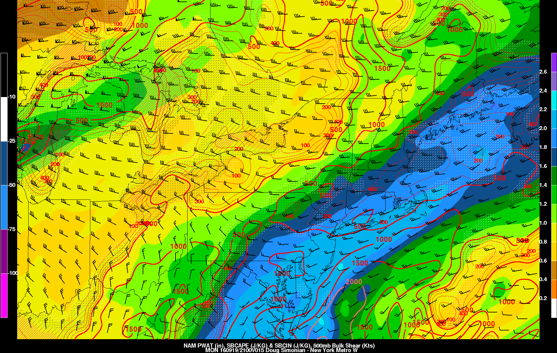
The NAM models showing high precipitable water values and more instability later this afternoon and evening.
Showers and thunderstorms should begin taper off later tonight as the northern shortwave energy flattens out and the frontal boundary weakens. Some scattered showers are still possible into Tuesday with some weak lift and leftover moisture over region. But high pressure from the northwest, building in to region, should gradually cause more clearing throughout the day. Temperatures during the afternoon should reach the lower to middle 80s with more sunshine.
High pressure will be in control Wednesday through Friday with pleasant, dry weather expected High temperatures during the day will be lower to middle 80s, with sea-breezes possibly keep some coastal areas little cooler. Overnight lows will be in the 60s, over much of the region with some mid-upper 50s possible for the Interior Valleys and Pine Barrens. But temperature departures will be several degrees above normal each day.
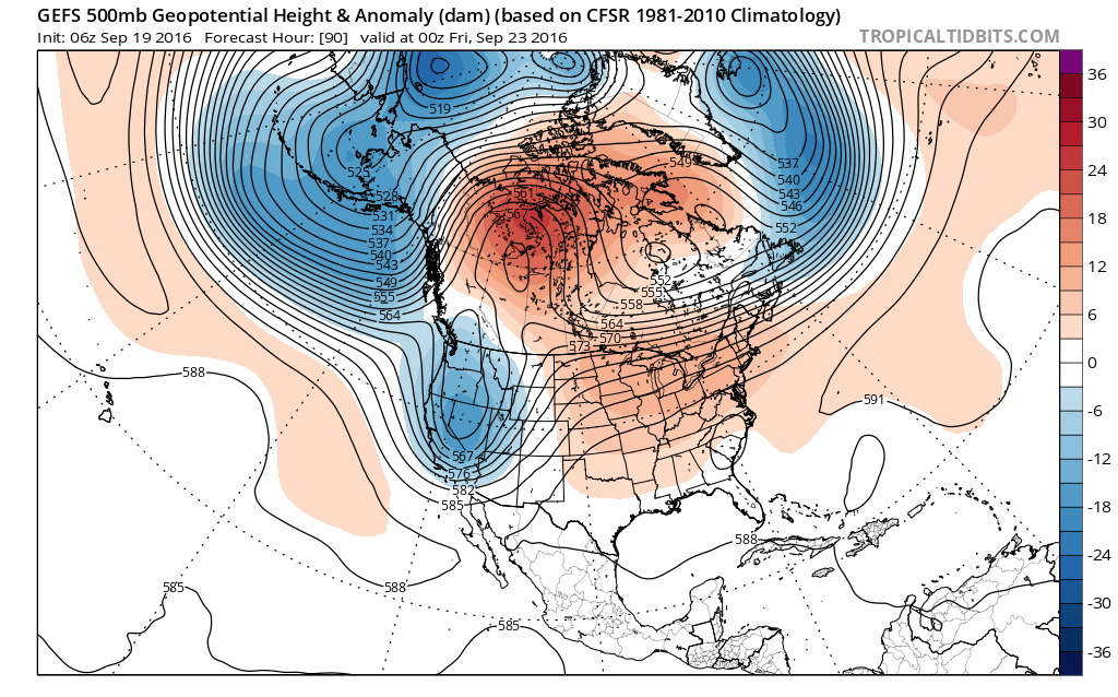
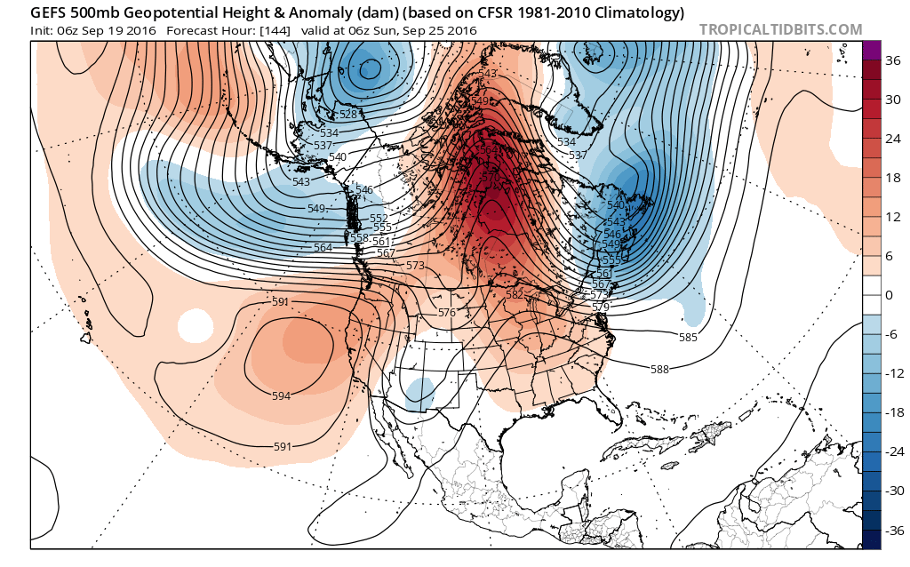
Then model and ensemble guidance are showing a more blocking with a ridge over Central Canada and Hudson Bay. This cause a trough to dig deeper over Southeast Canada and Northeast. This will strong confluence and high pressure pushing a more late Autumn-like cold front on Saturday. Moisture will likely be very limited ahead of this front. So not much rainfall if any, is expected at this time, with the frontal passage. Temperatures on Saturday may still get into upper 70s or near 80 before the cold front arrives.
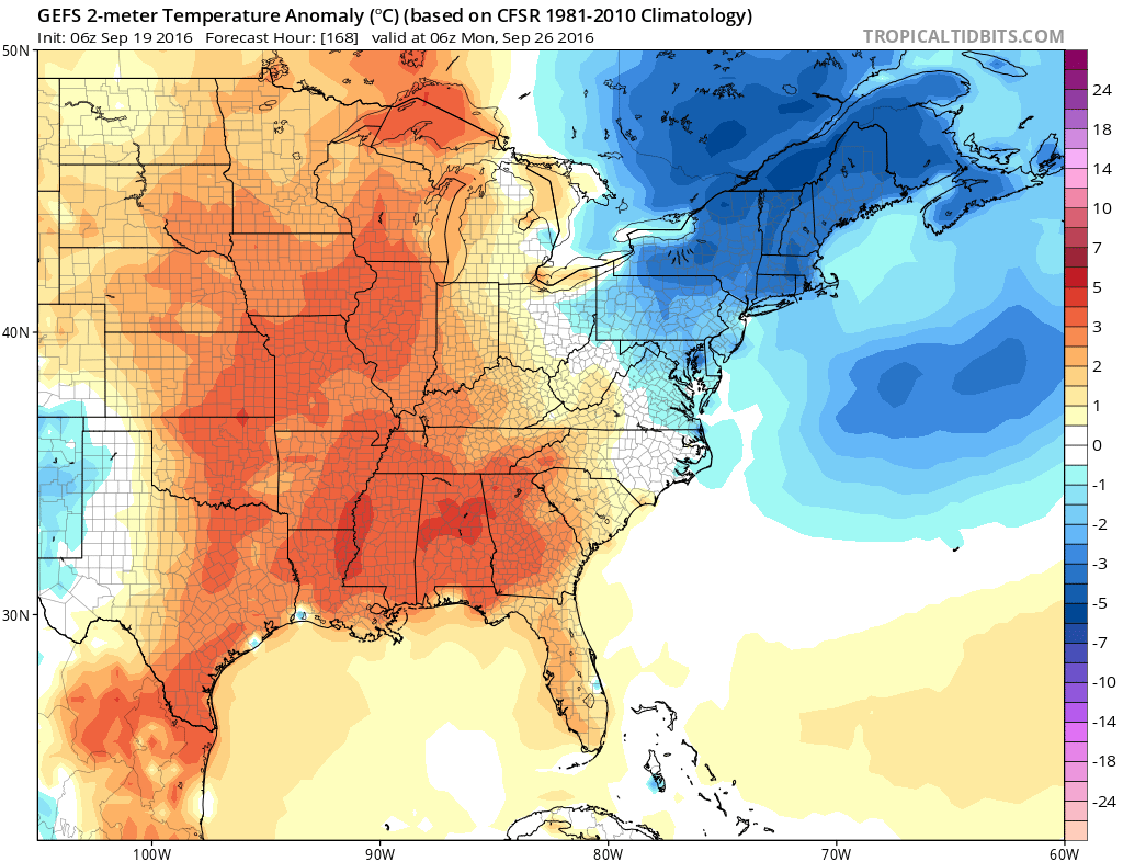
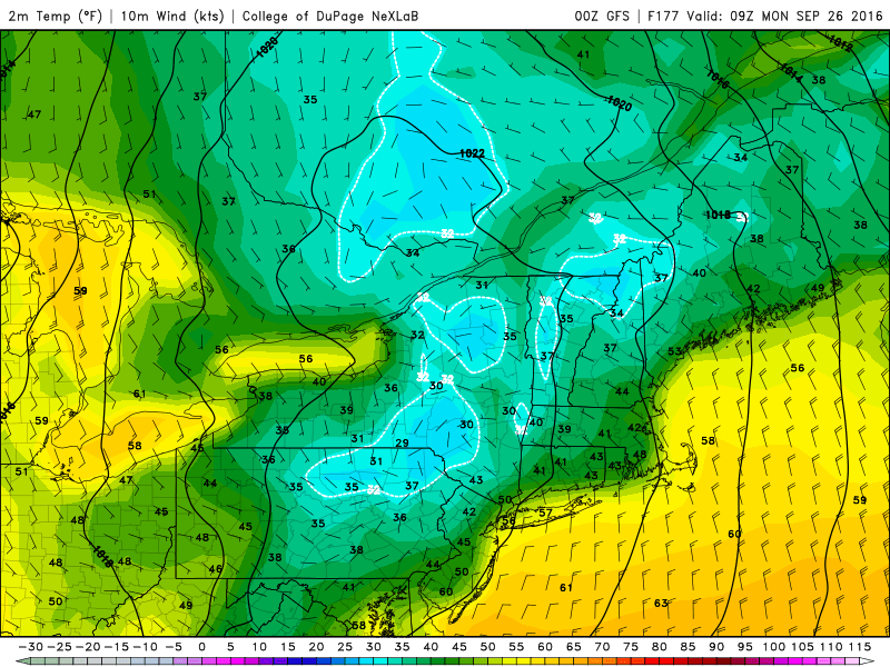
GEFS showing below normal temperatures again by Sunday
But a much cooler airmass with below normal temperatures will follow for a couple days. By Sunday high temperatures may only be in the 60s in the region. High pressure moving closer to regions may allow for significant radiational cooling with first widespread frost or freeze possible over interior parts of NY/PA and New England by Sunday night. Closer to local region. low temperatures could be well down into 40s or 50s. Stay tuned for more premium forecast updates and video discussions, throughout this week.