-2")
Matthew’s shifting track spares Northeast, targets Florida
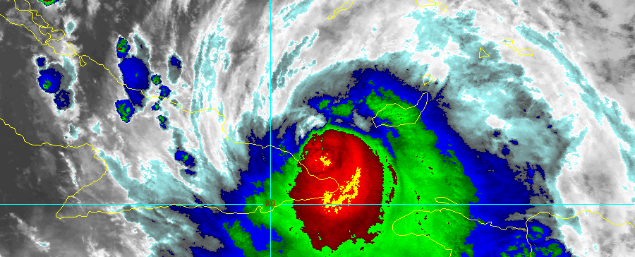
Hurricane Matthew is tracking northwest of Cuba today, strengthening and re-organizing after land interaction as it moves into the Bahamas. Extremely warm water and favorable to near-ideal upper level atmospheric conditions will support re-strengthening of the storm on its trek northwestward over the next few days. This is troubling for many reasons, but none more than the fact that while the storm strengthens, a large ridge will build to its east over the Western Atlantic. This will essentially block any eastward component to Matthews movement, instead insuring west-northwestward movement toward the Bahamas and Florida late this week.
Forecast models, in fact, have come into better agreement on the exact track of Matthew over the next 48-60 hours or so. As the storm strengthens, with favorable sea surface temperature and depth as well as favorable mid and upper level jet positioning for ventilation, it will move toward the Southeast Florida coast. The mid level ridge to the east of Matthew will guide the storm on a northwest heading, eventually with a more northward turn, near the coast of Florida.
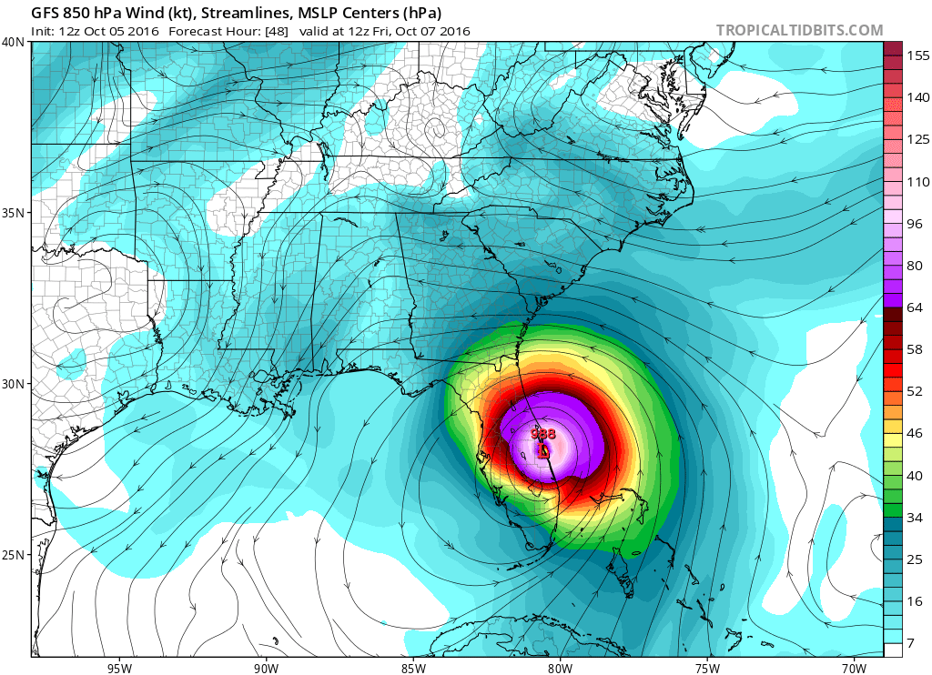
GFS model showing Hurricane Matthew making landfall on the Eastern Florida shores.
Some guidance suggests the storm system will make landfall on the Eastern Florida coast, particularity the space coast’s general area. With the storm strengthening on approach, such an event is a troubling possibility — and impacts would be significant even if the storm just grazes the shore. A Category 4 hurricane (Estimated by most forecast models) would result in significant damage as it landfalls or scrapes the coast late this week into the weekend. The exact track of the storm will depend on mesoscale details including the strength of the ridge to its east and small, intricate processes within the circulation of the storm.
A major change in modeling later this weekend has opened the window for Matthew to turn eastward after it reaches the latitude of the Carolinas. Previously, some guidance had suggested a deep trough would work into the Central United States, aiding in upstream ridging and guiding Matthew further northward. This would allow the two to interact and phase, with Matthew and his associated moisture being pulled up the East Coast.
This Central US disturbance, however, has trended much more progressive on model guidance — likely owing to a persistent Pacific Jet and progressive pattern. The disturbance, then, is expected to track much farther north across the Great Lakes and Ohio Valley. Once Matthew misses the connection with this disturbance, it almost serves as a stop sign for the storms northward movement. Instead, Matthew is guided eastward into the Western Atlantic Ocean after reaching the latitude of the Carolinas, before again being shunted southward by the aforementioned Atlantic Ridge — which still will not have moved.
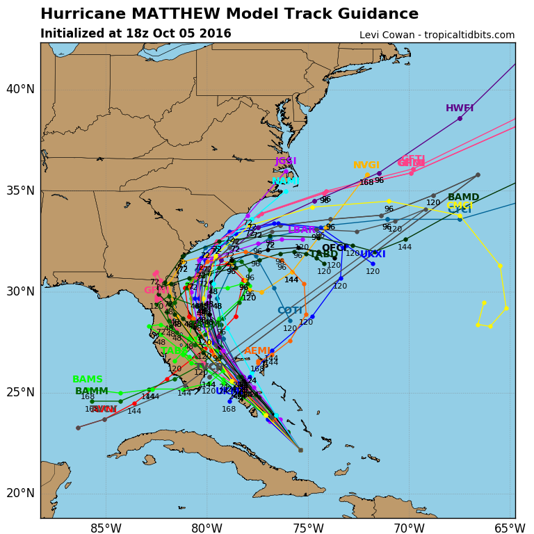
Latest tropical model guidance for Matthew showing a track near the Southeast US with minimal movement up the East Coast.
All of this adds up to a few key points, one being that impacts from Matthew in the Mid Atlantic and Northeast US are increasingly unlikely. But the main takeaway is the increasing confidence in significant impacts along the Eastern Coast of Florida and the coasts of Georgia, South Carolina and North Carolina. Interests in those areas should already have hurricane plans in place and should be well underway with preparedness steps.
Over the next few days, our team will continue a stream of updates on the storm system with the latest information on its positioning, strength, and expected path and impacts.