-2")
Friday Overview: Showers into Saturday, turning cooler and windy
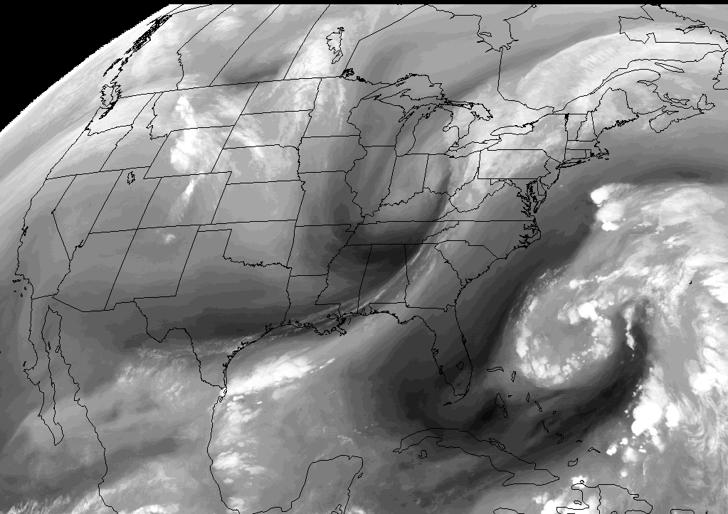
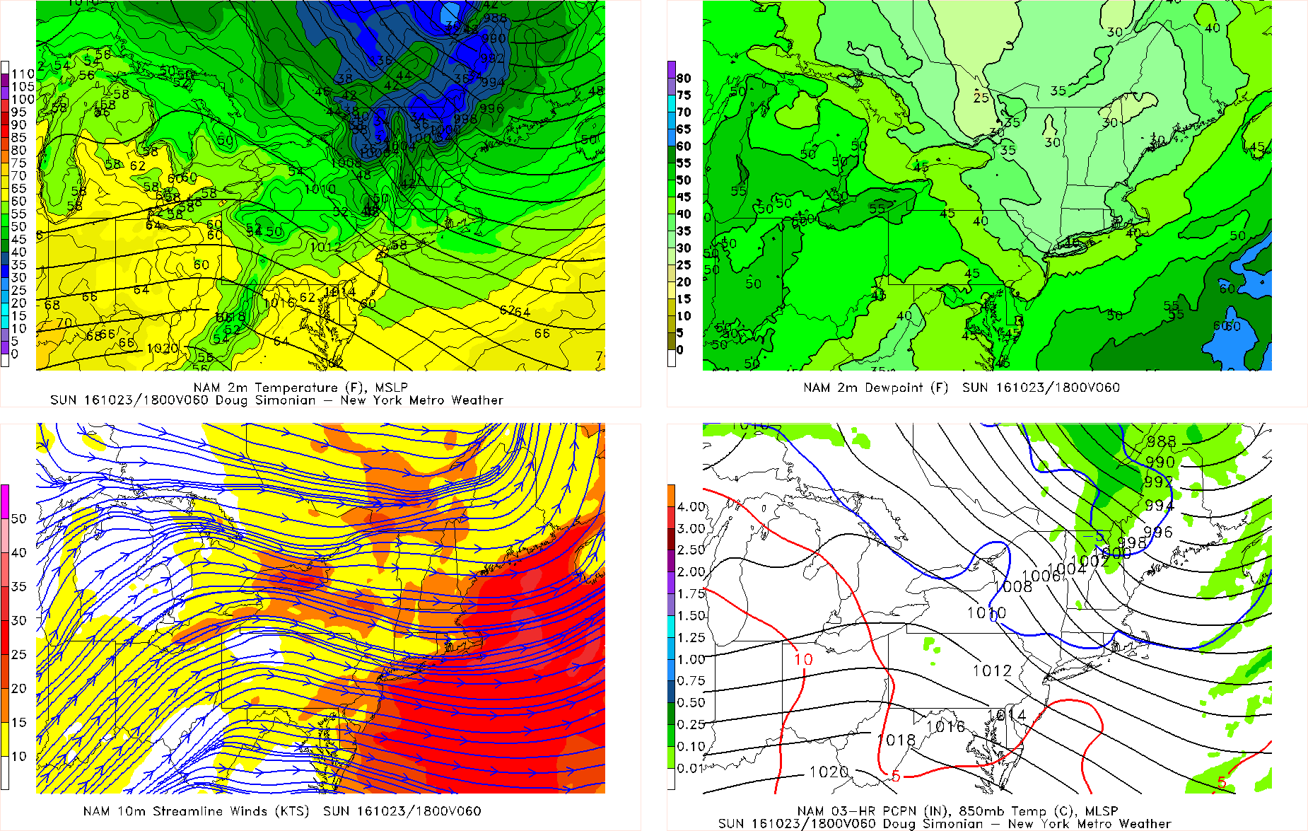
Cooler and unsettled has arrived late this week, as anticipated. This morning showers are moving northward with moderate to heavy downpours, over Eastern NJ, NYC metro and into Lower Hudson Valley. These showers will move north of region by early this afternoon. But more showers could developing later this afternoon and evening as a cold front and a wave of low pressure developing along it approaches the region. Some locally moderate to heavy downpours with possible with any showers. But some subsidence between the cold front and another system offshore, will likely keep showers from becoming more widespread over region and could cause clouds to break for more sunshine this afternoon. This will help temperatures rise into the lower to mid 70s this afternoon, over much of the region.
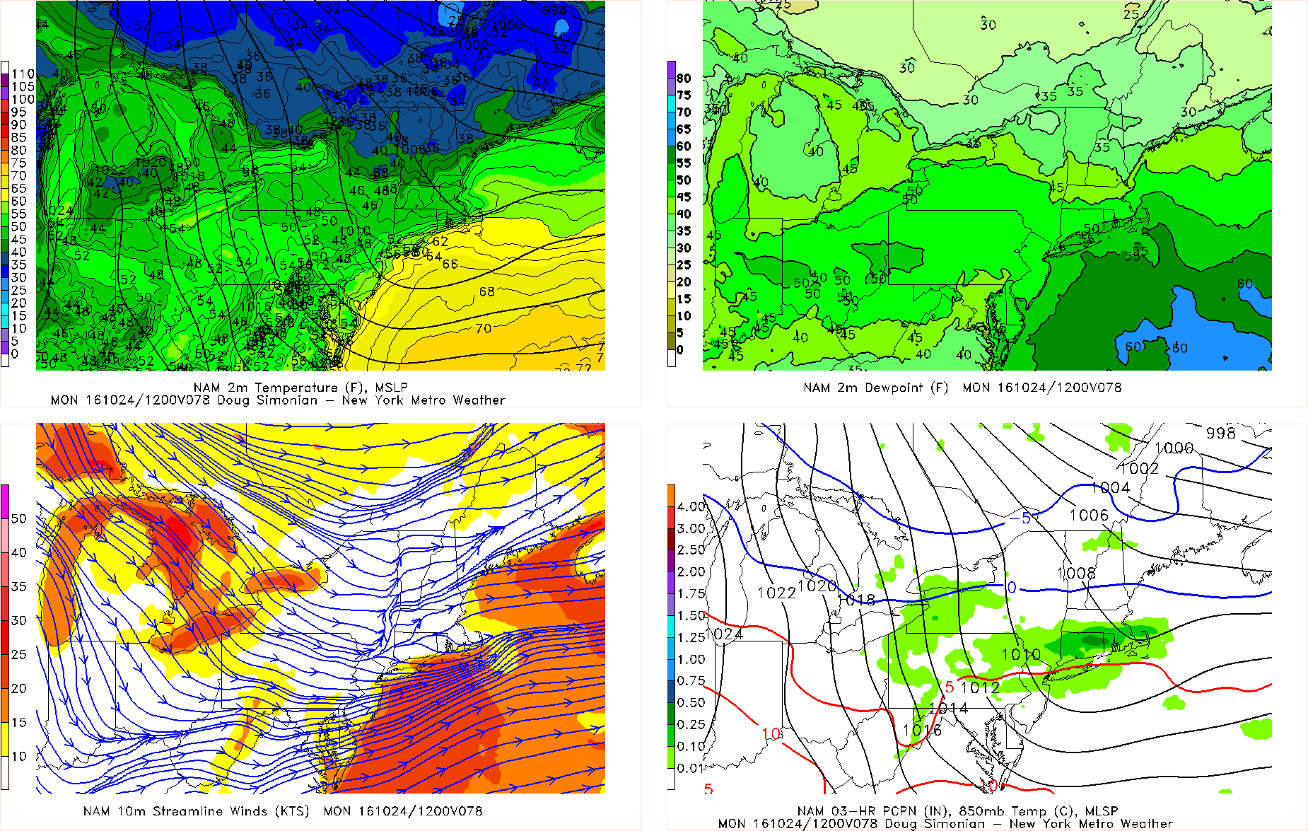
Then wave of low pressure will intensify as moves northward through New England tomorrow, as it merges with another system with tropical moisture over the Western Atlantic. Some more showers wrapping behind this low, are possible in the local region, later tonight and Saturday. But the main story, will be increasing west-northwest winds with cooler temperatures on Saturday. Temperatures will drop into 50s late tonight and then remain in the 50s for much of the day on Saturday. A tight pressure gradient, will likely result in wind gusts up to 40-45mph during the day on Saturday. Then temperatures will fall into 40s with some lingering showers possible tomorrow evening. Some other highlights going into next week:
- Weak high pressure builds in for Sunday with more sunshine, but breezy conditions will continue.
- A few showers are possible Sunday night into Monday morning, with a weak disturbance moving through region.
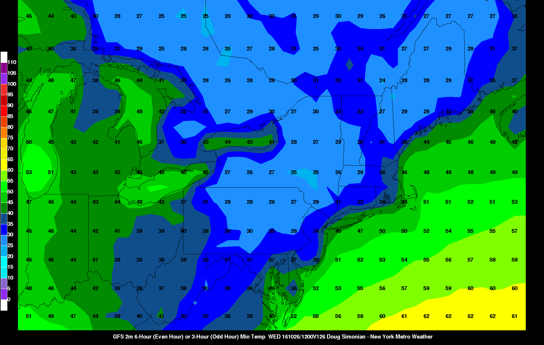
- An even colder airmass could arrive by middle of next week, with potential for morning lows in the 30s into NYC
For more details on the forecast, including video discussions and long-range outlooks, sign up for a Premium membership today!