-2")
Another interior snow event likely Tuesday evening
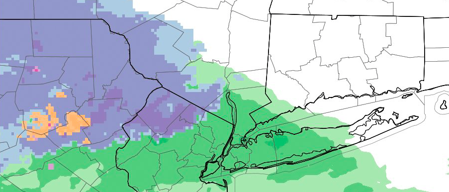
Light snow fell throughout much of the interior on Monday morning, with higher elevations in Northwest New Jersey and Southeast New York reporting nearly 2″ of snow as of 9:00am.While this lighter and weaker disturbance moves away later on Monday, a second and more notable disturbance will be approaching from the southwest. Increasing moisture and lift, as well as warm air advection, will approach the area on Tuesday — allowing most areas near the coast and even in the suburbs to warm up enough to support rain.
But farther inland, in the higher elevations and mountains of Northwest New Jersey and Southeast New York, the atmosphere will remain just cold enough as this moisture and lift approaches. In fact, the dynamics of the storm system itself will help to cool the atmosphere in an aptly-named process called “Dynamic Cooling”. Forecast models are in good agreement that this moisture will overrun cold air — allowing snow to fall later Tuesday afternoon and evening into early Wednesday morning before an eventual changeover to rain.
Exactly how much precipitation falls will determine snowfall amounts, but it appears probable that this event will be more impactful that Monday’s. For one, precipitation intensity looks likely to be heavier and more significant, aiding in snow accumulation even on surfaces that are only “borderline” warm.
Second, the event looks likely to continue for more than just a few hours, leaving time for roads and other surfaces to become slick and snow covered. As mentioned, this looks likely to be relegated to the higher elevations and mountains to the Northwest of NYC — particularly in Sussex (NJ) and Orange (NY) counties.
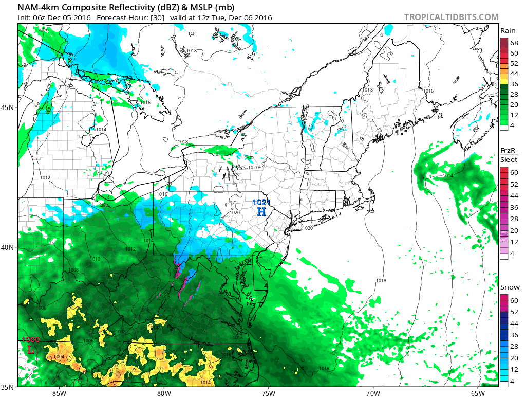
NAM model showing the expected evolution of the storm system late Tuesday into Wednesday.
The event won’t come without some uncertainty, though — precipitation will start as rain before dynamic cooling begins to have its effects on the atmospheric column. Essentially, precipitation falls heavily enough to cool the air around it. So an atmospheric profile that may be too borderline to support snow reaching the ground can suddenly become supportive due to the rate that the snow is falling.
While accumulations won’t be “significant” by definition (6″+), they will be noteworthy, and it appears that for a period of time from Tuesday Night into Wednesday, interior locations will be looking at the potential for a few inches of snow. Roads may become slick and travel could be difficult in these areas, especially early Wednesday morning.
Stay tuned for the latest information including further details on timing and intensity as the event draws nearer.