-2")
First in a series of wintry events likely late this weekend
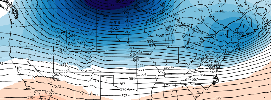
A changing hemispheric pattern will lead to the development of an active, colder regime across the Northern 1/3 of the United States. Changes are already afoot, and are expected to continue developing through this weekend. A large ridge building near Alaska will begin forcing arctic air southwards into Canada, suppressing the jet stream in the United States and allowing colder air to seep into the Northern 1/3 of the country.
An active jet stream pattern is expected to continue to bring disturbances into the United States with relative frequency. The first arrives late this weekend into early next week, and forecast models have come into relative agreement on the storm system’s evolution. There are still considerable uncertainties regarding track and intensity, all of which will have major impacts on sensible weather.
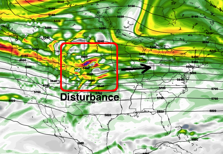
GFS model shows a disturbance ejecting eastwards from the Rockies this weekend, leading to the potential for snow across the Great Lakes, Ohio Valley and Northeast.
The overall setup, however, begins with energy ejecting out of the Rockies and towards the Plains States. With colder air seeping southwards into the Northern 1/3 of the US, the disturbance is shunted east/southeastwards into a position south of the Great Lakes by late in the weekend. Moisture developing east/northeastwards is expected to impact parts of the Upper Midwest, Great Lakes, and Ohio Valley.
There is likely to be a sharp gradient and demarcation line between wintry precipitation and rain with this storm system, as the disturbance rides along a thermal (temperature) gradient which is situated from west to east throughout the country. We spoke about this yesterday in our discussion. This gradient will guide the storm eastwards towards the Northeast US by early next week.
Wintry precipitation should spread into the Northeast US during the early part of next week, with warming gradually occurring and changing areas in the Northern Mid Atlantic and possibly Southern New England over to rain. But, again, the exact track and intensity of the storm will determine where these gradients and demarcation lines set up — and who gets wintry precipitation.
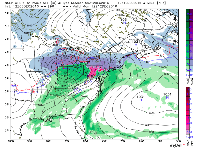
A low pressure develops into the Central US with snow possible in many areas late this weekend into early next week.
A high pressure to the north of the storm system will likely have major impacts on precipitation type in the Northeast US, as well. Forecast models have wavered back and forth with the high pressures configuration. A high pressure directly to the north of the developing storm could keep colder air locked in for longer, while a high pressure slipping eastwards will allow warm air to surge north.
Confidence in the positioning of major features is currently still very low — with the storm system still several days away and forecast models remaining in flux. The pattern, additionally, is one of low confidence inherently with multiple disturbances running near a thermal gradient and a changing hemispheric pattern.
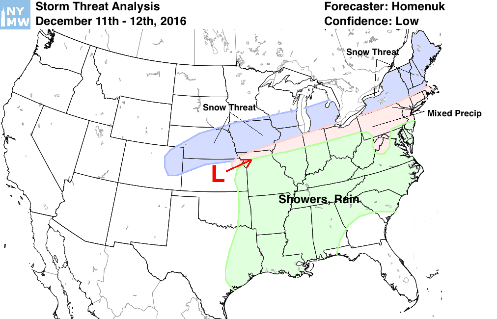
Regardless, the potential exists for wintry weather throughout a swath of the country late this weekend into early next week, highlighted in our Storm Threat Analysis map below. Stay tuned for updated information this afternoon including a video discussion and the latest technical details on the storm systems evolution.
https://www.youtube.com/watch?v=eeqNmw_JN7M