-2")
Weekend storm system will start wintry in Northeast
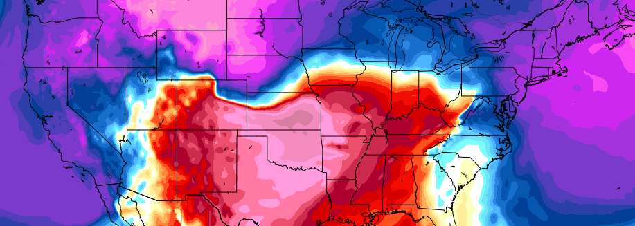
An arctic airmass will drive southeastward from Canada and into the Northeast United States late this week, bringing with it the coldest temperatures in quite some time. In fact, the arctic airmass is part of the polar vortex — yes that one which we discuss all too often — a piece of which is dropping southward into New England. This isn’t necessarily unusual in winter, but it certainly is this time of year — some of the temperatures being modeled at 850mb (5000 feet) would challenge record lows for this time of year.
Nevertheless — the polar vortex swinging through will, after it brings some brutally cold air, begin a quick departure. This is occurring mainly due to a lack of high latitude blocking. In other words, there is no feature to “keep” the polar vortex from shifting away, and back to where it typically stays. There was an impetus to bring it here, the Alaskan ridge which we discussed at length the past several weeks.
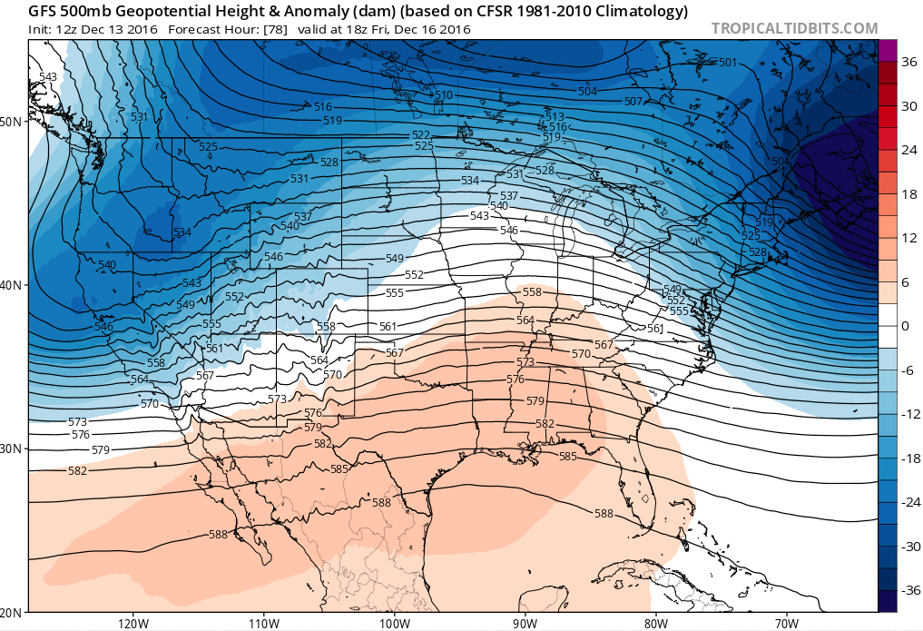
The polar vortex, and source for cold air, will already be departing (top right) by the time the weekend storm system arrives.
Without any force to keep it this far south, the polar vortex will begin quickly lifting out of New England and back towards Canada as a disturbance approaches the area this weekend. Making matters more interesting is the fact that this disturbance is being driven mostly by warm air advection, or the movement of warm air in multiple levels of the atmosphere. So its presence will inherently have warm characteristics.
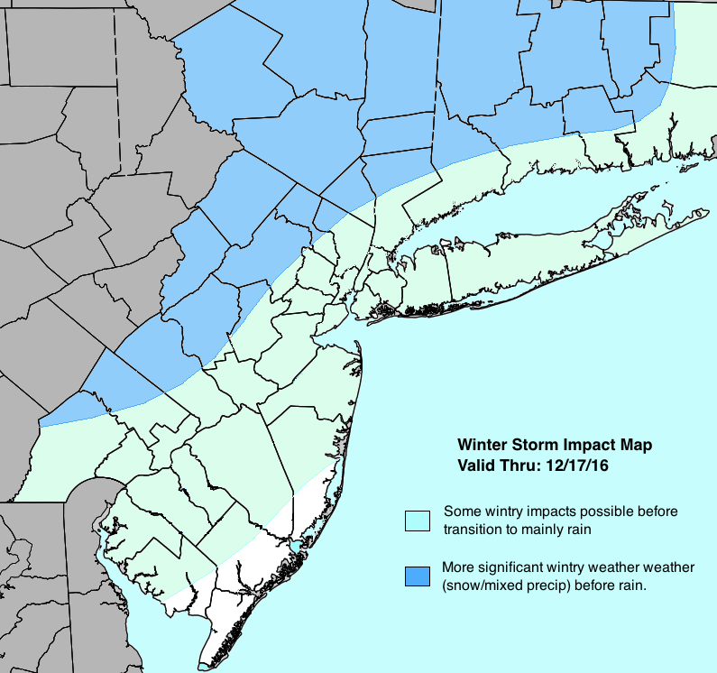
A challenging and complex forecast is likely to evolve over the weekend as this clash between deep, cold air — which is moving away — and the incoming warm air advection occurs. Forecast models have come into better agreement on the fact that moisture will “overrun” the cold airmass before it can erode, bringing a higher likelihood of wintry precipitation to much of the Northeast US. The changeover from frozen precipitation to liquid will be gradual, working northward and westward from the Mid Atlantic and coastal plain.
Locations in the interior and higher elevations are likely to experience a more prolonged period of wintry weather — with the possibility of snow, sleet, and freezing rain on Saturday before a transition to all rain occurs. Accumulations are likely to moderate — with the potential for 3-6″ of snow in many areas away from the city and coast. This could cause travel concerns on Saturday for those who will be commuting or traveling around the Northeast.
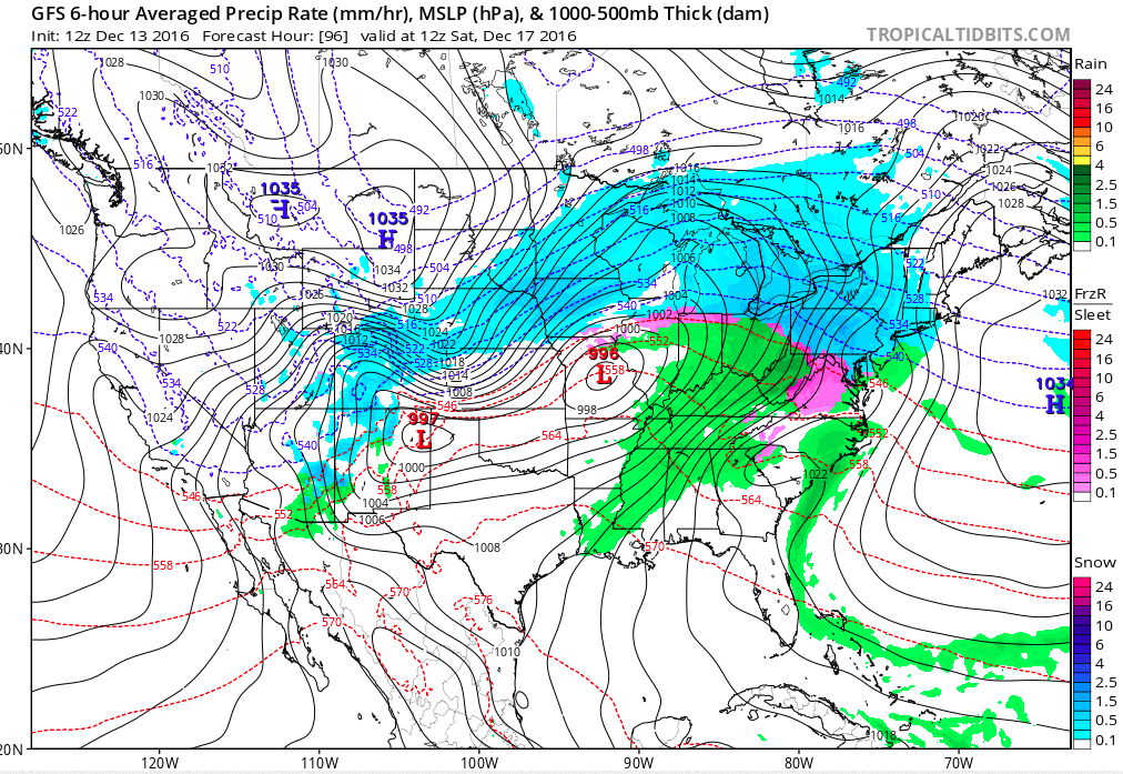
The system as it approaches the Northeast US on the GFS model
These concerns are likely to be maximized in an area that has become familiar with winter weather over the past few weeks: Northeast Pennsylvania, Northern New Jersey, New York State and New England. These areas are likely to see the most stout and stubborn cold air, which will lead to a more prolonged period of wintry weather compared to areas farther south.
Of course, with storms like this, uncertain runs very high. Slight differences in temperature, often owing to the exact track of the storm system and/or surrounding environment, can have a huge impact on the sensible weather. Accordingly, our confidence remains quite low moving forward with this storm system; and likely won’t become much higher until we are within 24-48 hours of the storms arrival.
For now, our hazards impact map has been updated and posted below. You can continue to check back for further updates throughout the next few days, including a video which is upcoming this evening.