-2")
Threat Analysis: Weekend winter storm
A well discussed storm system — with winter weather potential — is heading towards the Northeast US this weekend, in the wake of a brutally cold airmass associated with the polar vortex in the troposphere. This storm, however, will come with a vast amount of warm air advection — which occurs when warm air moves in multiple levels of the atmosphere. In this case, southwesterly winds are driving the storm system towards the Northeast as the polar vortex departs.
The resulting storm system will be one of transition, with a cold airmass in place to start, followed by a moist and warm airmass as the storm begins its departure. The transition itself will occur with quite a bit of complexity, and interior locations are likely to see a impactful winter storm on Saturday, particularly in the morning hours. Nearer to the coast, a change to rain should occur relatively quickly, alleviating widespread impacts.
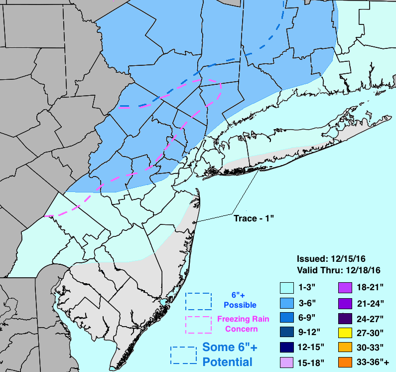
Friday night, forecast models are in good agreement that moisture will begin surging towards the Northeast US. This moisture will overrun the aforementioned cold airmass, allowing snow to move through Pennsylvania and towards New Jersey and New York. This snow will gradually build into New England. As this occurs, the intensity will gradually increase, and a coastal front will begin pushing inland from the shores of New Jersey and New York. This will change coastal locations of Southeast NJ and Long Island over to rain rather quickly, with snow accumulations there expected to average less than 1″.
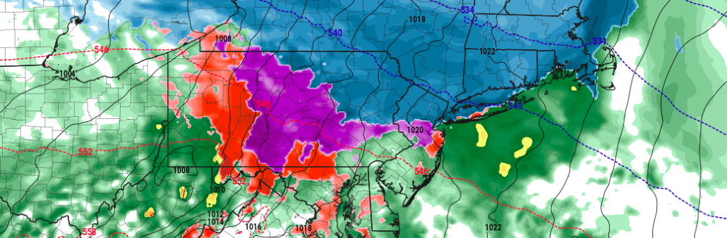
Meanwhile, warm air will also be surging towards the Northeast US from the Mid Atlantic — but cold air pressing southward from New England at the surface. After snow picks up to a briefly moderate/heavy pace in Pennsylvania and New Jersey Saturday morning, precipitation is expected to begin transitioning. Warm air may surge into the mid-levels of the atmosphere first, while the surface remains cold. This suggests the potential for freezing rain, especially across Central Pennsylvania and interior New Jersey and New York. Further north in New England, snow will continue through Saturday morning.
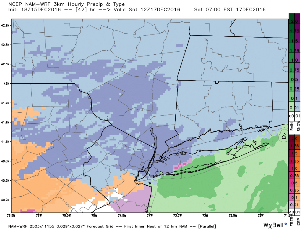
Models suggest precipitation will begin as snow early Saturday across much of Northern NJ, NYC, Northeast PA and New England.
Eventually, the warm layer in the atmosphere will gain depth and precipitation will change over to rain throughout the majority of the Northeast US — save for far Northern New England. As you can imagine, the gradients of impacts and snowfall accumulation with this storm system are likely to be very complex and large changes in sensible weather may occur over small areas. This will be particularly true in the immediate suburbs of places like New York City, where 25 miles could mean the difference between mostly rain and a prolonged wintry event.
Still, confidence has increased in these *General* boundary areas over the past 24-48 hours. Operational models and their ensembles have tightened the envelope of possible solutions over the past 24 hours especially, lending confidence to our ideas which were outlined over the past few days. We have fine tuned them below and included a map with more detailed snowfall information throughout the area.
Stay tuned for further updates over the next 24 hours including more detailed information on timing and adjustments to gradients and snowfall amounts as the event draws closer!