-2")
Winter storm increasing likely in interior New England late week
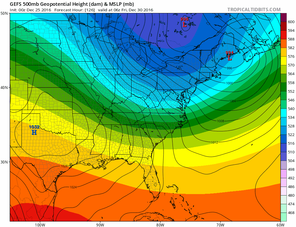
Discussed at length yesterday was the potential for a notable winter weather event this weekend in New England, particularly interior locations, with the development of an impressive low pressure area in the Gulf of Maine. Forecast models over the past 12-24 hours have trended favorably for the development of this low pressure area, with a shrinking envelope of potential solutions on the table.
The most notable change has been a trend away from a progressive mid level atmospheric solution, which many forecast models had agreed was going to occur just a few days ago. Synoptically, this type of solution made sense — but a change in the pattern across the Pacific Ocean will lead to more amplification potential downstream over the United States. A more amplified disturbance driving into New England has led to the slower, stronger trends on forecast model guidance.
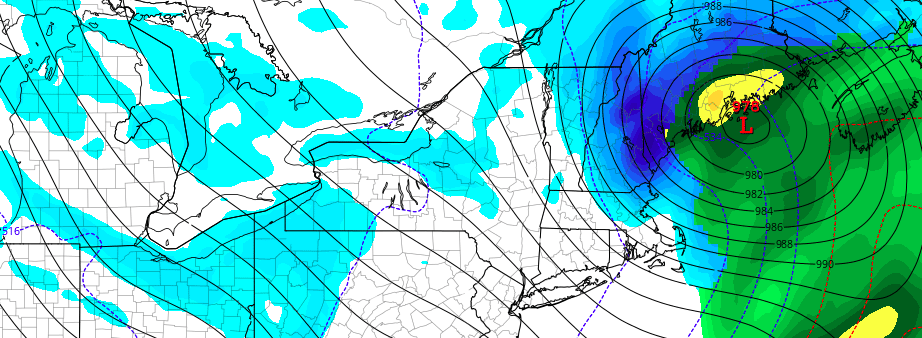
Forecast models (pictured, GEFS) have trended slower and stronger with the storm system in the Gulf of Maine late this week.
Initially, a low pressure area is still expected to develop northward into the Great Lakes and parts of Southeast Canada. While not necessarily a significant area of low pressure producing widespread precipitation, the location of this low pressure area is significant — because it enhances a south/southeasterly wind ahead of the storm. This all but ruins the setup for wintry weather near the coast and along the I-95 corridor. Even as a secondary low pressure develops, the airmass is far too warm.
Nevertheless, enough cold air remains entrenched in New England that when the secondary low pressure area forms south of Long Island and swings eastwards towards Cape Cod (there is good model agreement on this) the low level flow around the low pressure area begins to enhance cold air drainage. This will be especially true in the higher elevations of New England.
The exact timing, strength, and positioning of the low pressure’s development will be the key to exactly how much snow falls and where. One important thing to consider — upper level jet dynamics support forecast model ideas that the storm system itself will be quite compact. So while there may be impressive banding and heavy snow, it looks likely that it will be over a smaller area despite the storms strength as it move into the Gulf of Maine.
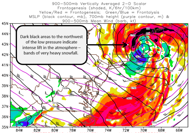
NAM model showing the area of heaviest snow banding Thursday PM into Friday AM.
Banding signals are currently very impressive on all forecast models, with frontogenic forcing and deformation banding signals showing up in New England, particularly from Northern Massachusetts into South and Eastern Vermont, New Hampshire, and Maine. Where this banding tracks is the area where the heaviest, most dynamic snowfall will fall. Forecast models currently agree that the best banding will miss the Vermont ski resorts just to the east — but this isn’t game over. Trends will have to be continually monitored over the next few days.
Over the next 12 to 24 hours it will be important to monitor more detailed aspects of the forecast guidance. This will include individual perturbations aloft, jet dynamics, precipitation coverage and storm structure. All of these will give us an idea as to where the bands of heaviest snow should set up from Thursday into Friday. Of course, model guidance is just that — guidance — so it will be important, also, to look at which solutions make meteorological sense and which don’t.
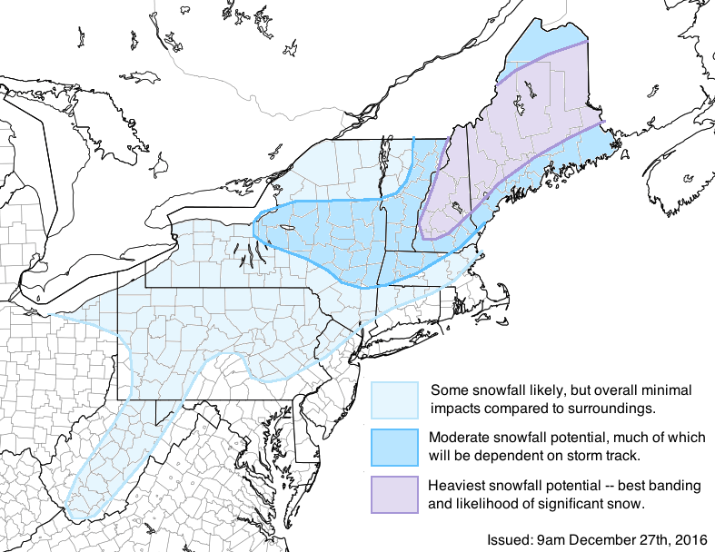
Check back throughout the day today for more updates, and particularly on Wednesday when a snowfall map will be issued with detail on banding locations and impacts. Our latest impact map is available below!