-2")
Public: Chilly & Breezy, but not Cold as the Calendar Turns to 2017
Happy New Year, everyone! The weather today is relatively pleasant with seasonable temperatures but a relatively stiff southerly wind at times. Wind gusts will continue to be around 30mph for most of the day. We have a decently potent shortwave to the north that is pumping up some southerly flow out ahead of it and is also streaming some high clouds into the region, but because of the previously chilly airmass from yesterday, our temperatures are still relatively cool today.
There is not a lot of moisture with this shortwave and it’s also missing us well to the northwest, which means there is not a lot of forcing or lift. However there may be just enough southerly flow to provide a tad bit of moisture later this evening and tonight. This, combined with the distant shortwave may be enough to provide a few scattered snow showers in the interior and some rain showers closer to and on the coast. These are not expected to be heavy at all for the aforementioned reasons and for the most part it should just be dry and mostly cloudy, but the potential for precipitation this evening into the early overnight is enough to be made aware.
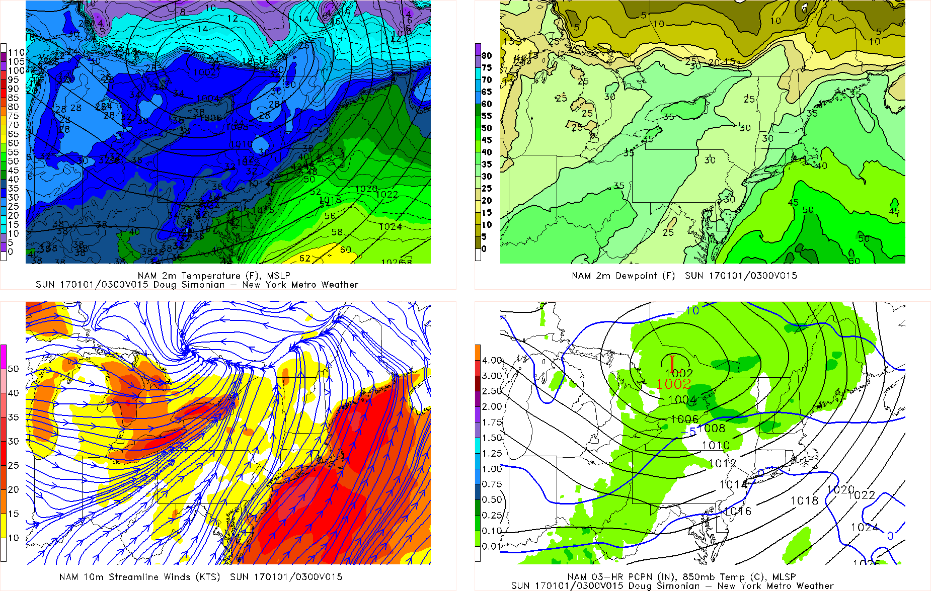
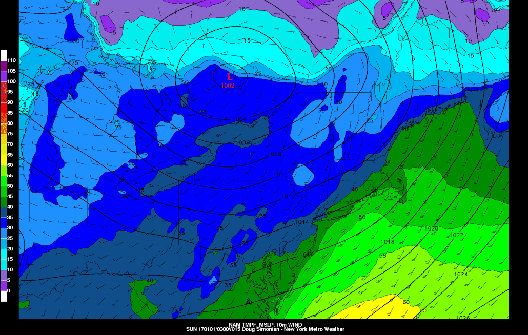
Today’s NAM valid for 10:00am tonight shows a low pressure passing to our northwest, which may trigger scattered light precipitation. There is also plenty of southwesterly flow as evidenced on the bottom left — particularly for the coast.
Once the shortwave passes, the winds will eventually turn more westerly. It should still be gusty at times, too, with gusts as high as 30mph at times. Along the coast where there is less frictional resistance from the land, winds may gust up to 40mph. The winds initially being southerly and southwesterly, combined with the fact that winds will stay up and not be in a direction that leads to cold air advection means that temperatures will generally be in the mid to upper 30s inland to around 40 closer to the coast when the ball drops at midnight. Wind Chills will be around 30 or in the low 30s. Any isolated shower or snow shower should taper off by 1:00 or 2:00am.
Behind this shortwave, a Southeast ridge will begin to pump up warmer air for New Year’s Day, when temperatures will rise into the mid or even upper 40s with partly cloudy skies. Rain will then move in on Monday and get heavier on Monday night and Tuesday ahead of a large storm system that runs into our warmer air from the Southeast Ridge. There is a chance that enough low-level cold air will linger on Monday morning for the initial precipitation to be freezing rain well in the interior and in elevated areas, but even they will go over to plain rain pretty quickly.
Behind this storm will be a much colder airmass on Wednesday, before we watch for the potential for a couple of disturbances bringing snow from Friday and beyond. Today’s model runs, however, were a bit disjointed with all of the energy and thus did not bring us snow, but this could easily change.
For more detailed information, sign up to be a Premium Member! Once again, have a Happy New Year, everyone!