(Premium) Weekly outlook and hazards information

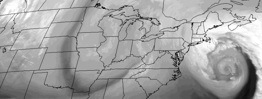
A powerful coastal storm will shift east/northeast this afternoon, toward the Northwestern Atlantic Ocean, with lingering impacts expected in our area. This will be especially true for coastal sections of Eastern Long Island, where bands of snow may linger until the evening hours of Monday as the coastal low pulls away. Elsewhere, relatively benign weather will take over with gusty winds in the wake of the storm system — but no further accumulating snow.

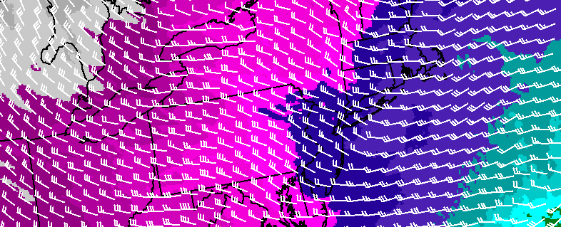
Despite the departing storm, there are several other weather events to speak about during the upcoming work week. They begin with a weak coastal storm from Tuesday into Wednesday, and end with bitter cold and a possible coastal storm threat this weekend.

Read more

Behind coastal storm, more snow possible Tuesday

Two atmospheric disturbances within a relatively short distance of one another will impact the area early this week, with the first and more powerful storm grazing the area on Monday. That storm system will strengthen off the East Coast and shift northeastward, bringing periods of heavy snow to Long Island on Monday. The bands of steady snow should graze New York City and the NJ Coast, as the fringe of precipitation sits near the area.

Behind this storm system, precipitation will remain in the forecast — not the typical dry air and clearing that we often see behind Nor’Easters. Instead, another atmospheric disturbance will drive southeastward from the Great Lakes to a position near the Mid Atlantic on Tuesday, and a surface low pressure area will develop off the coast of the Northeast US yet again.

Read more

Complex setup, powerful coastal storm to graze area

An anomalous and powerful coastal storm is likely to graze the area late this weekend and early next week, with a tremendous breadth of precipitation as the center of low pressure passes hundreds of miles to our east in the Atlantic Ocean. Forecast models have come into better agreement on the evolution of  a large and intense mid and upper level system, with an impressively strong trough moving from the Southeast States to a position southeast of New England by Monday.

Read more

Snow likely with accumulations Friday morning

Forecast models have trended farther northwest — and stronger — with a low pressure system, which is forecast to develop on a frontal boundary off the East Coast from late Thursday into Friday. This is the same frontal boundary which crossed the area on Wednesday Night and Thursday morning, brining the area rain and wind.

Models suggest that as the frontal boundary moves offshore, a secondary area of energy in the mid levels of the atmosphere approaches the area. This energy provides enough lift for precipitation, with sufficient moisture, with precipitation redeveloping to the west of the offshore front. After beginning as rain, precipitation is likely to change to snow — with accumulating snow possible during the morning commute on Friday

Read more