-2")
PM All Zone Update: Rain continues, heavy at times Tuesday
An approaching storm system will bring continued drizzle and showers through tonight — with periods of steady rainfall expected on Tuesday. The disturbance affecting our area tonight is quite weak, but moisture in the atmosphere’s low levels is creating drizzle and showers. These will continue on and off for the next few hours — but accumulation is expected to be light.
Temperatures will continue warming through the morning hours as southerly winds continue. This southerly flow will be drawing more moisture into the area ahead of the stronger storm system approaching on Tuesday. An area of steady to heavy rain is expected to move through the Mid Atlantic and Northeast from the late morning to early afternoon hours, producing rainfall totals between 0.35″ and 0.50″ during its passage.
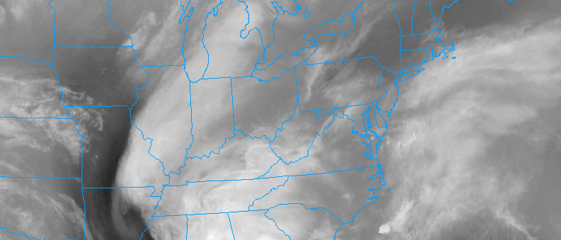
Simulated radar imagery valid 1:00pm on Tuesday.
These periods of steady rain are likely to continue during the afternoon, with the heaviest rain spreading north into the northern zones of Southeast NY and Connecticut during the mid afternoon hours. As a low pressure area shifts north of the area during the day, clearing will occur from southwest to northeast through the area.
Improving weather conditions are expected after sunset, as west-northwesterly winds begin ushering in a drier and colder airmass. Breezy conditions may develop by late afternoon as the frontal boundary moves past the area. Cold air will surge into the area by Wednesday with arctic air pushing south from Canada.