-2")
AM All Zones Update: Coastal storm scrapes by Friday
Cool, crisp, and windy conditions are likely to be the dominant weather today as high pressure builds into the area and arctic air surges through as well. The cold start to the day will continue well through the afternoon hours as high temperatures remain below seasonal averages throughout the area. Blustery winds are expected as well, as mixing and steep lapse rates help mix down some winds aloft.
As we move towards Friday, the focus will turn towards a polar disturbance which will drop southwards from Canada into the Mid Atlantic States. While the atmosphere will be cold and dry initially, a gradual increase in moisture and lift in the atmosphere is expected from late Thursday Night into early Friday morning. Clouds should increase from southwest to northeast.
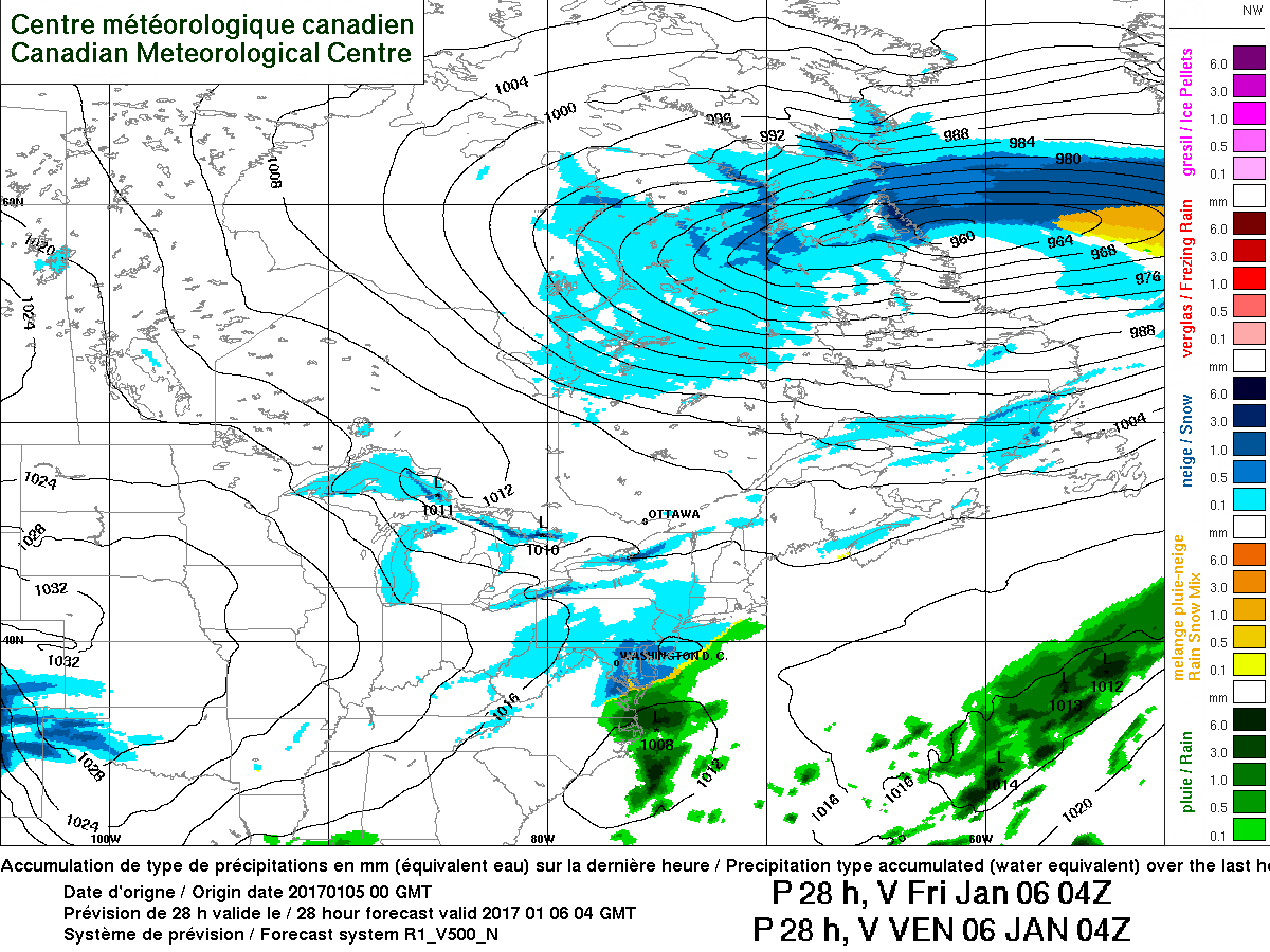
RGEM model showing snow remaining light throughout the majority of the area on Friday morning.
This will allow for the development of light snow, beginning first over portions of Southeast PA and New Jersey and then spreading northeast — during the early morning/predawn hours of Friday. Snow will be light and accumulations are expected to be minimal through the morning commute.
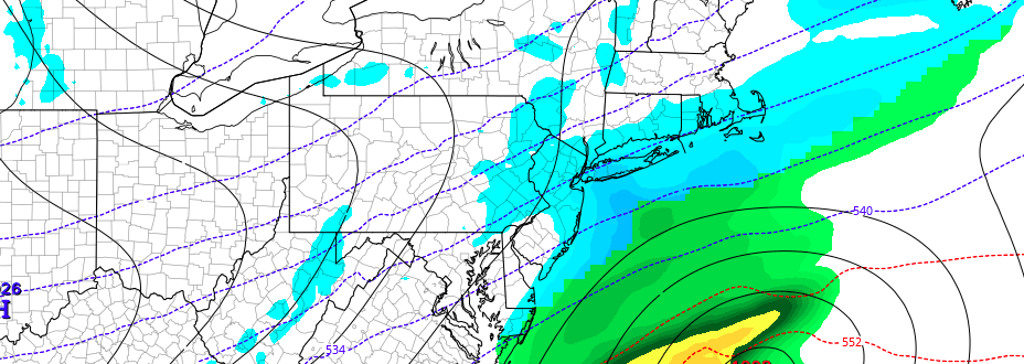
Thereafter, forecast models diverge with the track and intensity of the storm system. The NAM remains the most amplified, with the low pressure system pushing bands of moderate snow along the New Jersey coast and Long Island. The GFS, ECMWF, and other global models remain less impressed — and our forecast leans in that direction as well. Snow will continue lightly during the day on Friday, but wane during the afternoon as the coastal storm system begins to pull northeast of the area.
Accumulations overall are expected to be light — only a trace to 1″ throughout the majority of the area. The exception would be along the NJ and Long Island coasts, as mentioned, where 1-3″ of snow would be possible should the storm take the unlikely north and west track.
Individual zone forecasts will be needed beginning this afternoon.