-2")
Light snow tapers off this morning…more light snow possible Saturday
Snow has begun tapering off and ending southwest to northeast across all zones early this morning. This occurs as low pressure tracks east-northeast off the North Carolina coast and more lift with an associated upper-level jet streak start to move the northeast of the region. Most snowfall reports so far have been between 1” – 3″, as expected. Some additional light accumulation is possible over the next few hours over Eastern parts of Long Island and Connecticut that could bring snowfall totals to near 4”. Otherwise, take more precaution driving out roadways, as some slick spots will likely remain for another into the mid-morning hours.
Some clouds will continue to linger for rest of the day. But some breaks of sunshine likely by this afternoon, with increasing subsidence behind this storm system. It will remain cold with high temperatures will be in lower to middle 30s with light northwesterly winds. Clear to partly cloudy skies are expected for much of the night. It will be very cold with temperatures will drop into teens lower 20s over the NYC and urban areas and down into into teens over many of suburbs.
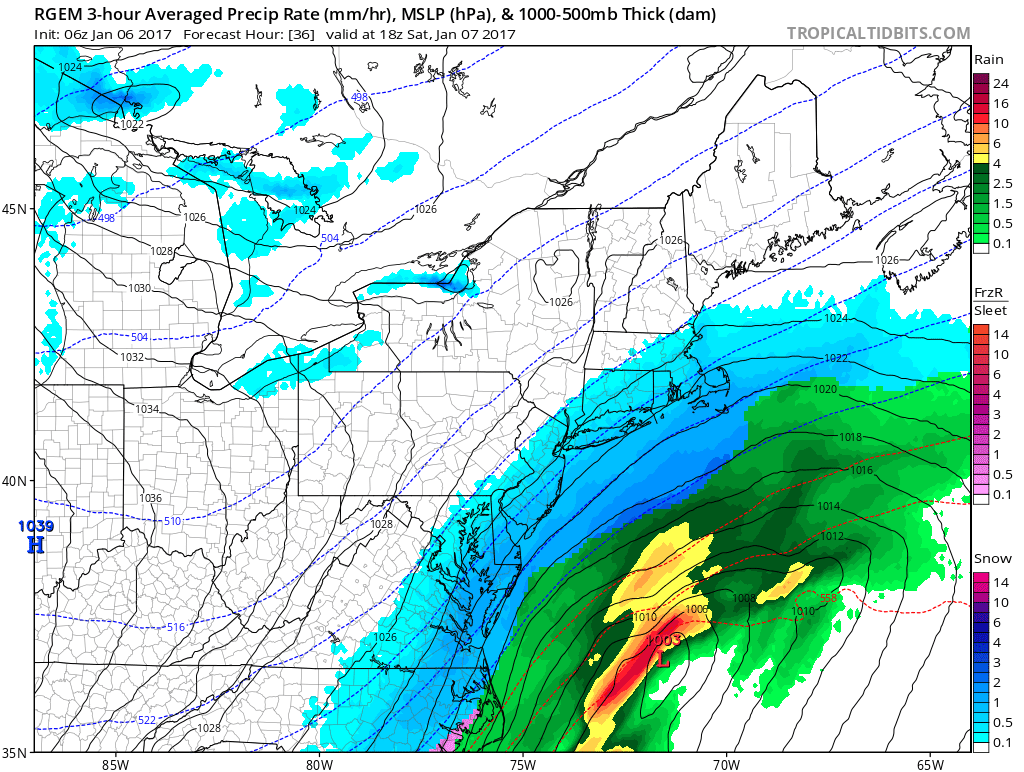
The 6z RGEM models showing region being brushed by mainly light snowfall tomorrow by a low pressure tracking east-northeast off the Mid-Atlantic coast
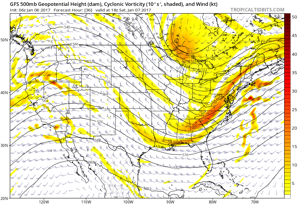
Then it will become mostly cloudy early tomorrow morning, as another off low off the Southeast US being moving northeast. Latest model guidance has gradually trended northwest with low over the last day or so, as more amplification occurs with pacific shortwave energy and some interaction polar shortwave energy, inside the larger trough. However, brunt of this storm with heavier snowfall still stays south and east of the region as mid-level centers get organized too late or well offshore.
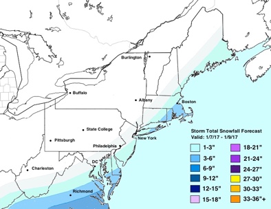
Snowfall Totals Updated 7am January 6th, 2016
So only light and possibly moderate snow at times, is currently anticipated to spread over much of the region during the day tomorrow. Best chances for snow will over Eastern Long Island and Southeast NJ, where snow accumulations could be as high 6”. While interior locations such as Northwest New Jersey and western parts of the Lower Hudson Valley, may be hard pressed to see any snow at all. This could change though if the two track shifts NW or SE by 25-50 miles on the guidance later today or tonight. High temperatures tomorrow will likely stay be in the middle to upper 20s. Stay tuned more updates later today and tonight more information snowfall totals and arrival times over individual zones.