Offshore Storm Brings Snowfall for Coastal Areas Today
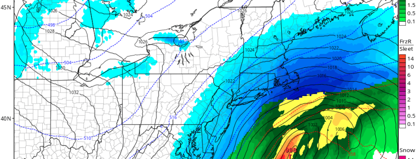
Low pressure off the Southeast coast early this morning, will track quickly northeast today. Snow will overspread from the southwest to northeast across most of the region this morning. The low will slowly intensify today and have a lot moisture from the Gulf of Mexico and Atlantic Ocean. But the low track well south and east of 40/70 benchmark. This will keep the brunt of the storm mostly offshore.
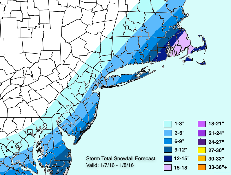
However, lift from upper-level jet and mid-level disturbance are anticipated to enhance some moderate to possibly heavy banding over snow particularly for coastal sections by early this afternoon. Heaviest snowfall is expected over parts of Central and Eastern parts of Long Island and Connecticut and over Southeast NJ where 6” of snow and greater is mostly likely fall. The National Weather Service has issued Winter Storm Warnings for these areas.
Further northwest, latest guidance early this morning, indicates some low-level dry air with north-northwest winds may cause sharp cut-off in snowfall totals especially just of west of the Hudson River. At this time, we continue anticipate about 3″-6″ for NYC and Nassau and back towards I-95. Just northwest of these locations, snowfall totals will drop off quickly. But if low-level dry air wins out, these amounts may be lower with far less snow farther northwest We will keep monitoring for these trends today and update as necessary. Otherwise mostly cloudy skies are expected today with high temperatures in the lower to middle 20s.
Snow will begin tapering off late this afternoon and this evening, as the storm moves further into Atlantic. It will turn colder behind this storm temperatures dropping into teens over region overnight. Skies will clear later tonight, as high pressure builds into region. Sunday will be partly sunny, but very cold, blustery with highs in the middle to upper 20s.


