-2")

Zone 5 (Southern NJ) Update: Significant snow through tonight
Regional analysis suggests the development of a coastal storm will continue over the next few hours. The most recent near term/mesoscale models continue to remain relatively steady with a continuation of moderate to heavy snow over Southern New Jersey through the afternoon hours. Currently, the juxtaposition of moisture and lift is creating a substantial area of moderate and heavy snow throughout the area.
Increasing lift in the atmosphere will be supported by the developing storm system and the presence of a very notable jet streak in the atmosphere’s upper levels. This will allow precipitation to expand to the northwest of the low pressure area, which will be off the coast of the Mid Atlantic states during the middle part of the day today.
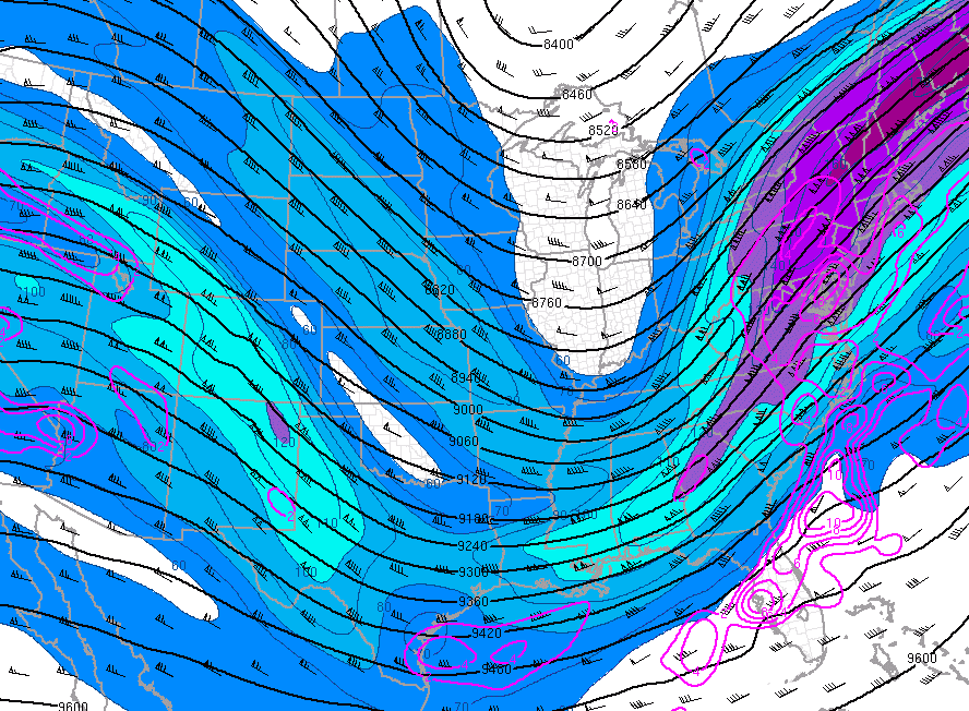
Analysis showing a very strong jet streak int he upper levels of the atmosphere. This will allow precipitation to expand and intensify.
Closer to Southern NJ, snowfall intensity is expected to remain moderate for the next several hours. This will be especially true near the shores of Southeast New Jersey, where enhanced lift in the atmosphere will create bands of heavy snow from late this morning onward into this afternoon.
These periods of moderate to heavy snow will result in poor road conditions and significant accumulations by the early afternoon hours. Travel is not recommended, and contractors and snow plows in the area should prepare for a full day of action with moderate to heavy snowfall intensity continuing through the afternoon.
Snow will eventually taper to a light intensity by evening. Stay tuned for further updates today including videos and further zone information.