-2")
All Zones AM Update: Cold morning, warmth on the way
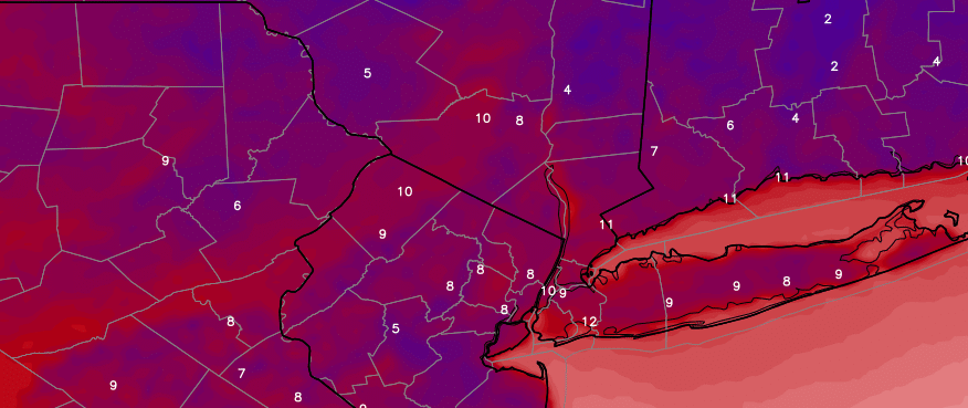
Impressively cold air settled in to the area this morning with temperatures falling below zero in many locations. This occurred at the typically favorable radiational cooling locations such as the Pine Barrens and Central/Eastern Long Island. Westhampton Beach dropped to -9F shortly after sunset, which is extremely impressive even for this time of year! Most other areas saw single digit lows, with temperatures predictably remaining warmer in the city and other urban locations.
Temperatures will remain quite cold today with an arctic high pressure still hanging on to control of the weather pattern. Blustery winds will have calmed down this morning and afternoon, and the day is expected to be pleasant overall. Plenty of sunshine will dominate the skies early with no precipitation impacts anticipated — with a gradual trend towards more cloud cover as the day goes on. The biggest threat may be black ice which could have formed on some area roadways.
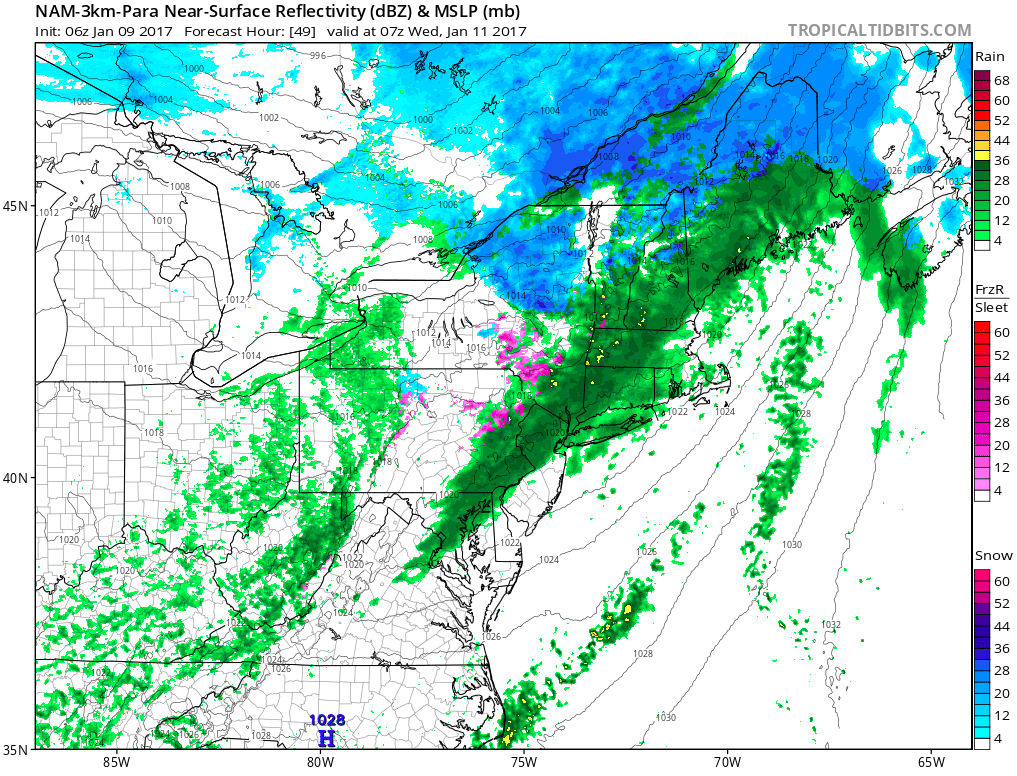
NAM model suggesting a period of steady rainfall with a cold front on Wednesday morning.
A strong storm system begins tracking well to the northwest of the area on Tuesday morning, traversing from the Northern Plains into Southern Canada. Southerly flow ahead of the storm system will cause a gradual warmup by the middle of the week, but enough cold air will be in place across the interior and higher elevation suburbs to support a period of snow or freezing rain late Tuesday evening.
The transition to rain will gradually occur from south to north Tuesday Night, with a period of steady rainfall as a cold front approaches the area early on Wednesday morning. More unsettled weather is likely to return as early as Thursday with another disturbance approaching the area — this time with almost all rain, owing to a warmer airmass in place.