-2")
AM Zones Update: Light snow showers possible this afternoon, then more rain likely tonight
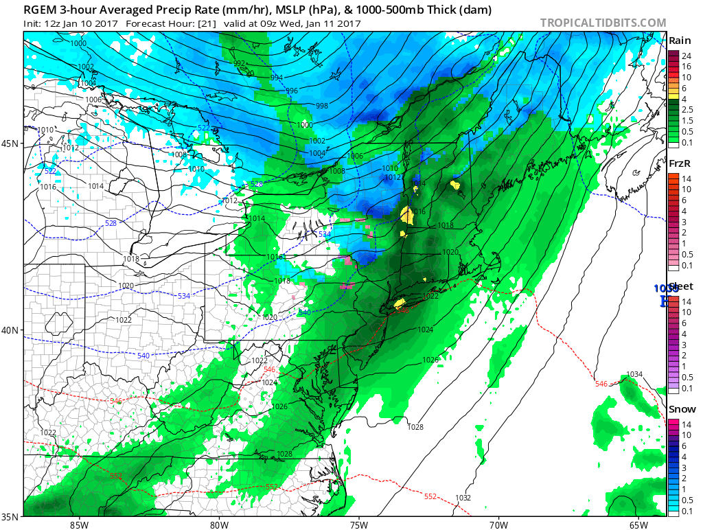
Low pressure tracking over Great Lakes will push a warm front the region late this afternoon and evening. Any sunshine early today will give away to more cloudy skies, as the warm front approaches form the southwest. Some snow showers possible with this front later this afternoon or early evening.If these happen, some light coatings are possible, where temperatures are still below freezing-especially northwest of NYC.
However very dry-air in lower levels, make it difficult for precipitation reach the ground this afternoon. Also lower-level temperatures may warm enough for sleet or rain to mix with in the snow showers. So weren’t aren’t anticipating widespread hazardous travel this afternoon.
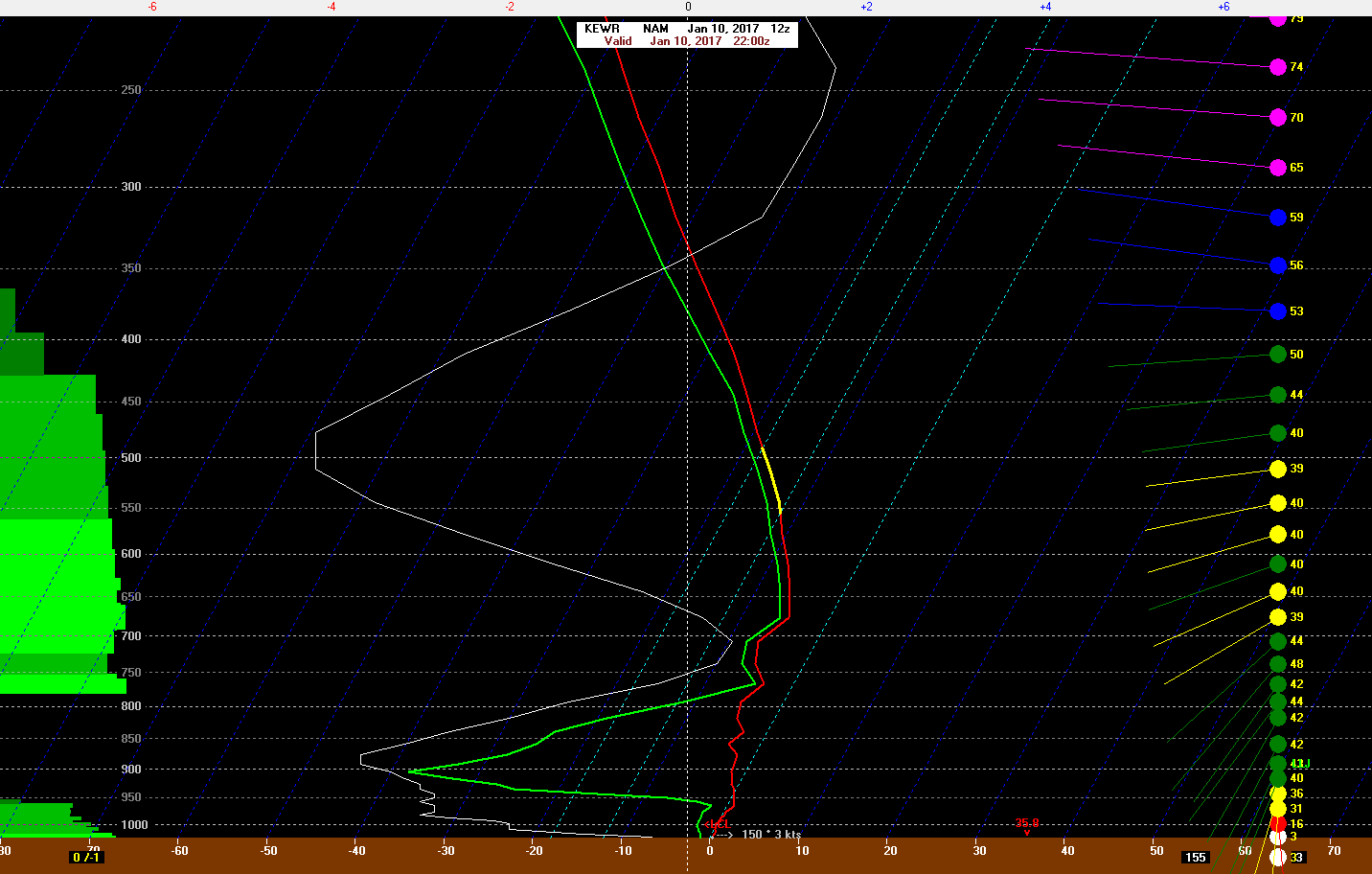
12z NAM sounding at Newark, NJ showing some between 800mb and 950mb and some weak lift at 5pm today
It may dry be early tonight, before more arrives precipitation later tonight as cold front approaches from the west. Temperatures will be rising into the lower to middle 40s with southerly winds overnight. So most of this precipitation is expected to be rain. Some interior locations may still be have enough low-level cold for some sleet or freezing rain at the start. That could cause some slick spots on area roadways. If this appears to becoming more likely, then short-fuse these individual zones may be need later today or early tonight.
Otherwise, rain might become moderate to heavy at times, with lift and moisture increasing from a strengthening southerly low-level jet. But this rain should taper off from west to east across all the zones during mid-morning hours, as the cold front pushes east. So serious flooding issues are expected. Some areas roadways could see could some ponding of water.
Behind it, clouds will break for some sunshine by the afternoon hours. But airmass behind will actually be moderating with winds turning more southerly by the end of the day. Temperatures will remain steady in the lower to middle 40s. Another frontal system arrives with more showers possibly later Wednesday night and Thursday.