-2")
Public Analysis: Colder air intrudes this weekend, in a sea of warmth
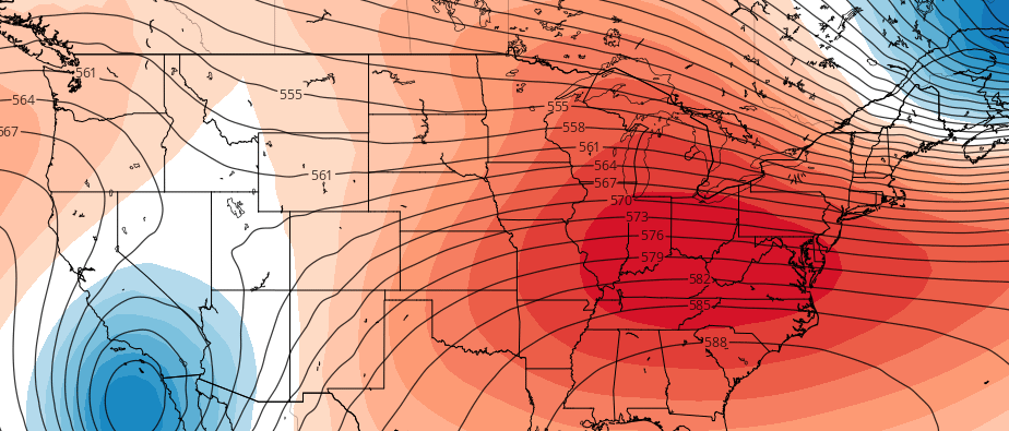
After coming out of frigid airmass early this week, temperatures gradually moderated to above seasonal levels for mid-week period. This is due to more troughiness over the Western United States, and lack of high-latitude blocking, leading to more progressive pattern with a stronger Southeast ridge.
On the periphery of the ridge, the a more southwesterly flow will has allow for warmer airmass to move into Northeast and Mid-Atlantic region. Meanwhile the storm track has shift well to our north and west due the Southeast ridge. This pattern continue will for the next few days. Another low passing over the Great Lakes will push a warm front with some rain likely through the region tonight. Then temperatures tomorrow could rise well into the 50s or even lower 60s, across the area as even warmer airmass moves into region.
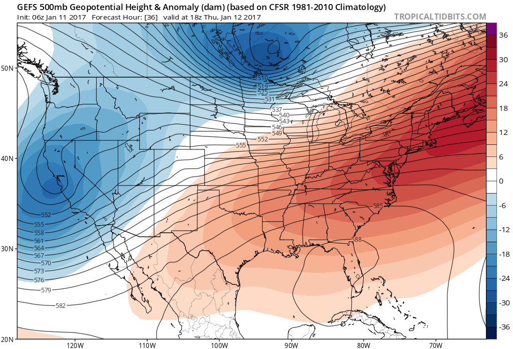
The GEFS at 500mb level showing a strong SE ridge over the East Thursday
But some changes will start coming in tomorrow night, as a pretty strong cold front comes through region. A few showers are possible with this front. But main story will be the a very cold airmass that will come into region by Friday night and Saturday. Temperatures will return to near or slightly below normal levels for this weekend.
We’ve also been watching the potential for light wintry precipitation event this weekend. There will likely enough cold air with the weak ave tracking to our south for mostly snow to fall, especially from NYC north. However, some model guidance as of late this morning has trended drier with this storm system the Northeast and Northern Mid-Atlantic regions. Confluence from strong high pressure over Southeast Canada may keep this system and its moisture further south. We will continue monitor it.
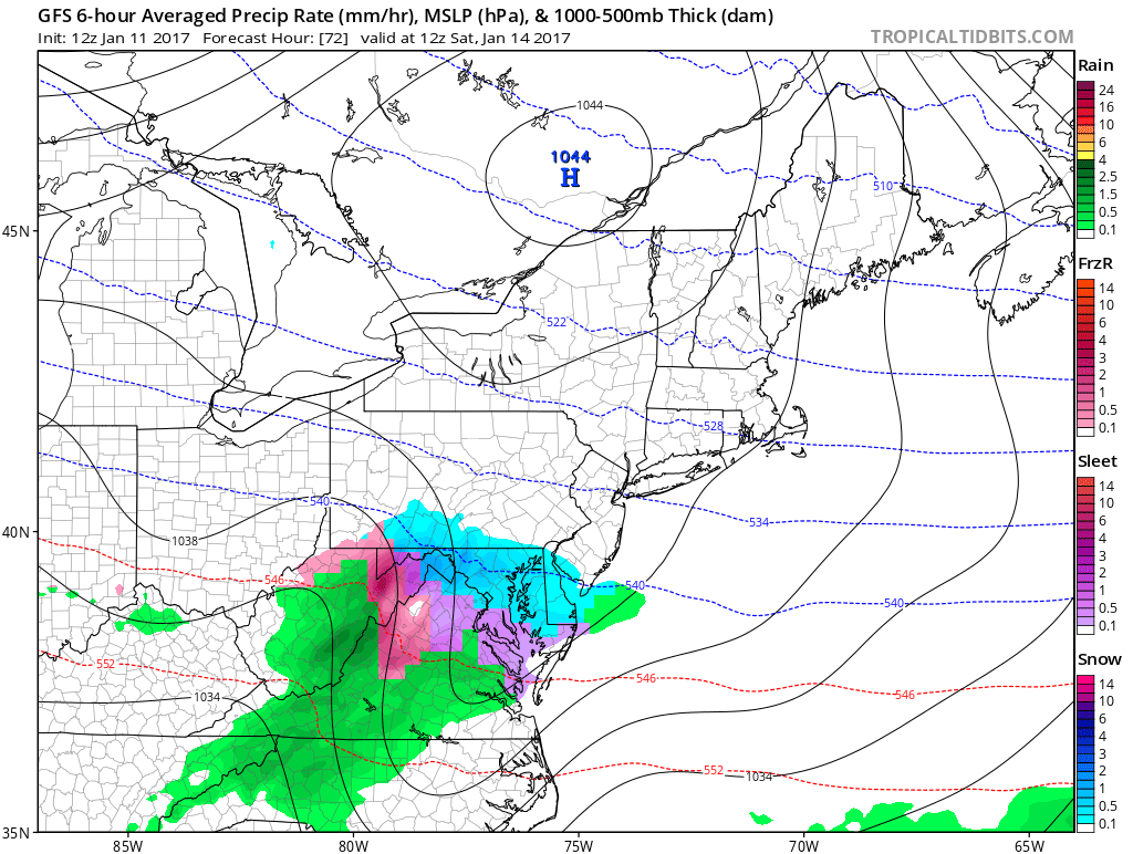
The 12z GFS this morning shows very strong high pressure over Southeast Canada forcing this wave move south of NYC metro region on Saturday.
However, this period of more wintry weather won’t last long, as the pattern remains progressive overall. After this weekend, the southeast ridge builds again and temperatures will begin warm again to above normal levels, during the week. We do see however some changes to colder pattern towards the end of this month that will be detailing more soon to our premium members. If you are interested, sign up to become a Premium member today!