-2")
AM Zones Update: More Rain Likely Tonight, Mild on Thursday
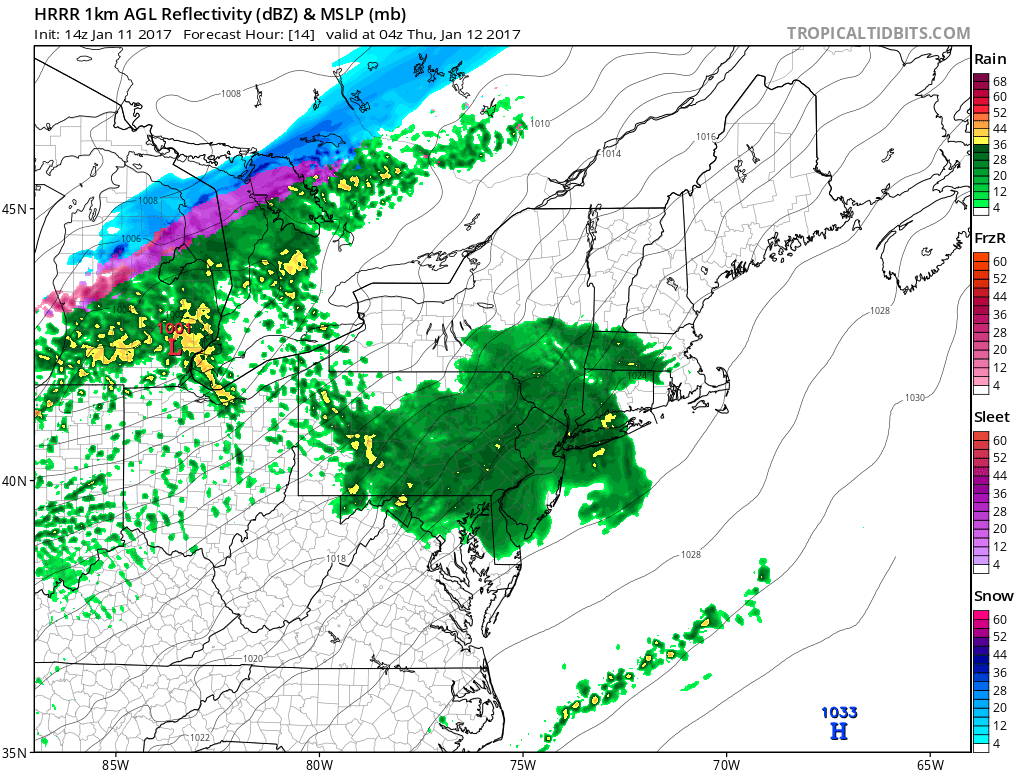
More sunshine and dry weather returns today with a frontal system having passed through. Temperatures will remain with highs in the upper 40s to lower 50s. However, some clouds may start increasing again this afternoon, as another low frontal system with low pressure over the Great Lakes moves begins approaching the region.
A warm front with this system will move through region tonight. A strengthening southwesterly low-level will enhance lift and moisture along this frontal boundary. This could to period of steadier rain with briefly moderate to heavy downpours. However, rain will off taper quickly by daybreak tomorrow. So rainfall totals are expected to be mostly under a .50” and not cause any serious flooding issues.
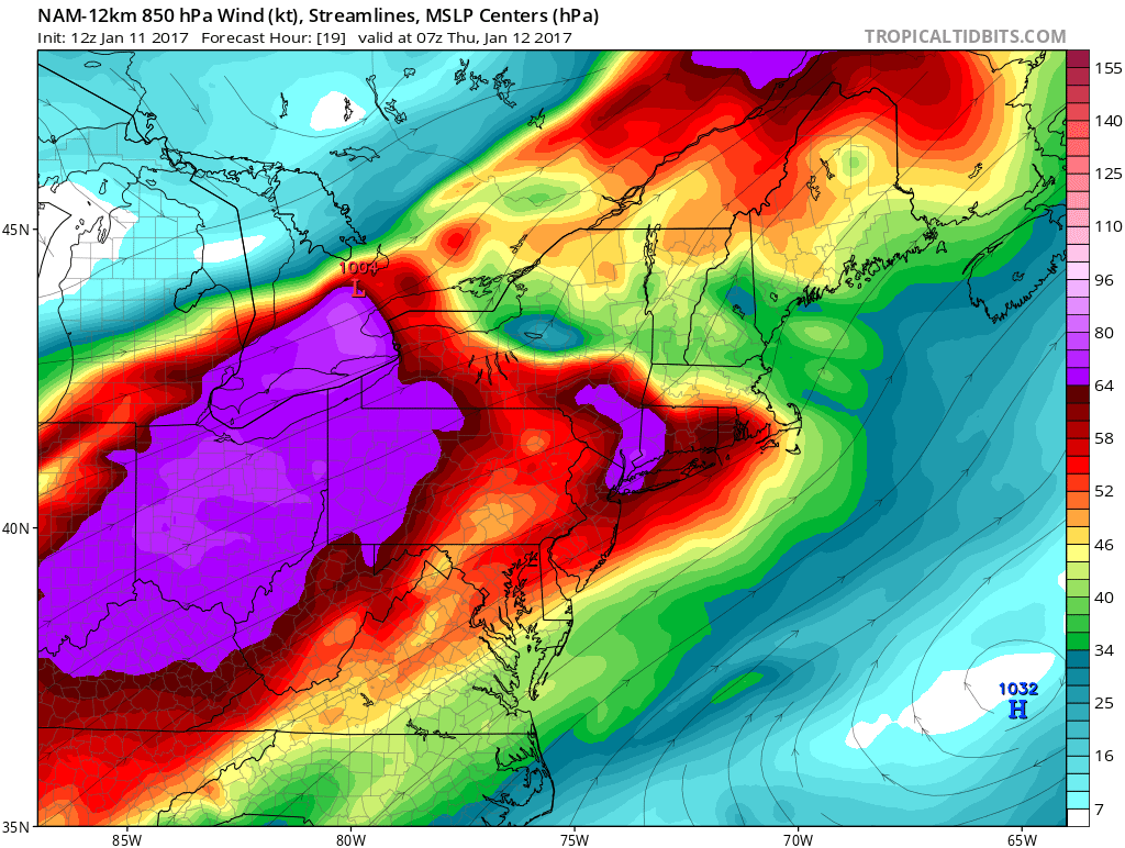
NAM model showing a strengthening southwesterly low-level with 850mb winds near 64kts
Some clouds and light showers or drizzle, may linger into tomorrow morning. Then clouds may break for some sunshine tomorrow afternoon, with the warm front north of the region. Temperatures will likely rising back well into 50s over much of the region, with a deep southwest flow and higher mid-level heights. Some southern zones, especially over New Jersey may see temperatures rise into the lower 60s.
Then a cold front will move through all the zones during tomorrow night. But most of dynamics for forcing will be northwest of the region. So just some scattered showers are possible as front moves through the region. Temperatures may not drop that much with cloud cover and winds southwest ahead of the front much of the night.
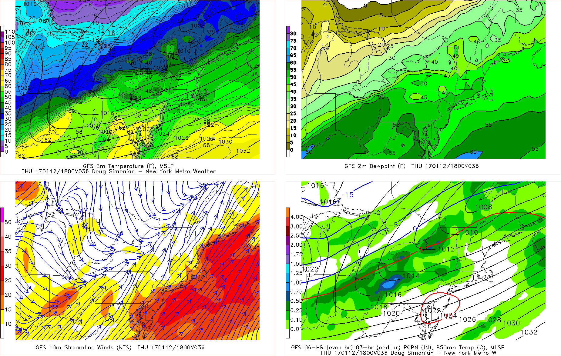
GFS model showing temperatures rising into the 50s and even 60s over Central and Southern NJ tomorrow
On Friday, an colder airmass from the north, will start filtering into region, as a strong Arctic high begins moving into Southeast Canada. Temperatures will start out warmer early in the day, likely in the 40s. Then will begin falling as the day goes on, perhaps down into 30s by late afternoon, especially over northern zones. By late Friday night temperatures could in the 20s or below freezing over all zones
Stay tuned more updates later today and tonight, including a premium article and video on a possible light wintry precipitation event over the weekend.