-2")
PM All Zones Update: Wintry precipitation slides south
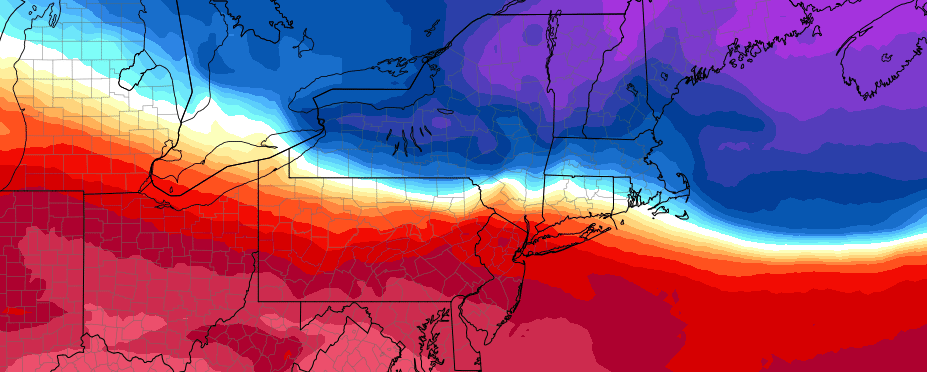
Fair and relatively mild weather remained in place this afternoon throughout the majority of the forecast area. Temperatures in the 40’s were fairly common and a mix of sun and clouds made for a pleasant day. A more complex situation will develop from later tonight into Saturday, however, as a temperature gradient to our southwest shifts towards the East Coast.
Colder air will move into the Northeast tonight and into Saturday morning with a very impressive surface high pressure area shifting over New England. Precipitation along the temperature gradient in the Mid Atlantic states will fall as a wintry mixture — with freezing rain, sleet, and rain all possible by Saturday afternoon.
The main concern becomes the development of a weak low pressure area off the coast of the Mid Atlantic on Saturday afternoon and evening. This low pressure area could act to enhance lift in the atmosphere, causing more precipitation to break out throughout New Jersey — especially Southern and Central parts of the state. Snow, sleet and freezing rain would be possible should this low pressure develop.
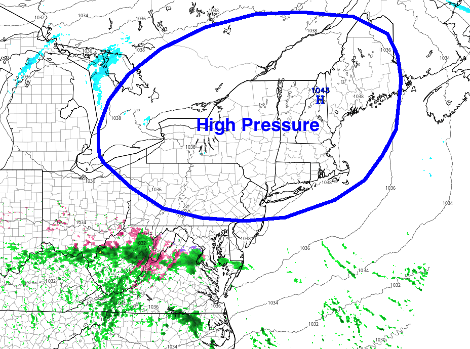
Models show a strong high pressure over New England shunting a disturbance to the south on Saturday.
Confidence in its development being significant, however, is quite low. The strong surface high pressure to the north is likely to mitigate the development of steady precipitation and the low pressure area should remain weak and progressive. A 1045mb high exists over New England on Saturday morning — not supportive of any precipitation of significance in most of the region.
Still, a few periods of wintry precipitation are possible on Saturday afternoon and evening across southern parts of New Jersey. Accumulations are expected to remain minimal, although roads may become briefly slick. The weather is expected to remain cold and calm from later Saturday night into Sunday as the mentioned high pressure sinks southward and takes over.