-2")
1/15 All Zone Update: High pressure in control for now
On the heels of a weak disturbance Saturday, high pressure has built back into the region today. This high pressure will be the dominant force in the weather pattern throughout the Northeast US over the next few days as a thermal gradient, responsible for enhancing yesterdays low pressure area, sinks southward into the Middle Atlantic. Temperatures will fall colder as this cold high pressure builds overhead.
Sky conditions, however, will remain quite pleasant — with plenty of sunshine and the weather remaining mostly calm. This pattern will remain through Monday as temperatures are expected to gradually moderate. Another storm system will gradually develop well to our west over the Central United States, and while it will remain far from our area to begin with, southerly winds will begin bringing warmer air northward through the Mid Atlantic and Northeast once again.
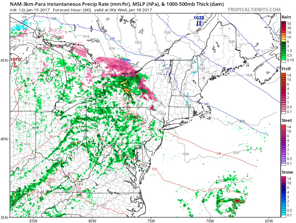
NAM model showing showers approaching the area on Tuesday
Warming temperatures will continue through early Tuesday, with a storm system approaching from the southwest on Tuesday afternoon. Wintry precipitation seems highly unlikely in most zones at this time, with the lone exception being the far northwest areas of Connecticut, where some colder air may remain entrenched and create some icing problems on Tuesday afternoon and evening. We’re closely monitoring forecast models in this area — a specific zone update for this area may be needed as the event draws closer.
The storm system impacting our area on Tuesday will eventually shift east/northeastwards. A low pressure system over Southeast Canada will transfer off the coast of New England, with drier air moving into the Northeast US by later Wednesday. The exception will be over New England where precipitation may linger into early Thursday thanks to the developing coastal storm. Elsewhere, more pleasant and (Relatively) cool temperatures will return.
Look for further updates this afternoon including an update on the long range forecast as we look towards late January and February!