-2")
1/24 PM All Zones: Lingering rain, clearing late tonight
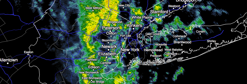
As expected, showers and periodic steady rain lingered throughout much of the area today. This was most prevalent in Northeast NJ, NYC, Long Island and Connecticut, where the bands of rain pivoted westwards from the Western Atlantic Ocean inland. The potential for rain will continue for a few more hours, likely into the early evening, as the surface low pressure meanders offshore.
Much of the banding is being enhanced by frontogenesis, or lift, in the atmosphere’s mid levels. Mid level low centers are still only a few hundred miles off the coasts of New Jersey and New York, and lingering dynamics and moisture are juxtaposed to support bands of rain moving inland. Over time, these dynamics will wane, especially during the early to middle part of the evening.
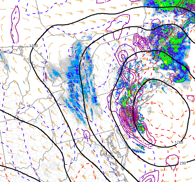
Frontogenesis (lift in the atmosphere) aided int he development of precipitation on Tuesday afternoon and evening.
Gradually, tonight, banding will become more sporadic and shift eastwards. This may not occur throughout the area until after 2am, with bands lingering especially on Long Island and in parts of New England until the early morning hours of Wednesday. Clouds will linger as well, especially across areas further east on Long Island.
As Wednesday morning goes on, drier northwest winds and subsidence (sinking air in the atmosphere) will bring the return of sunshine. Temperatures are likely to rise above seasonal averages during the afternoon hours. High temperatures may reach the upper 40’s or even lower 50’s in some areas, despite northwest winds continuing.
Another chance of showers arrives Wednesday evening with the passage of a weak frontal boundary – but the storm is not expected to be significant and precipitation amounts should be rather negligible.