-2")
1/26 PM Zone Update: Colder weather arrives this weekend
After some showers this morning, skies cleared for more sunshine with temperatures in the 50s. It will be breezy this evening with drier westerly winds possibly gusting over 35 mph across parts of region this evening. This is due a tighter pressure gradient over the region. Colder air begins arriving later tonight as temperatures fall into the lower to middle 30s.
Friday looks likely to feature more breezy conditions with sunshine expected throughout the day. High temperatures, while a few degrees cooler, will still reach the middle 40’s throughout the region. Winds aren’t likely to be as gusty as they were on Thursday — and that will be noticeable during the afternoon hours.
Another cold front, with limited moisture, moves through the area with a reinforcing shot of cold air on Friday. Temperatures will fall during the evening and overnight hours into the middle and upper 20’s throughout the suburbs, with the typically warmer spots near the city and along the area shores remaining in the lower 30’s.
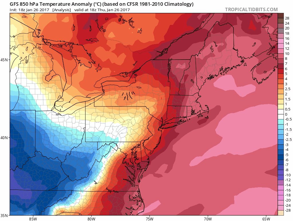
Colder temperatures aloft will move into the area this weekend.
Blustery conditions continue on Saturday — and the trend of the weekend will be cooler. Westerly winds continue and temperatures will be noticeably colder than the days before. High temperatures are likely to only reach the upper 30’s and lower 40’s, close to seasonable levels for this time of year, with cold and dry conditions in place.
The active weather pattern will, however, continue. A weak disturbance looks likely to scrape by the area from late Sunday into Monday with the potential for some wintry precipitation. The vast majority of forecast models currently suggest the storm will remain offshore and impacts will be limited, but some light snow still appears possible — and could be more notable if the storm trends closer to the coast.