-2")
AM All Zones: Showers clearing for sunshine later today
A weak atmospheric disturbance, moving towards the Northeast US from the Ohio Valley this morning, will continue to shift through the region as the morning goes on. Isolated to scattered showers have shifted through Pennsylvania, New Jersey, and New York and have become slightly more widespread this morning. Temperatures remain relatively mild as the system shifts through.
The showers will continue their northeast movement as the morning goes on. Drier air, visible on water vapor satellite imagery and local observations, will shift eastwards from Pennsylvania through the Northeast US later this morning as a frontal boundary moves eastwards. This will clear showers away from the region, with a drier atmosphere leading to more sunshine as the day goes on.
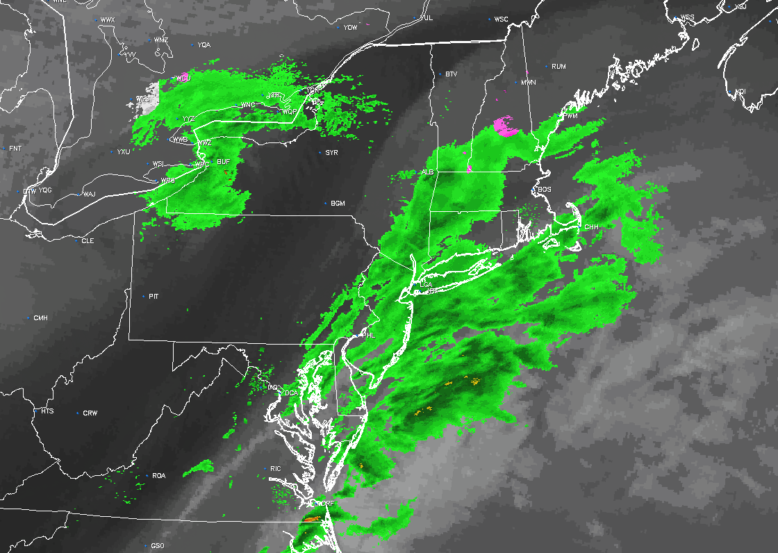
Analysis as of 9:30am showing showers shifting away from the region with drier air building in.
Temperatures are likely to rebound into the upper 40’s and lower 50’s throughout the area, making for quite a pleasant afternoon. Westerly winds behind the front will be quite gusty at times, especially during the mid afternoon hours as the atmosphere works to mix some mid-level winds down to the surface.
Colder air is on the way as the weekend approaches, with multiple cold fronts bringing colder air into the region. The airmass will still remain above normal for this time of year, but it will feel very cool compared to the mild airmass that has been in place during the majority of this week.
More details on the medium range forecast are on the way!