-2")
1/27/17 AM All Zones: More Seasonably Cold Weather Returns
A mixture of clouds and sunshine is expected to dominate the weather today, as some instability and moisture will be around to keep some cloud cover over the region. But it will be mainly dry, with westerly downsloping winds. Temperatures will likely hold steady or slowly rise into the lower to middle 40s for most of the region, as another cold front moves through this afternoon. Winds could be gusty again behind this front, but they shouldn’t be quite as high as yesterday.
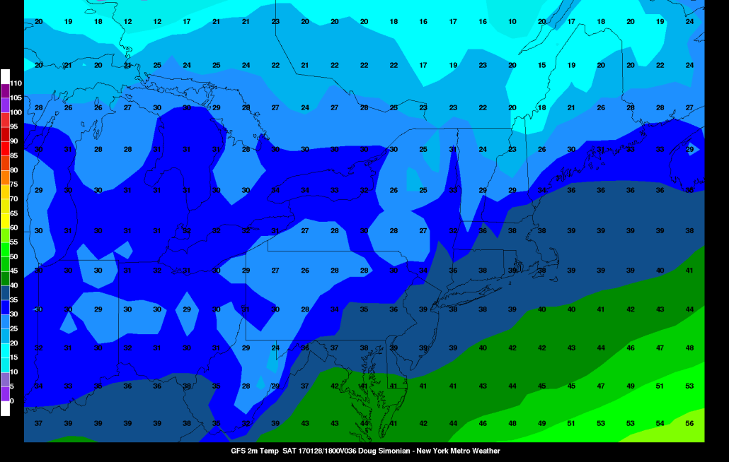
Clear to partly cloudy skies are anticipated for tonight as another reinforcing shot of cold air arrives. Temperatures will drop into the mid-upper 20s over the nterior and lower 30s for more urban and coastal areas. A mixture of sunshine and clouds is expected again for Saturday, but it will be a little colder with high temperatures closer to 40 degrees.
A couple more upper-level disturbances with a reinforcing shots of cold behind them, will move through the region for rest of the weekend. Mainly seasonably cold and dry conditions are anticipated. By Monday temperatures may be actually be below normal with highs in the lower to middle 30s throughout most of the region — a big change from the past several days of warmth.
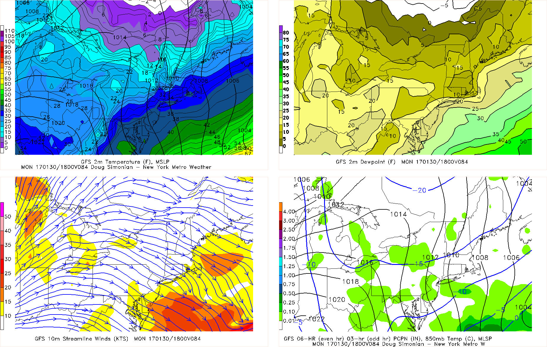
The GFS on Monday afternoon with colder temperatures and weak inverted trough with some light snow showers over the region
From Monday through Wednesday, we will be watching the potential for a couple of weak systems to possibly bring some wintry precipitation. Models have been somewhat inconsistent with the handling of these systems. But any large storms or significant precipitation are unlikely for the region, with a lack of high-latitude blocking.
An inverted trough could set up with some shortwave energy around backside of through with an offshore storm on Monday. This could produce some light snow or snow showers over the region. Then an Alberta clipper tracking well to the north of our region could produce more snow or even rain showers on Tuesday or Wednesday. Temperatures may briefly moderate, before more colder air likely returns later next week.
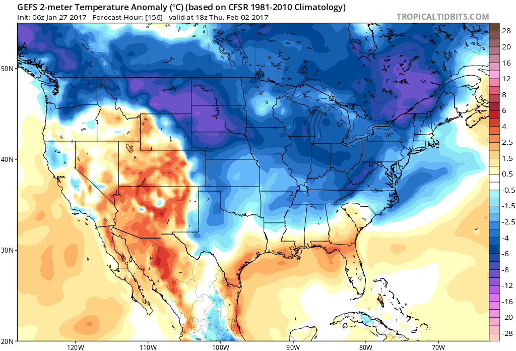
6z GEFS showing below normal temperatures for late next week
Stay tuned for more zone forecast updates and continue to check the premium dashboard for more discussion for late next week and extended term! We will likely be fine tuning the forecast as we get closer to each system.