-2")
PM Zone 4/5 (Southeast NJ) Update: Light snow tonight
A weak low pressure system is developing this evening across the Mid Atlantic states, and will continue to move east/northeastwards to a position off the New Jersey coast from later tonight into Sunday Morning. The low pressure area is associated with a deep, but progressive mid and upper level trough which is moving through the Northeast states as we speak. This trough is of polar origin, emanating from Canada.
The “clipper” system will develop through the evening, as lift in the atmosphere strengthens and expands. Additional moisture will also be drawn into the system as the low pressure center develops tonight. The two will coincide over Southeast parts of New Jersey from late Sunday Night into Monday morning.
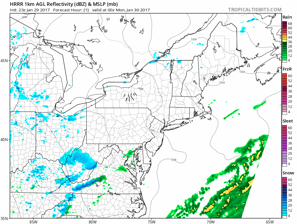
HRRR model evolution of the storm system through Monday AM
As a result, bands of snow are expected to develop northeastwards into New Jersey tonight after 10pm, with snow becoming steady at times in Southeast parts of the state. The bands of snow will begin to expand a bit during the pre-dawn hours as the lift in the atmosphere expands. The morning commute is likely to be affected in Southeast NJ, particularly near the coastal areas.
While no bands of heavy snow are expected to develop, bands of moderate and steady snow are likely, especially during the early morning hours. These will be most prevalent across Atlantic, Cumberland, Cape May, and Ocean Counties. Forecast models indicate the potential for frontognesis here — which is an area of enhanced lift near gradients of wind or temperature that can produce steadier or heavier precipitation.
The bands of snow should begin to drift offshore rather quickly, by mid morning, with steady snow ending by the mid morning hours across the state. Snowfall totals should fairly uniformly fall into the 1-3″ range. However, there is the potential for isolated amounts towards the higher end in the aforementioned county areas.
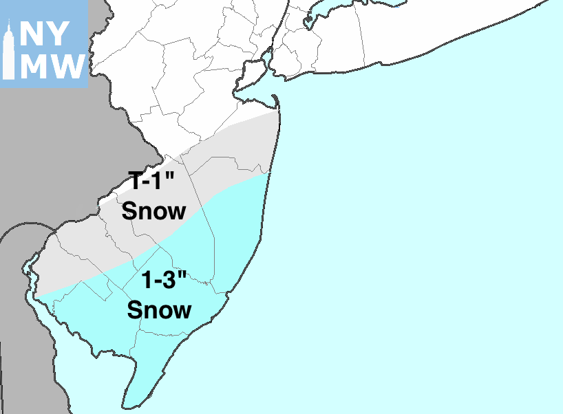
Forecast accumulations through Monday AM
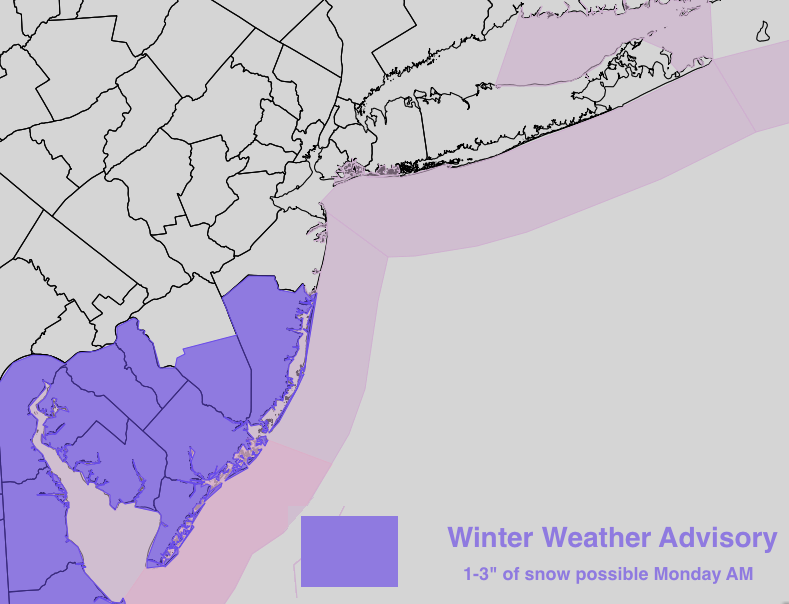
The National Weather Service has issued Winter Weather Advisories in Southeast parts of the state, for the potential of 1-3″ of snow. Again, the morning commute does look to be affected by the storm system in these zones. Crews should prepare to at least lightly treat roads in the Winter Weather Advisory areas for the morning commute. Plowing does not appear likely at this time.
The threat for wintry weather drops off further north — although snow is possible, noteworthy accumulating snow currently appears likely to be relegated to the areas of best frontogenesis (where the Winter Weather Advisory is in effect). Areas further north should expect a coating to around a half inch of snow, especially on colder surfaces.
Stay tuned for additional nowcasting observations through the overnight period — especially on the Premium Dashboard — with zone updates likely tonight as well.