-2")
2/2/17 AM All Zones Update: Colder Trend Late Week, More Active Wx Early Next Week
Some cloud cover and perhaps some flurries will be around this morning, as a cold front passes through region. Then skies will clear for more sunshine this afternoon, with drier westerly winds. Temperatures will rise into upper 30s to lower 40s over most of the region, by early this afternoon. Then begin falling later in the afternoon, as a colder airmass begins moving into region. Winds could also be gusty, behind the cold front this afternoon, from between 30 to 40 mph.
Skies will be mostly clear tonight. Winds will diminishing overnight as well. A polar airmass will be settling over the region with temperatures dropping into the lower to middle 20s for urban and coastal areas and middle to upper teens for the Interior, by daybreak.
Then strong high pressure moving from the Ohio Valley to Mid-Atlantic regions will be mostly in control between Friday and Saturday. Some high clouds are possible again on Friday as a couple of weak disturbance move through Northeast and Mid-Atlantic regions. Otherwise more sunshine and dry conditions are anticipated both days.
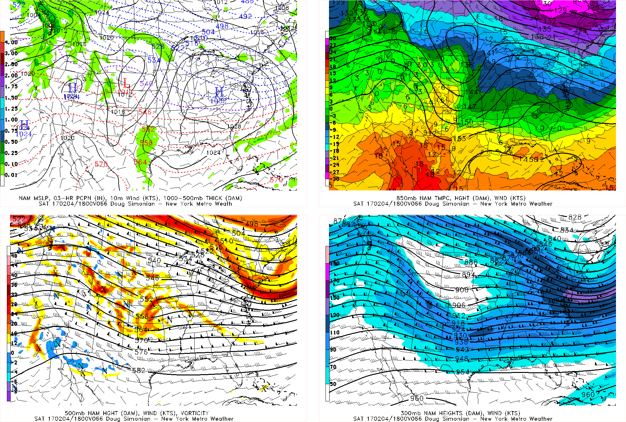
NAM model forecast at the surface and upper-levels of atmosphere for 18z (1pm) Saturday afternoon.
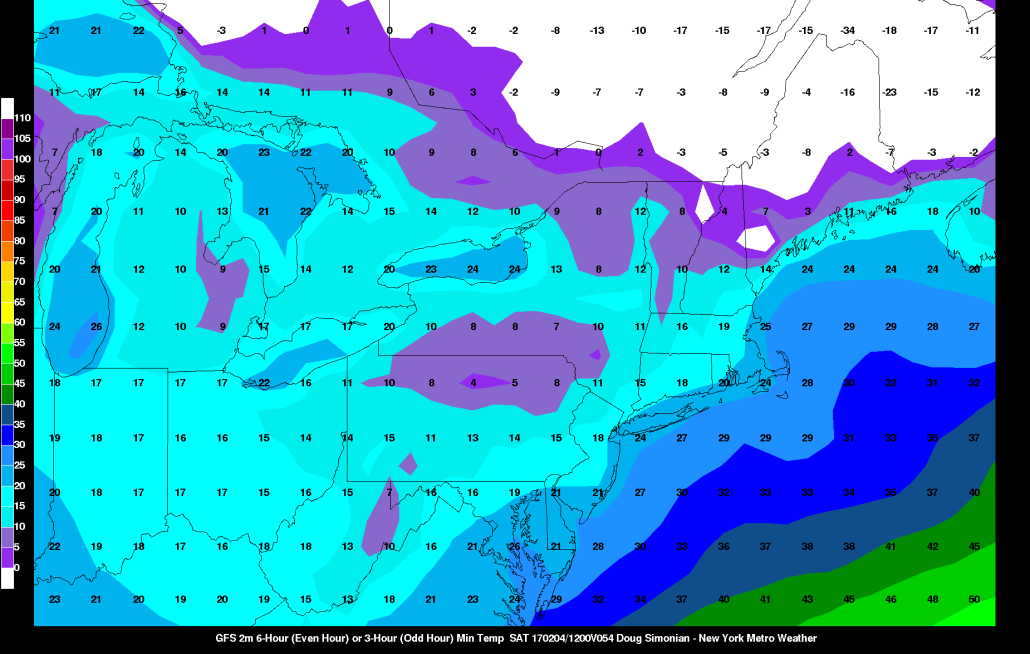
A confluent flow underneath a larger upper-level low over Canada, will keep a colder airmass with temperatures several degrees below normal over the region each day. Daytime highs will likely be in the lower to middle 30s each day. Low temperatures early Saturday morning will likely be the coldest over the region, with temperatures getting down to as low as between upper single digits or lower teens in some of the suburbs.
More cloud clover is likely for Sunday. Latest models continue to show polar and pacific disturbances remaining weaker and unphased. So it appears mainly a weak frontal boundary with some warm-air advection, will be moving through region on Sunday on Sunday with some snow showers possible. Temperatures will be rising into mid-upper 30s and possibly lower 40s with more southwest winds ahead of the frontal boundary. So little if any snow accumulations are anticipated across the region, at this time.
Another colder-air mass may come behind this frontal boundary for Monday, as low pressure deepens over Canada Maritimes. This could setup some cold-air damming over the region with high pressure to the north and east, during the day on Tuesday, as large storm system approaches.
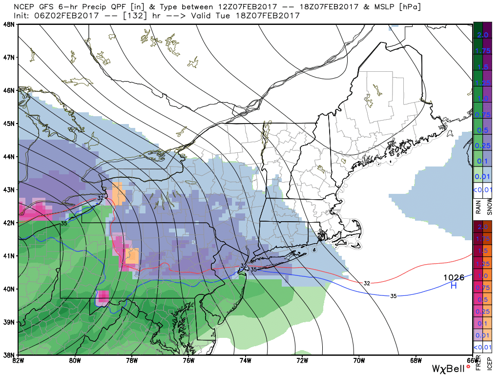
Early morning GFS model showing snow over northern areas and rain over southern areas on Tuesday
This storm will likely be tracking well north and west of the region, with a warmer airmass arriving by Tuesday night or early Wednesday. But strong lift along a thermal gradient, may cause snow or wintry mix to break over the region during the day Tuesday, before eventually changing over to rain in most areas.
If this scenario happens, some snow/ice accumulations will become possible, especially over the Interior on Tuesday. Otherwise, some heavy rainfall is also possible with this system, by Tuesday night, with Gulf of Mexico and Atlantic moisture involved. But we are still 6-7 days way from this system impacting the region. So there is plenty of time for some changes. So stay tuned more updates and discussion on this system, as we get closer