-2")
AM All Zones Update: Few Snow Showers Possible Sunday, Rain Likely Tuesday & Wednesday
Large high pressure over the Lower Ohio Valley and Mid-Atlantic regions, will provide mostly sunny skies today. But a deep northwest flow, will keep a cold airmass with temperatures several degrees below seasonal averages, over the region. High temperatures will be in the lower to middle 30s, again by this afternoon.
Then high pressure starts moving offshore tonight. It remain cold and dry. But the flow with turn more southerly. Some clouds will increase during the evening and overnight hours, well ahead of a weak storm system to the west. More cloud cover and a light southerly flow, will likely keep low temperatures a little warmer tonight. Lows will likely be somewhere in the 20s, for most of the region.
On Sunday, a weak upper-level disturbance and cold front will be approaching the region. This will likely keep more clouds than sunshine around. There could still be enough lift and moisture with these features, for some snow showers, especially over Northwest NJ, Lower Hudson Valley and Interior Connecticut.
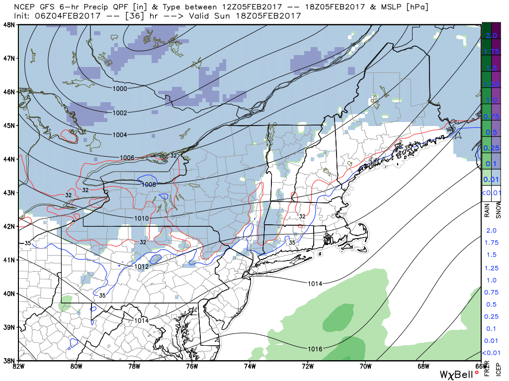
GFS model showing more snow showers northwest of NYC and moisture with a second wave of low pressure offshore tomorrow
However, the best dynamics for precipitation, will be with low pressure areas moving well north and south of the region. Southerly winds will help temperatures to rise into middle to upper 30s over Interior and lower to middle 40s closer to the coast, during the afternoon. So if snow showers occur, they may be widely scattered with little or no accumulations. Skies will begin clearing tomorrow evening, as cold front moves through the region. Temperatures overnight will drop into middle to upper 20s over Interior and lower 30s.
High pressure will briefly build back into region with more sunshine again on Monday. As low pressure deepens over the Canadian Maritimes, it will be little colder with northwest winds and highs in the upper 30s to lower 40s. Then as high pressure moves offshore tomorrow night, winds will turn more southerly.
We still anticipate, predominately some rainfall across much of the region, with larger low pressure system tracking over Great Lakes, on Tuesday and Wednesday. But some low-level cold air could remain fir some wintry mix of precipitation at the onset for the Interior locations on late Monday night or Tuesday.
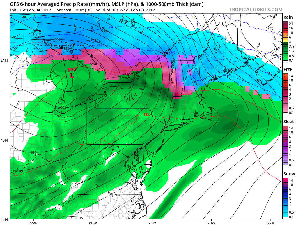
GFS model showing the area in the warm sector with more rain on Wednesday
Otherwise, a strong southwesterly low-level jet is likely help push a warm front north of the region by Tuesday night and early Wednesday. Temperatures will be mild, in the warm sector on Wednesday. Perhaps reaching the 50s or even 60s, especially if clouds can clear for some sunshine during the day.
Then a cold front will pass through with more showers late Wednesday. Models continue to show large high pressure building into region, with colder and drier weather later in the week. Stay tuned for more zone forecast updates on this storm system through this weekend and early next week.