-2")
Zone 2/8 (LI/CT) Update: Heavy snow continues today
Bands of heavy snow will continue moving into the region late this morning and into this afternoon, as a low pressure system develops and continues to strengthen offshore. This low pressure will shift from a position off the New Jersey coast towards a position south of Southern New England as the day goes on today — strengthening quite significantly as it does so.
In the mid and upper levels of the atmosphere, dynamics will continue to become more impressive this afternoon. This will be most notable in the mid levels, where temperature and wind gradients will enhance a phenomenon known as “Frontogenesis”. This occurs when temperature and wind gradients create enhanced lift — leading to very heavy precipitation.
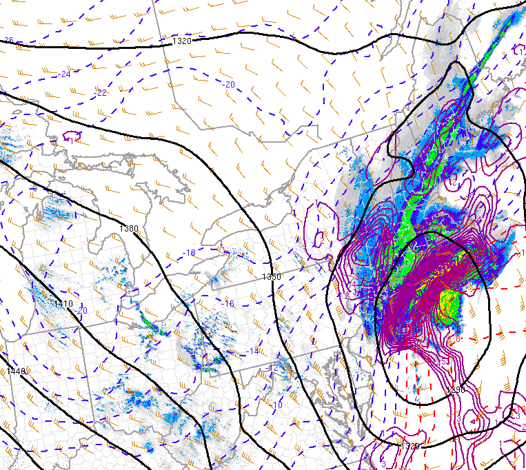
Frontogenesis, or enhanced lift for precipitation, is widespread in Long Island and CT this morning.
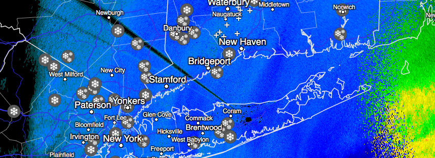
These frontogenic bands of heavy snow will move over Long Island and Connecticut as the late morning and early afternoon period continues. Arcing from southwest to northeast, very heavy snowfall rates are likely within these bands of snow. Thundersnow has been reported several times already this morning within these dynamic bands of snow.
A gradual movement to the east is anticipated as the day goes on, with snowfall rates diminishing first over Central Long Island and Western Connecticut. The event will take slightly longer into the early afternoon to wrap up over Eastern Long Island and Central/Eastern Connecticut. Snowfall totals are likely to range from 10-15″ throughout this area, and higher amounts are likely in isolated locations where banding is most prolific. Radar trends will continue to be monitored throughout the afternoon.
Stay tuned for additional updates planned around 2:00pm.
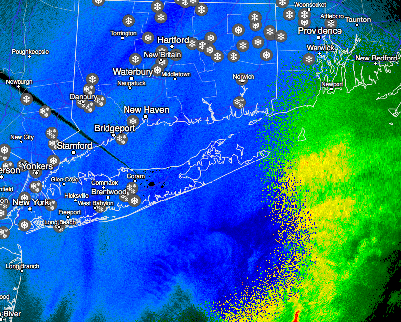
Latest radar as of 11:00am Eastern.