-2")
Late AM All Zones Update: Snow & Ice Continues For Some Areas This Afternoon
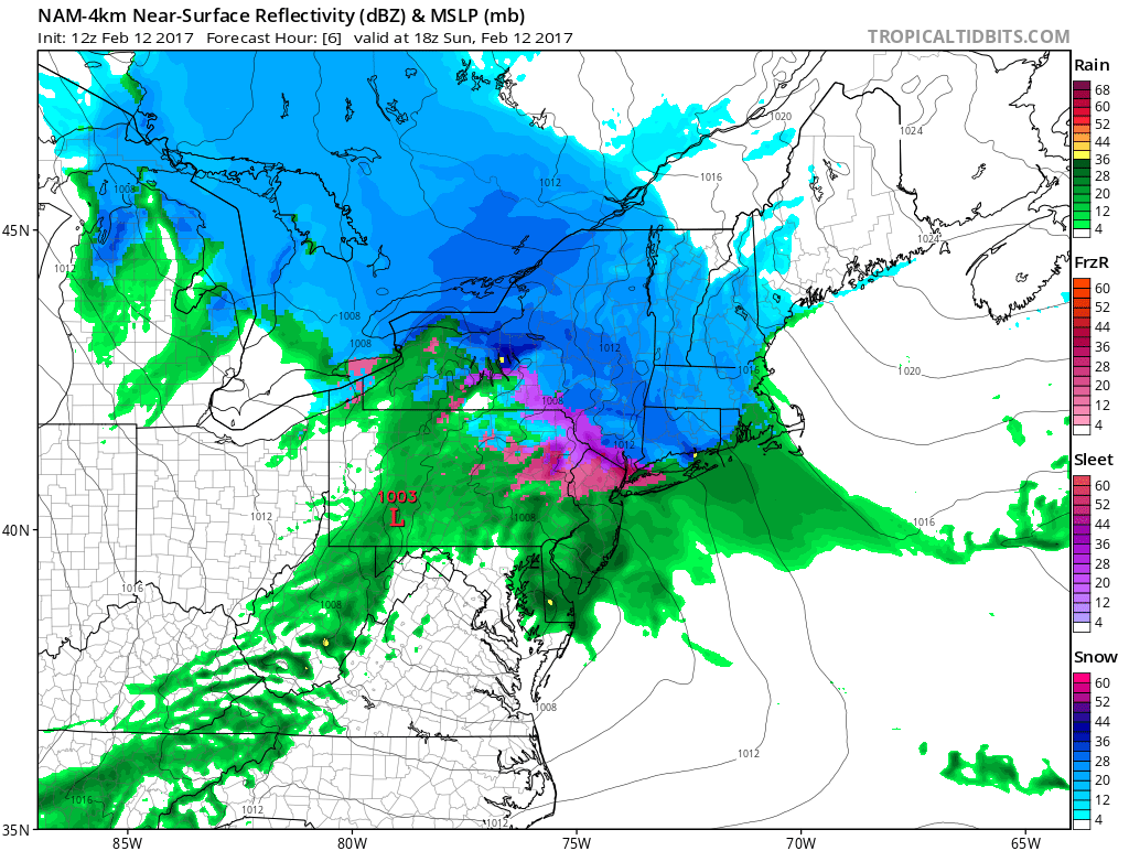
Low pressure currently over Western Pennsylvania will weaken, and as secondary low develops over Southern NJ/Delmarva. This storm system will try to push a warm front through the region. But it will likely stall south and west of NYC, as high pressure positioned over New Brunswick supports more cold-air damming with east-northeast winds over the region.
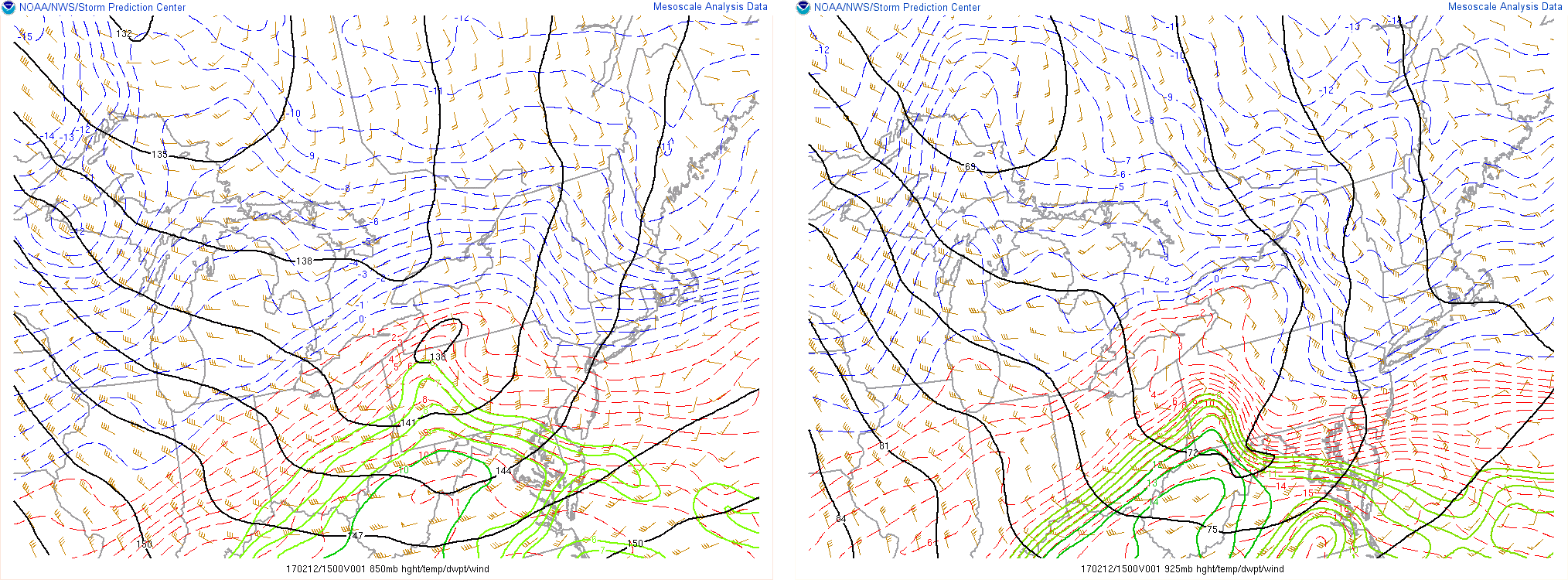
Some warmer-air has intruded this morning around 850mb the level or at several thousand feet in the atmosphere. But 925mb and surface temperatures are near or below freezing, north of this warm front. This will allow some snow, sleet and freezing rain to persist into early and mid-afternoon hours. Especially over the inland areas, where Winter Storm Warnings and winter weather advisories will remain in effect into the afternoon hours.
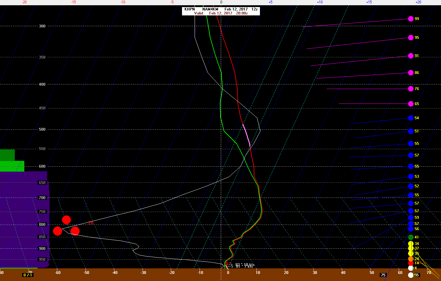
4km NAM skew-t sounding on bufkit showing freezing with warmer tounge aloft, 3pm at White Plains,NY
Over NYC and Long Island and nearby areas, enough warm off the ocean may bring surface temperatures above freezing and change to plain rain early this afternoon. But latest trends support some dynamic cooling with stronger lift and heavier precipitation. This may keep more snow, sleet or freezing rain for sometime into the afternoon here as well. This will be monitored closely with more individual zone and mesoscale updates possibly this afternoon.
We have little changes to our snowfall forecasts for the all the zones. Mid-levels may be warmer over Northern New Jersey this afternoon, resulting in more freezing rain to mix with snow or sleet. This will help reduce snowfall accumulations, but also lead to more icing and hazardous driving on roadways. More snow and sleet is likely to dominate further north over Lower Hudson Valley and Connecticut. Snowfall will be highest where precipitation mainly falls as snow today. Further south temperatures where temperatures have already warm into upper 30s and 40s, so mainly rain is expected. As low pressure moves away from the region, Any lingering precipitation will taper off to showers early tonight. Skies will later tonight, but winds will begin increasing our northwest, as low pressure intensifies.
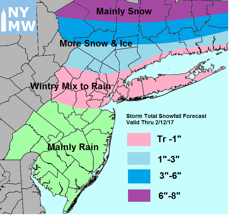
Snowfall Total Forecast Map for For Sunday
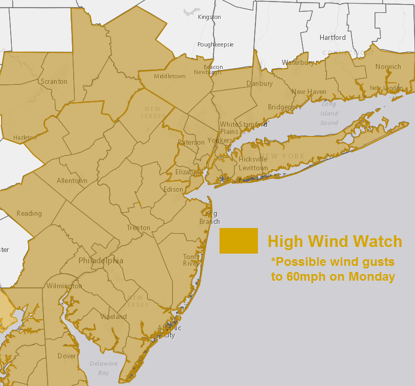
Then Monday will feature very windy conditions with mixture of sunshine and clouds, as the storm intensifies more east of New England. A tight pressure gradient and instability could cause frequent wind gusts between 40mph to 50mph. Some higher gusts between 50 to 60mph are also possible. Temperatures will likely be in the 30s most of the day. The National Weather Service has issued High Wind Watches for much of the region.
Tuesday will be calmer with weak high pressure over the region supporting lighter winds and more sunshine. Some snow or rain showers are possible late Tuesday night into Wednesday with a frontal system passing through the region. But models continue to show no phasing of northern and southern stream disturbance near the East coast. Temperatures will likely be near seasonal levels.
Stay tuned for full zone forecast updates later today and this evening.