-2")
2.13 PM Zones: Winds die down, tranquil weather returns
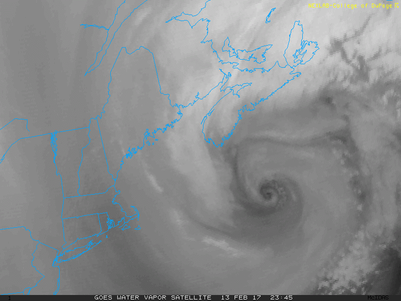
Whew! It has been an active few weeks around here. The weather pattern, which largely has been progressive and transient over the past several months, was quite active since the beginning of February. Multiple storm systems affected the area just within the past week, and wintry weather was fairly widespread, particularly in the interior and throughout New England. A strong coastal storm in the Gulf of Maine today is beginning its move east/northeastwards, and that move will loosen a pressure gradient over the area tonight.
This will result in diminishing winds as the evening goes on, although they will remain blustery. Cold northwesterly winds and cold air advection will continue, and temperatures will remain cold. Low temperatures tonight will fall into the teens and upper 20’s in the interior and remain quite cold even in the city and near the coast.
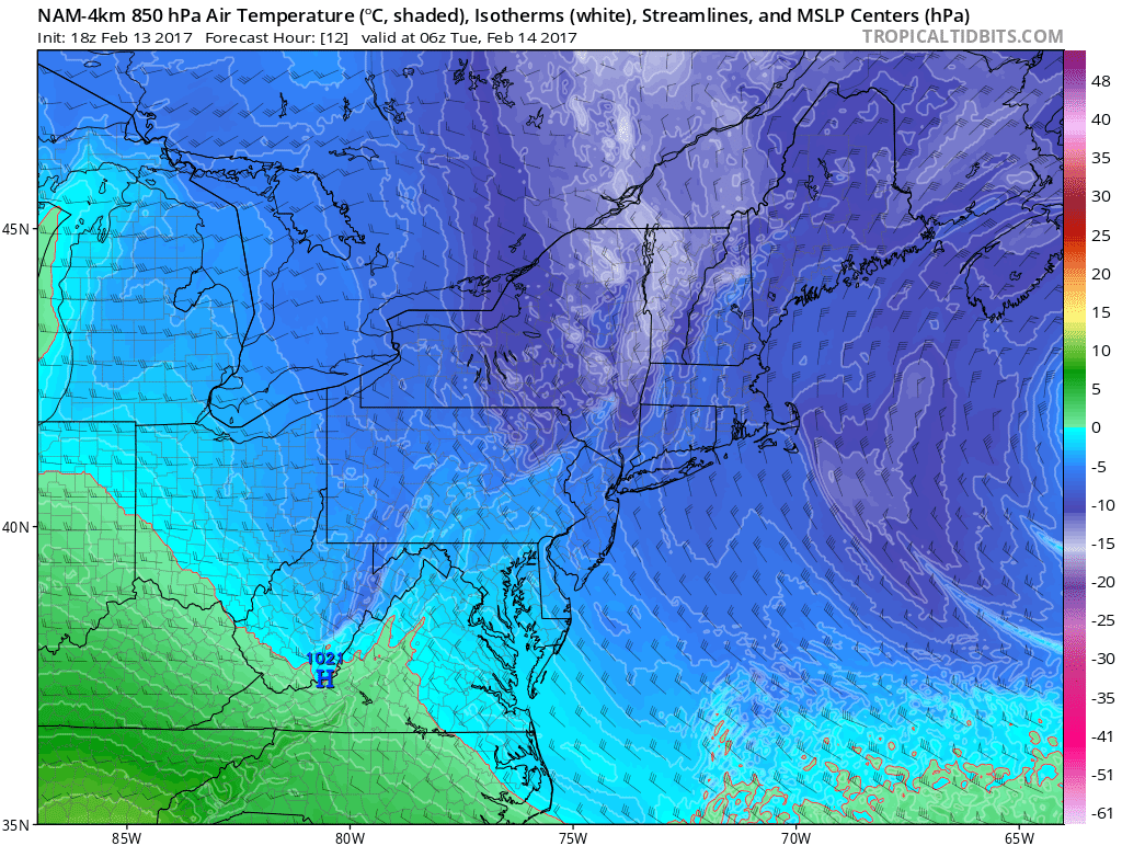
4km NAM model showing a cold airmasss with lighter surface winds overnight
More tranquil weather conditions are expected to take over during the week ahead. High pressure will build into the region on Tuesday, and while temperatures will moderate a bit, they are expected to remain near seasonal averages. The active jet stream will retreat, however briefly, with calm conditions and no precipitation impacts anticipated.
The next disturbance(s) arrive on Wednesday, and a “near miss” will occur in the mid levels of the atmosphere and at the surface. A potent and intense northern stream disturbance will surge southward from Canada through the Great Lakes, while a notable southern stream disturbance will glide eastwards through the Arlatex and into the Southeast States. These two disturbances will just barely miss phasing.
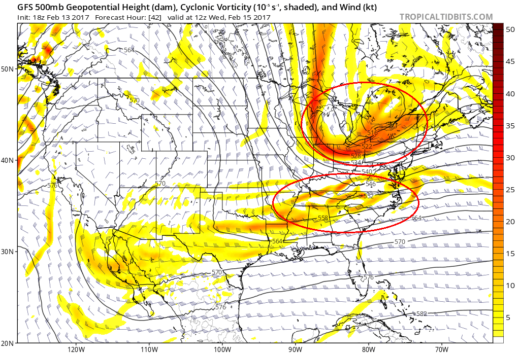
The GFS keeping both northern stream and southern stream disturbances separated on Wednesday
A phase would have created a much larger, powerful storm system which could have significantly impacted the region. Instead, the two will pass fairly harmlessly by, with the southern stream disturbance becoming sheared out over the Southeast coast. The northern stream energy will amplify over New England, bringing more wintry weather to Maine at the end of the week.
In the greater Northeast US, colder conditions will return as this disturbance passes with more cold air advection and the potential for snow showers. But a larger precipitation event appears highly unlikely at this time. Behind these two disturbances will come calm weather with moderating temperatures through the weekend ahead.