-2")
2/14 PM All Zones: Tranquil weather settles in
A barrage of disturbances which affected the area over the past several days has finally settled down, and high pressure has built into the area today. Blustery winds are also on the decrease, as a strong storm in the Gulf of Maine pulls well off to our east and northeast. One more disturbance will pass the area on Wednesday and Thursday, emanating from Canada and dropping into New England.
While the storm system could’ve been something more significant had it phased with a southern stream disturbance over the Southeast States, it will remain progressive and transient. The main effects from the system will come in the form of a cold front, which will sweep through the Northeast states late Wednesday into Thursday. More snow is anticipated in Maine as the system passes by.
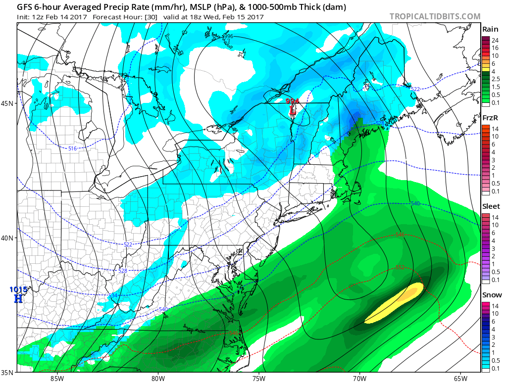
GFS model showing a cold front passing the region during the middle of the week.
The reinforcing shot of cold air will bring cooler temperatures and winds back into the forecast on Thursday, as the storm deepens to our north and east. But the cooler temperatures will be as transient in nature as the weather pattern is itself. Moderating temperatures will begin to become noticeable by the end of the week and even more so as we approach the weekend.
To our west, a large ridge over the West Coast will collapse eastwards over the Central Untied States. This will allow maritime and Pacific air to flood eastwards, leading to above normal temperature anomalies across the Central and Eastern United States from this weekend into next week. Moreso, arctic and wintry air will be on full retreat into Northern Canada during this time.
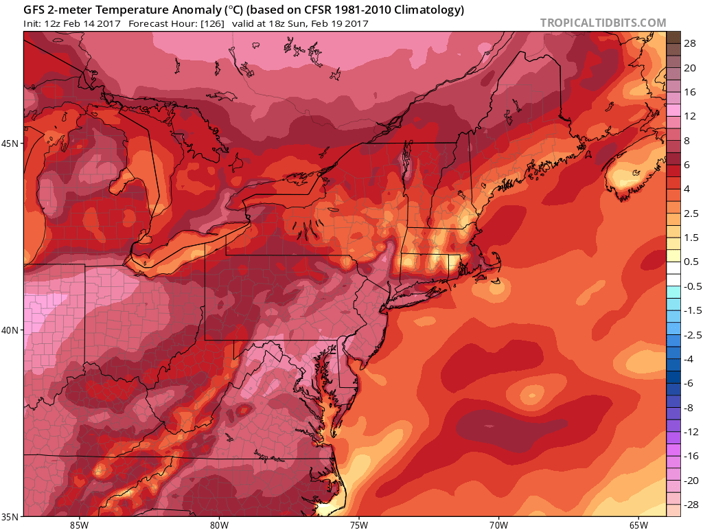
GFS Model showing very warm air building into the region by the weekend ahead.
The northern stream, which had remained very active for the past few weeks, will retreat with the arctic air as ridging builds into the United States during the 5 to 10 day period. This should lead to an overall downturn in notable atmospheric disturbances, and while some weaker disturbances are still possible, the overall weather will be warmer than normal and relatively quiet through this time.
Activity will likely pick up as we approach the 7-10 day time frame the pattern undergoing changes once again, but for now — enjoy the upcoming tranquil and warmer than normal weather ahead!