-2")
2/18 Noon All Zone Update: Very Mild Through Sunday…Cooler on Monday
A more pleasant and unseasonably mild afternoon is coming up with sunshine filtering through some high clouds . After a chilly start, temperatures are now rising quickly and will likely get mid-upper 50s to lower 60s over many parts of the region with more southwest winds this afternoon. Somewhat cooler temperatures in upper 40s to lower 50s, will be over extreme northern parts of Hudson Valley and Connecticut. Closer to coast, southwest winds off ocean and sound, may also keep temperatures in the upper 40s to lower 50s.
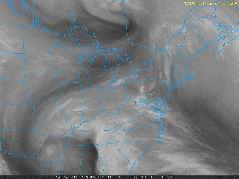
Some more clouds may be around this evening and overnight, from a weak cold front approaching from the north and a large disturbance passing well to the south. The airmass will be warmer than last night. But if skies remain clear enough and winds are light, temperatures may get well down into the lower to middle 30s over the Interior northern areas. Closer to the coast and over urban areas temperatures lows to tonight will likely range in upper 30s to middle 40s.
Then the weak cold front will push south through the region on Sunday. Temperatures will be cooler further north over the Hudson Valley and Connecticut, as colder air slowly comes behind this front. But more west-northwest downsloping winds will help temperatures rise to well above normal again in the mid-upper 50s to lower 60s over New York City, Long Island and much of New Jersey. Some locations, especially Central, Southern NJ and Southeast PA, may be even warmer with highs in the lower to middle 60s.
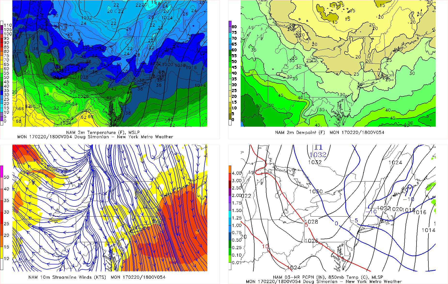
NAM model temperatures at 1pm Monday, after a cold front moves through the region
Then a stronger cold front will come through Sunday night and Monday. This front will likely come through region dry with lift and moisture very limited. But it will turn cooler for President’s Day Monday with more northerly winds. High temperatures will be closer to normal, in the lower to middle 40s for Monday and Tuesday.
However, the pattern will remain progressive for much next week. A shortwave trough and associated frontal boundary may produce some scattered showers around the region Tuesday night or Wednesday morning. But then another warming trending will begin, with a ridge building over the East later in the week. Temperatures could back well above normal with highs well into 50s or lower 60s on Wednesday and Thursday.
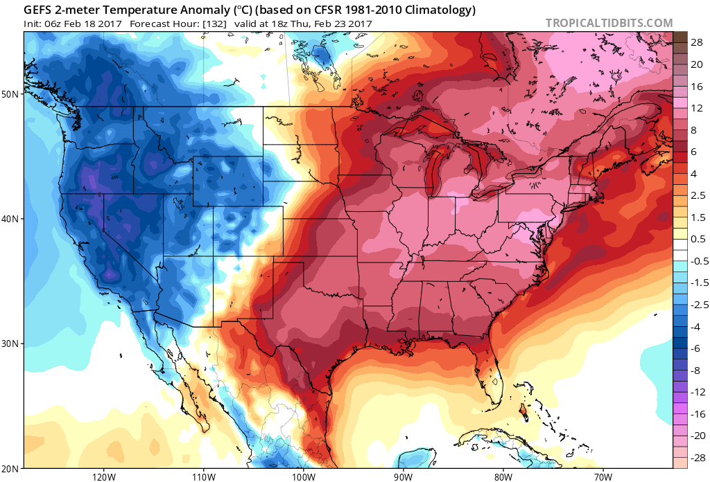
The GFS ensembles showing warmer than normal temperatures over the Eastern US on Thursday
Then model guidance indicates that northern and southern streams may phase into larger storm system for Friday or the weekend. But will likely be tracking to our west with more rainfall for the region, as some ridging and warmer temperatures remain over the Eastern US. Some colder weather may follow this storm to end the month, as a ridge begins building over the North Pacific and carves out a longwave trough over more country.
Check out the main dashboard for more discussion through the extended term. Then stay tuned for more zone forecast updates through the holiday weekend!