-2")
2.19 PM All Zones: Warmth today, noticeably cooler tomorrow
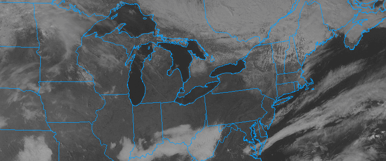
Unseasonably warm weather continues this afternoon throughout the area, with temperatures having risen well into the upper 50’s throughout the area. Temperatures in the lower 60’s have been quite common as well, especially across Southeastern Pennsylvania, New Jersey, and the New York City Metro Area. The warm temperatures and sunshine should continue over the next several hours with only some high and mid level clouds interrupting the sunshine.
Lingering to the northwest, however, is a stronger cold front associated with a mid and upper level trough over New England. This trough is associated with a northern stream atmospheric disturbance, which will sink from Southeast Canada into New England. This disturbance will suppress ridging over the area later tonight into Sunday. A cold front sides through the Northeast and brings cold air advection, ending the warmup temporarily.
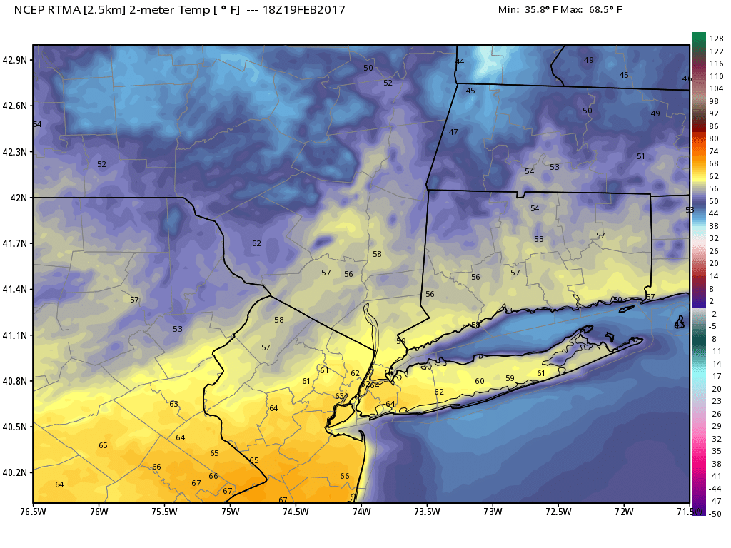
Temperatures early this afternoon were well above average in the lower 60’s.
Temperatures tonight will fall more towards seasonable averages and will stay there through Monday. While temperatures on Monday won’t necessarily be “cold” they may feel that way, especially when compared to the temperatures this afternoon and early evening. Temperatures 5000 feet above our head (about 800mb) will drop quite significantly from well above average to near or below average for this time of year.
The cold front itself is impressive, as well, with cold air advection and northwest winds continuing. Good radiational cooling conditions will then setup from late Monday afternoon into Monday evening. Temperatures will fall Monday Night into Tuesday morning near or below seasonal averages as clear skies and light winds continue.
The trend over the next week will be for a gradually warming atmosphere throughout the area with ridging building towards the region. There are very few significant precipitation events on the “Radar” so to speak, but some light showers and unsettled weather are possible on Tuesday afternoon and evening as a front moves through the area.
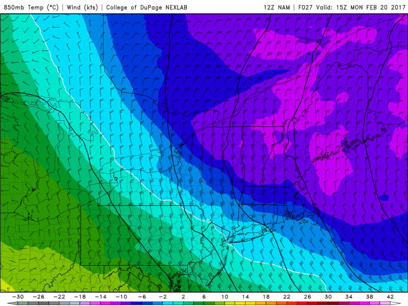
Temperatures aloft will get much colder on Monday.
Given the good cooling in the atmosphere ahead of the disturbance, there is the potential for some light wintry precipitation on the front end of the weak disturbance across the far interior.
Stay tuned for further updates on the workweek ahead — including multiple disturbances which may approach the area by next weekend.