-2")
2.20 PM All Zones: Warm, tranquil weather will continue
A warmer, tranquil weather pattern has settled into the Northeast US over the past several days, and despite a cooling trend over the past few days, the pattern is expected to generally continue. A cold front moved through the area last night, bringing cold air advection (movement of colder air), and the cooler air aloft quickly brought warm temperatures down towards average. Highs today were 10-15 degrees colder than yesterday in many areas.
The relatively normal temperatures will warm gradually over the next few days, while generally tranquil weather will also persist. Why the change? The answers lie in the Pacific Ocean. A changed pattern there has allowed disturbances, which were previously moving quickly eastwards towards our area, to remain much farther west and approach the U.S.A more slowly.
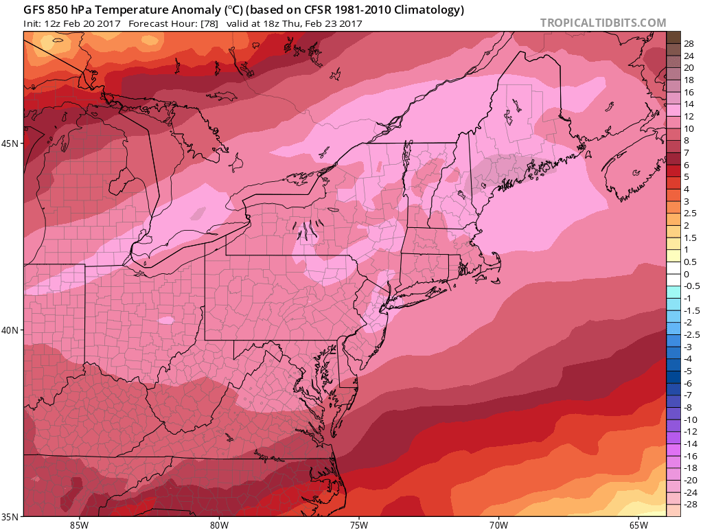
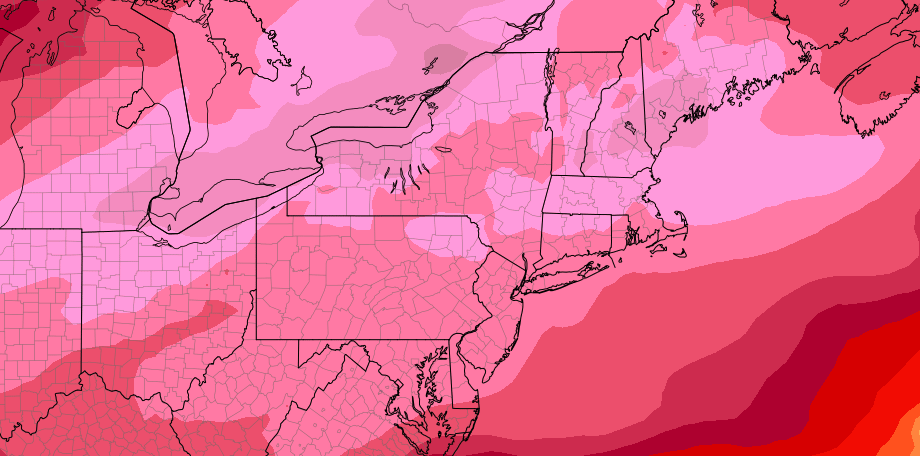
Forecast models suggest temperatures much warmer than normal moving over the area on Thursday!
The only disturbance approaching the area during the upcoming several days will be from late Tuesday Night into Wednesday. In the midst of a warming trend, a weak disturbance will shift northwards through the Great Lakes. Moisture from the system will be quite limited, but clouds and some showers are still possible from Tuesday Night into Wednesday. These will shift quickly eastwards with clearing and improving conditions again by Wednesday.
A westerly component to the wind will become established as a ridge builds over the area once again during the middle to latter part of this upcoming week. This will lead to rapidly warming temperatures aloft, which will become maximized towards the end of the week, particularly on Thursday. Very warm temperatures aloft will lead to warming at the surface and temperatures on Thursday, with sunshine, may approach the 60’s and even 70s (!) in some areas.
Where the warmest temperatures occur is still yet to be determined, but it appears likely that temperatures on Thursday will be well above average for this time of year. With the warmth continuing into the late part of this week, the question will become: When will the tranquil, warm pattern break? The answer may lie in a series of storms systems which look likely to impact the region beginning during the upcoming weekend.
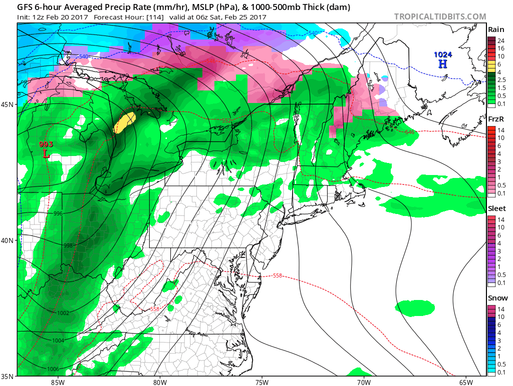
Forecast models are also suggestive of a changing pattern by next weekend, with more storm systems and cooler air approaching.
Forecast models suggest the Pacific pattern will change again by that time, allowing multiple disturbances to eject eastwards into the U.S.A. As these shift through the Central US and eventually Great Lakes, moisture will surge towards the East Coast by the weekend ahead. More significant precipitation, and a gradually cooling trend in temperature, is expected from this weekend into the early part of next week.
We’ll have more on the long range pattern in the upcoming few days, so stay tuned for an official long range post and details!