-2")
2/21 AM All Zones: Record Warmth Possible Thursday, Stormy Saturday?
Temperatures today will again be several degrees above normal for this of year. But some mid-high level clouds increasing out ahead of warm front approaching will likely keep highs a little lower then yesterday, in upper 40s to lower 50s.
Mostly cloudy skies are expected tonight, as the warm front and shortwave trough move through. Lift and moisture become more limited as they run into the upper-level ridging. But a few scattered light rain showers are still possible, especially northwest of NYC. Temperatures will likely only drop into the upper 30s to lower 40s tonight.
The more unseasonable warmth arrives again on Wednesday and Thursday, with rising mid-level heights and more west-southwest winds. Some cloud cover may be around each morning, with strong mid-level warm advection, enhancing more nocturnal low-level inversion.
But if clouds break for enough sunshine during afternoon hours, temperatures will likely be warmer than what most model guidance currently shows. We are looking at mid-level temperatures and southwest winds supporting temperatures well into the 60s in parts of region on Wednesday. Then a more west-southwest flow and higher mid-level heights and temperatures could support some record-breaking highs in the lower to middle 70s on Thursday.
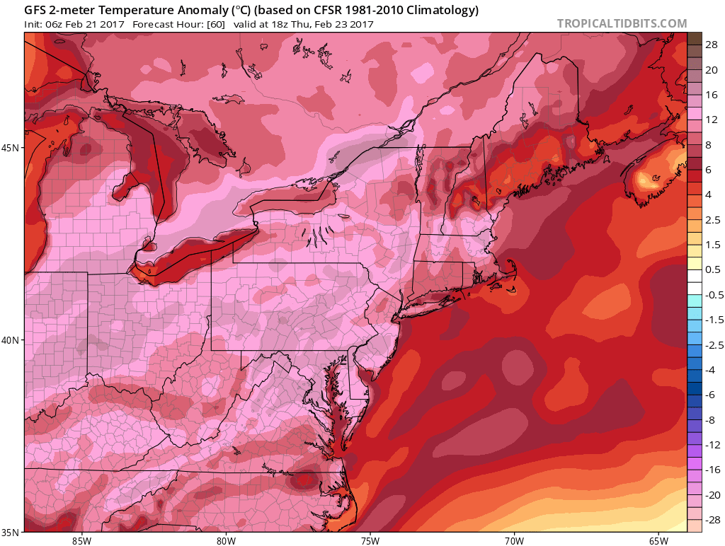
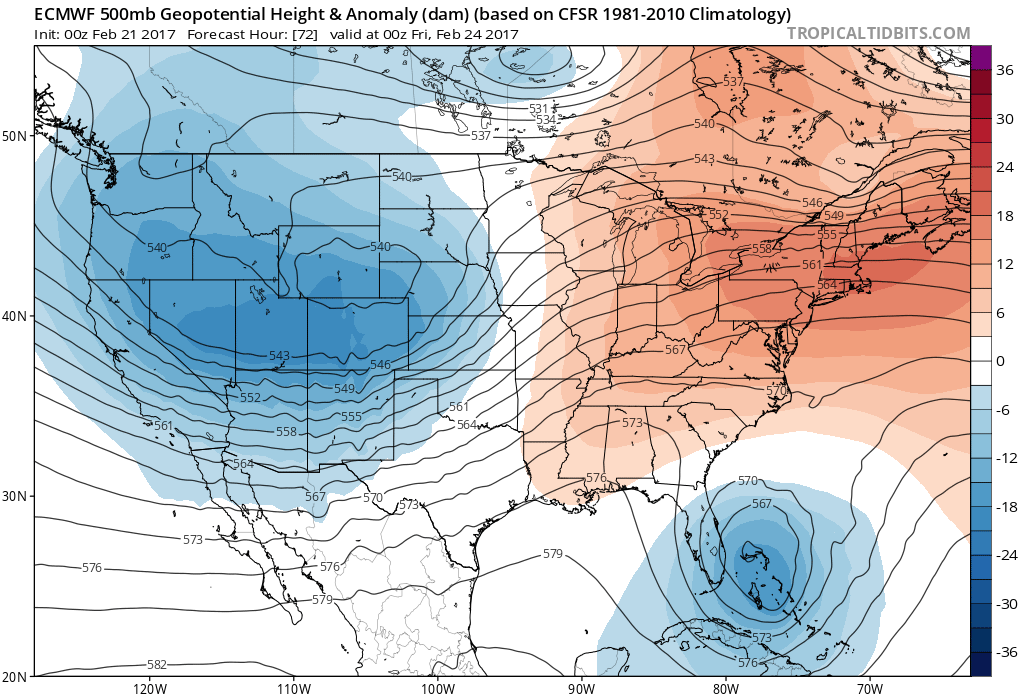
The GFS showing temperatures well above normal on Thursday afternoon
Then a larger storm system tracking into the Great Lakes, that could bring some heavy snow to parts of Upper Midwest and some severe weather over parts Ohio Valley, will begin to influence our weather. A warm front extending far east from this system will move through the region with some more clouds and showers possible on Thursday night into Friday morning.
Then the region will be the warm sector again with rising mid-level heights and southwest flow return by Friday afternoon. Temperatures may soar well back into the 60s or even lower to middle 70s again, with clouds likely breaking for some sunshine.
Saturday could also be unseasonably warm. But this storm system’s cold front will be arriving with more clouds and showers by the end of day. Best dynamics with this system will likely be northwest of region. But an upper-level jet, mid-level vorticity and some instability, along and ahead of this front, could still produce a low-topped convective squall line with at least some heavy downpours moving through region.
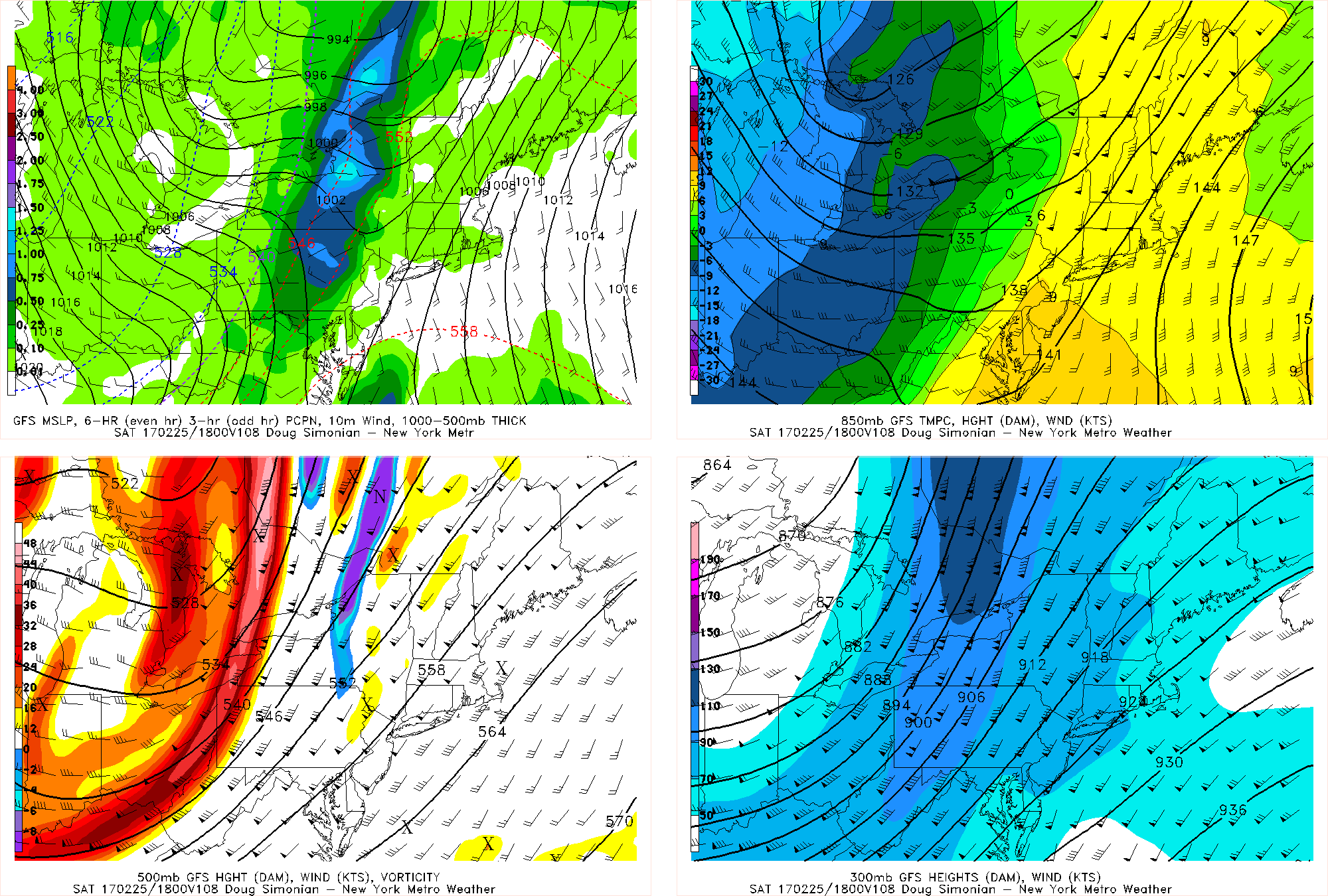
GFS model forecast for Saturday afternoon, showing strong 500mb vorticity and 300mb southerly jet enhancing a possible squall line over Central NY & PA
This system will exit the region with any lingering rain tapering off Saturday night. Then temperatures will likely return to closer to seasonably cold levels. Before another storm system could impact the region, with perhaps more wintry precipitation at least for the Interior, early next week. Stay tuned for another zone forecast update later this afternoon on the unseasonable warmth and the storm system on Saturday.