-2")
2/27 AM All Zones: Warming Trend, More T-Storms Wednesday, Friday Clipper
Happy Monday morning to you! High pressure, drifting off the Mid-Atlantic coast, will provide more pleasant and benign weather today. Sunshine will mix with more fair weather clouds this afternoon, but warmer than normal temperatures in the lower to middle 50s will return with southwest winds today — a big difference from yesterday’s northwest winds and cold air.
Clouds will gradually be on the increase tonight as a warm-air advection strengthens, well ahead of storm system tracking into Great Lakes. This will keep temperatures from dropping much overnight, without any good radiational cooling occurring. Mostly cloudy skies are expected to remain in place through Tuesday as the atmosphere remains unsettled. Enough low-level moisture may be around for some light showers or drizzle during the afternoon.
The weather will remain unsettled as the week goes on, with more scattered showers likely Tuesday night into Wednesday morning, as a warm front and mid-level disturbance moves through the region. There might be enough elevated instability for some isolated thunderstorms with heavy downpours. Temperatures will remain steady in or slowly through the 50s.
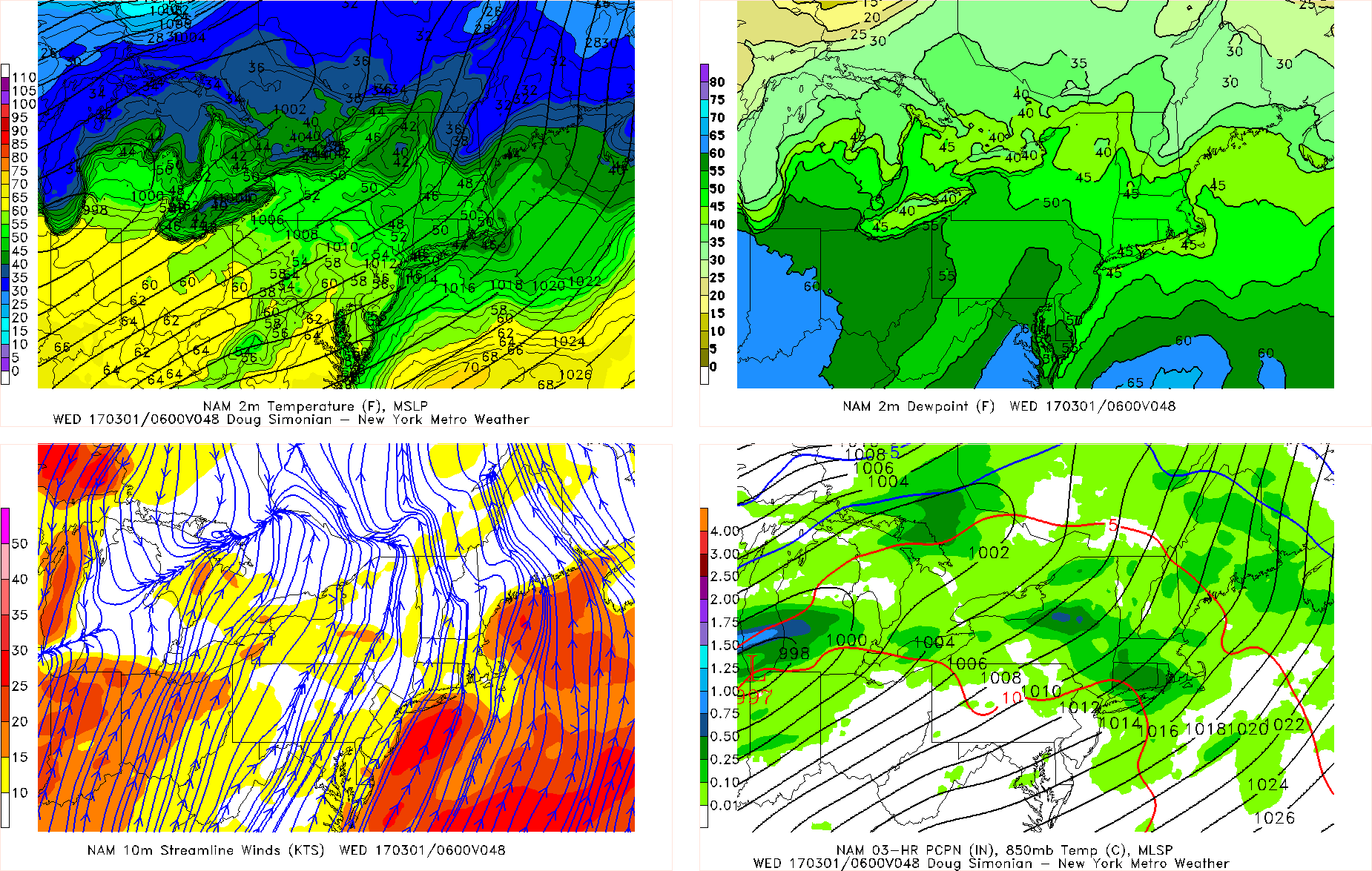
The NAM model for Tuesday night showing showers in the region with the warm front
More subsidence behind the warm front and a mid-level disturbance may cause skies to clear with some sunshine during the afternoon hours on Wednesday. If this happens, temperatures will rise well into the 60s and low to middle 70s across much of the region, with a strong, deep southwest flow. Parts of Long Island and Connecticut may remain somewhat cooler with winds off the ocean and sound.
The airmass will also become more moist and unstable, with dewpoints increasing into upper 50s and lower 60s. Model soundings also indicate a weak EML/cap with some steep mid-level lapse rates moving over the region. This could help trigger some more showers and thunderstorms during the late afternoon and evening hours on Wednesday, as strong cold front approaches. Strong, deep-layered shear will support the potential for more organized strong to severe thunderstorms with gusty winds. Stay tuned for another post later today with more details on this threat.
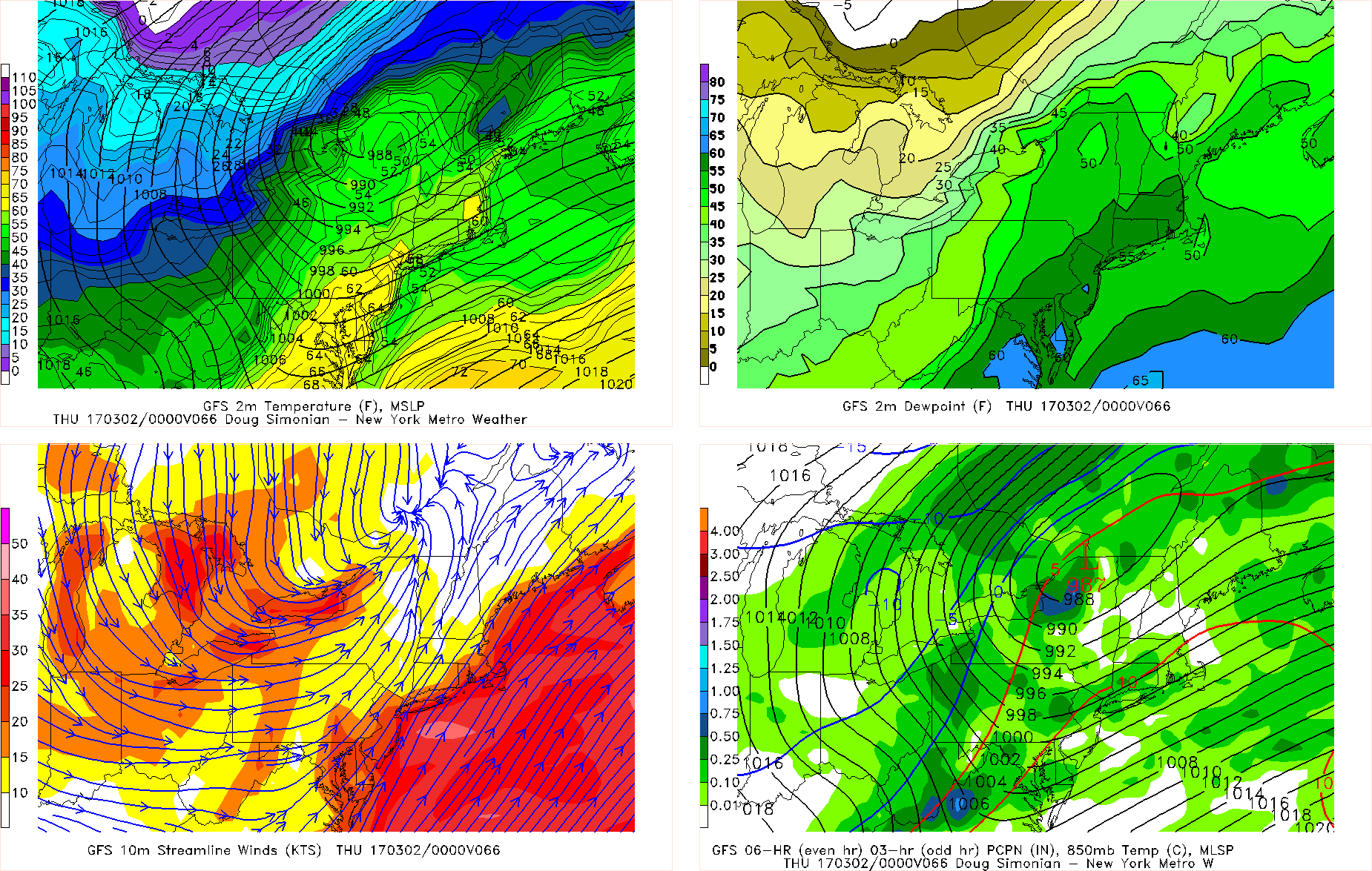
GFS model showing very mild temperatures and showers and possible thunderstorms, ahead of a approaching cold front late Wednesday afternoon and early evening
The cold front will move through region late Wednesday night and Thursday morning with unsettled conditions expected to continue. Then it will turn colder and drier later Thursdaywith increasing northwest winds. A tight pressure gradient and steep low-level lapse rates could cause winds to gust over 40mph on Thursday.
A clipper tracking over the Northeast or Mid-Atlantic region could bring some light snow or mixed precipitation on Friday. But there is some uncertainty with the exact track of system and surface temperatures supporting any snow accumulation, especially near the coast.
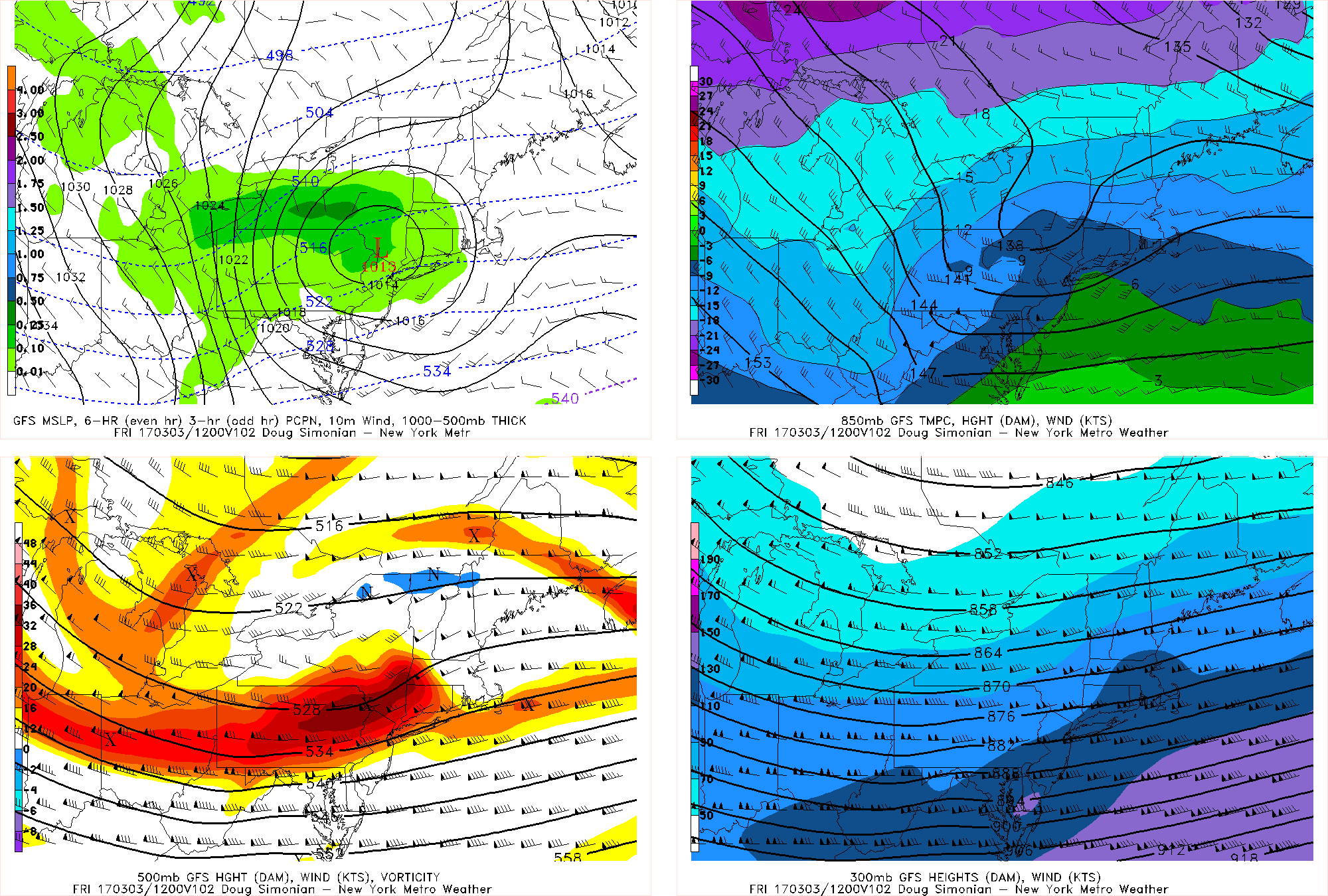
GFS model showing the low pressure and shortwave with a clipper just tracking to the north of NYC on Friday afternoon, which would keep more precipitation over northern areas.
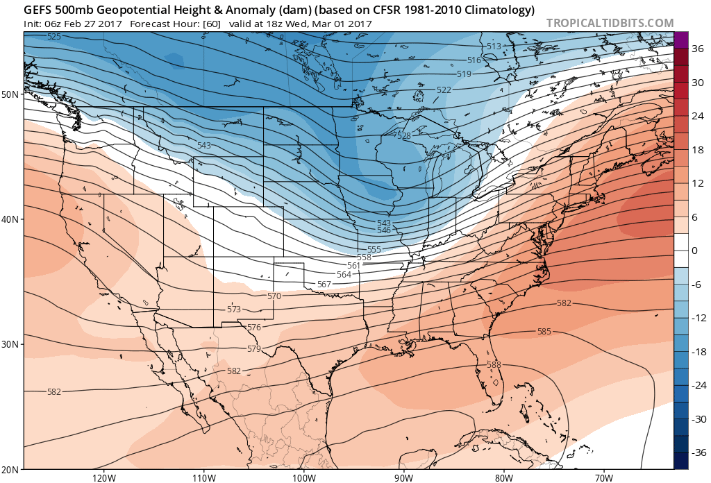
At this time, next weekend is looking more tranquil with more high pressure building into the region. Temperatures may be colder on Saturday and then moderate back above normal on Sunday, as more zonal heights return over the CONUS. But some high-latitude blocking and ridging out west may cause more wintry weather to return next week! Stay tuned for more updates this week!