-2")
3.1 Zones 4/5/6 (SE PA, S/C NJ) Severe Weather Update
A low pressure system will drive into the Great Lakes today, with warm air surging into the region from the southwest. This warm air has already arrived, with temperatures much above normal for this time of year. As a cold front moves towards the region later today and tonight, the combination of this warm air and plenty of wind shear in the atmosphere will lead to the potential for strong and severe thunderstorms. The wind shear in particular is impressive and could lead to the potential for strong, damaging winds in thunderstorms.
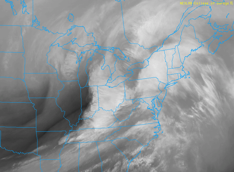
Much of what occurs in terms of severe weather, however, is highly dependent on thunderstorm complexes which have moved towards the area this morning from yesterdays severe weather event in the Ohio Valley. These will continue to shift east/northeast through the region from this morning into the early afternoon hours. Forecast models insist that the complexes will track over Northeast PA, Northern NJ, NYC and CT. This will significantly inhibit the development of instability in those areas.
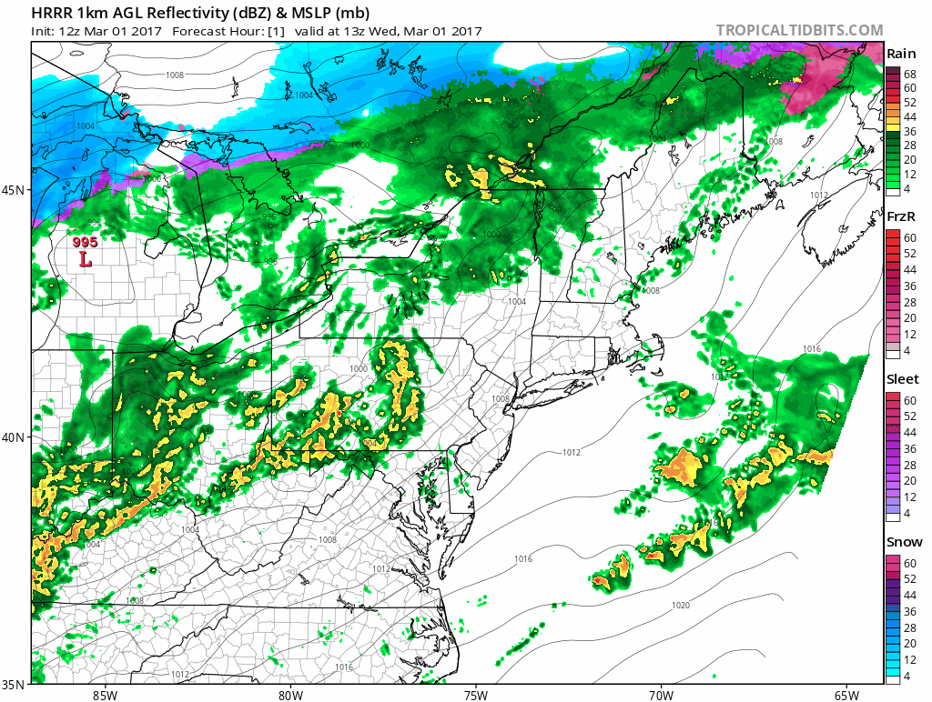
12z HRRR showing convective complex moving through the region today and tonight
Further south, however, over our zones in Southeast PA, Southern and Central NJ — as well as much of the Mid Atlantic States — more instability is expected to develop in the atmosphere. Models suggest instability could become moderate by the mid afternoon hours, with a complex of storms forming over Southeastern Pennsylvania at that time. As this occurs, wind fields will begin to increase and support storm organization.
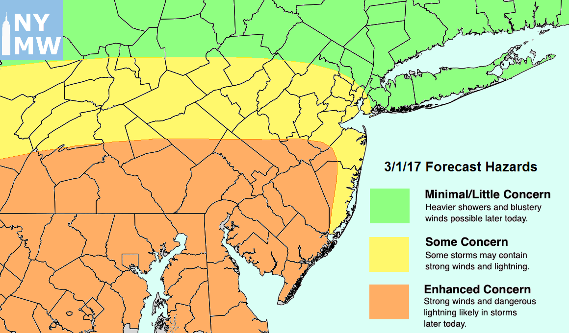
Anticipated hazards for Potential Severe T-storms Today around the region.
Complexes of storms should develop from Southeast PA into NJ and the Mid Atlantic from late afternoon into the early evening hours, with the main threat remaining damaging wind gusts, lightning, and heavy rain. There will also be the potential for an isolated tornado or two. This may be particularly true over Southeast PA and Central NJ, where a weak or diffuse secondary warm front is forecast by some high resolution models to develop. These warm fronts can often serve as a secondary maxima of backed winds near the surface and in the low levels of the atmosphere, enhancing rotation.
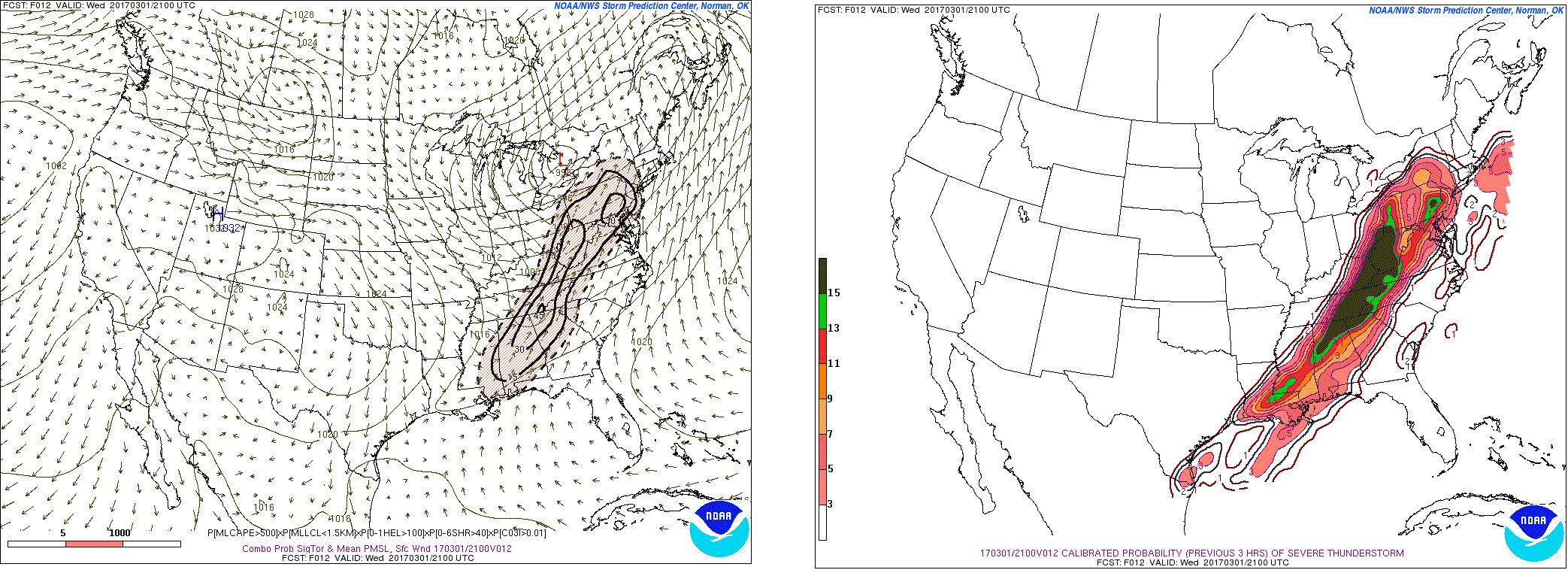
9z SREF showing showing highest probabilities for severe thunderstorms and isolated tornadoes for Southeast PA into Central/Southern New Jersey
Gradually, the threat for severe weather will shift southeast through these zones during the afternoon and early to mid evening hours. The main complex of storms will move offshore, shifting through Southeast NJ (Atlantic City and Cape May) during the early to middle evening, and then offshore. Cooler and more stable air will move into the area behind the storm complex.
Again — it is important to rehash the fact that the forecast remains uncertain. Over the next few hours, our forecasters will be continually monitoring upstream weather developments including the progression of clouds, showers and decaying storm complexes. These will all have critical impacts on the forecast. Stay tuned for further updates late this morning and early afternoon!