-2")
3/02 All Zones Update: More Winter-Like Weather Closes out the Week
Happy Thursday to you all! More sunshine is expected throughout the area today, behind a cold front which moved through last night. Temperatures this morning are slowly falling out of the 50’s. A tight pressure gradient will allow for very windy conditions to continue, with frequent wind gusts between 40 to 50mph likely and a few higher gusts up to 60mph possible. The National Weather Service has issued High Wind Warnings in most of our area for these winds, which may cause some trees, power lines and other unsecured structures to come down.
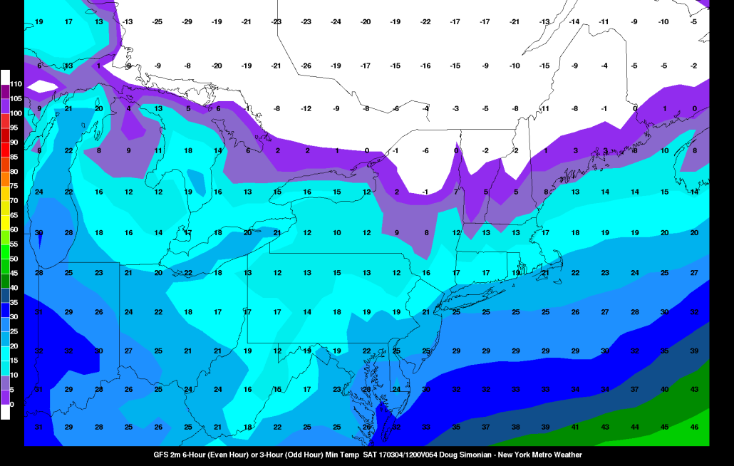
The winds gradually diminish this afternoon and evening as the pressure gradient weakens. Temperature remain steady or in some cases slowly fall through the 40s and 30s through the evening. Skies will be mostly clear overnight with temperatures dropping into the 20s to lower 30s across the region.
After some sunshine Friday morning, clouds will increase by the afternoon hours, with high temperatures in the upper 30s to lower 40s. A clipper system we’ve been watching this week, will remain weak and pass well to the south, as the shortwave trough associated with this system remains de-amplified. Some lift and instability — associated with mid level vorticity, a weak surface trough and steep low to mid-level lapse rates — could help trigger some scattered snow showers, especially Friday afternoon. More isolated, heavier snow squalls are also possible with reduced visibilities and light snow accumulations under 1”.
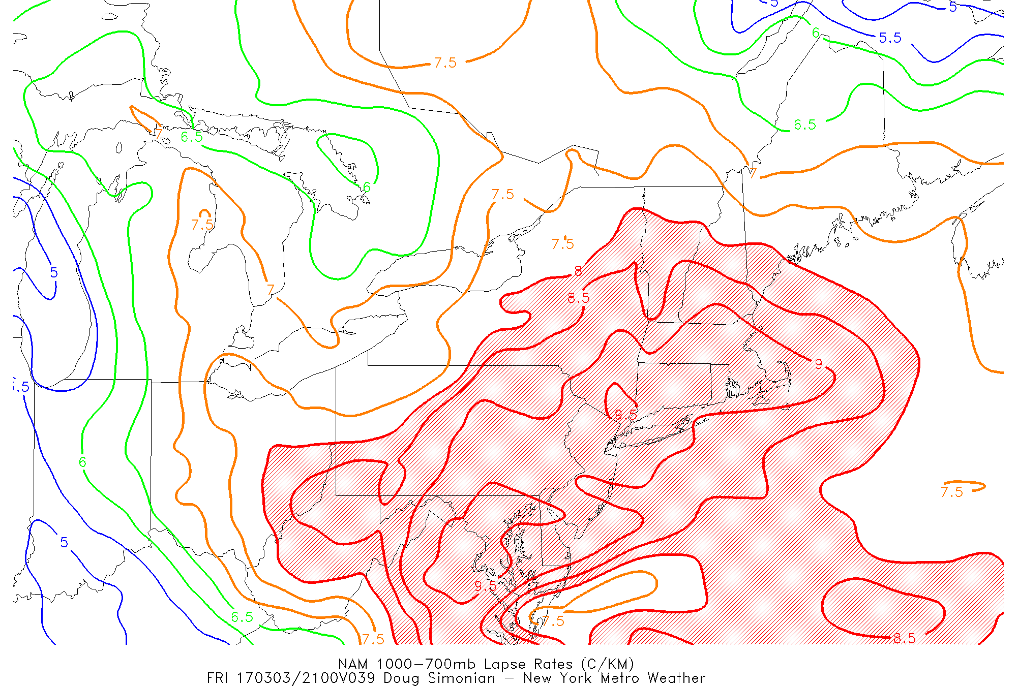
NAM showing an unstable airmass with very steep low-level lapse rates Friday afternoon
Then another taste of winter returns Friday night and this weekend with a polar airmass moving into the region. Mainly fair and dry weather is expected, but high temperatures on Saturday will only reach in the upper 20s to lower 30s. Overnight lows Friday and Saturday nights could drop down into the teens and lower 20s. It now appears this airmass will be slower to leave, before warm-air advection increases by Sunday night. So temperature may remain several degrees below normal on Sunday, perhaps with highs still not getting above 40.
On Monday and Tuesday, a mid-level ridge will start building over the region in response to larger upper-level trough moving into the Central United States. Temperatures should rise gradually to above normal at least into the upper 40s or 50s by Monday or Tuesday with a more established southwest flow. Mostly dry weather is expected until the upper-level trough and frontal system approaches the region later Tuesday into Wednesday. More moisture and stronger dynamics with this system might lead to some significant rainfall during this period.
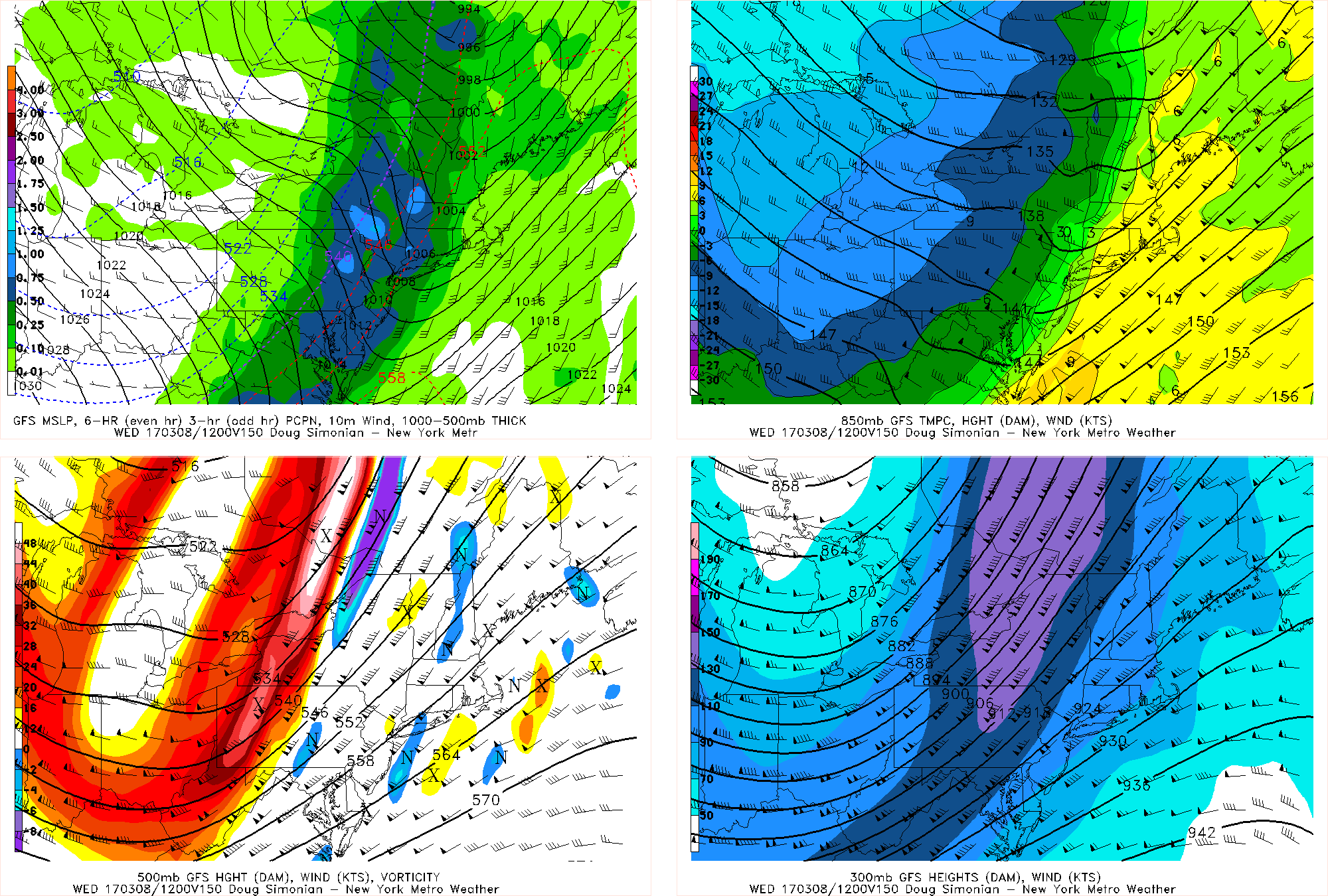
GFS model forecast for Tuesday night into Wednesday morning showing strong shortwave energy and upper-level jet moving through the Northeast.
Colder weather may return again later next week, as some ridging over Greenland forces some lower heights or troughiness to remain over the Northeast. However, the weather pattern in the Pacific Ocean continues to mitigate any prolonged below normal temperatures or large winter storm potential for much of the Northeast and Mid-Atlantic region. Stay tuned for more updates the extended-term and long-range coming soon.