-2")
Mid March may offer more wintry potential in Northeast
A happy Saturday afternoon to you all! We enjoy the weekends particularly because we often can take some time to dive into the details of more complicated discussion. In this case, we don’t have to look much further than the medium range weather pattern to find a complicated, convoluted evolution in the atmosphere. Over the next few weeks, the pattern will be changing quite dramatically in the higher latitudes — or the latitudes near the arctic and polar regions.
Blocking ridges of high pressure, more affectionately known as “blocks”, are forecast by multiple models and ensembles to develop — both on the Pacific and the Atlantic sides. The Atlantic blocking, from Greenland into Northern Canada, is the most significant for residents of the Northeast United States. Exactly how this blocking develops will determine when and where opportunities for cold and snow will arise.
These blocks are critically important to the forecast for multiple reasons. But most importantly, they disrupt the wave pattern in the hemisphere at high latitudes and force that colder air, which normally resides over the arctic and polar regions to move further south into Canada and often the Northern 1/3 of the USA. In addition, they can send polar and arctic disturbances southward which often cause winter storms.
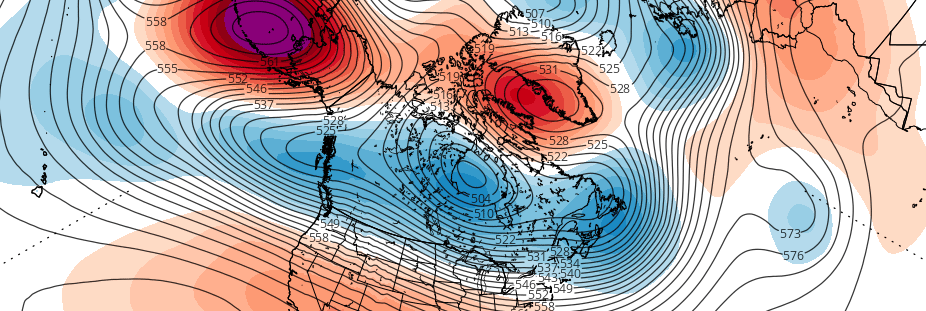
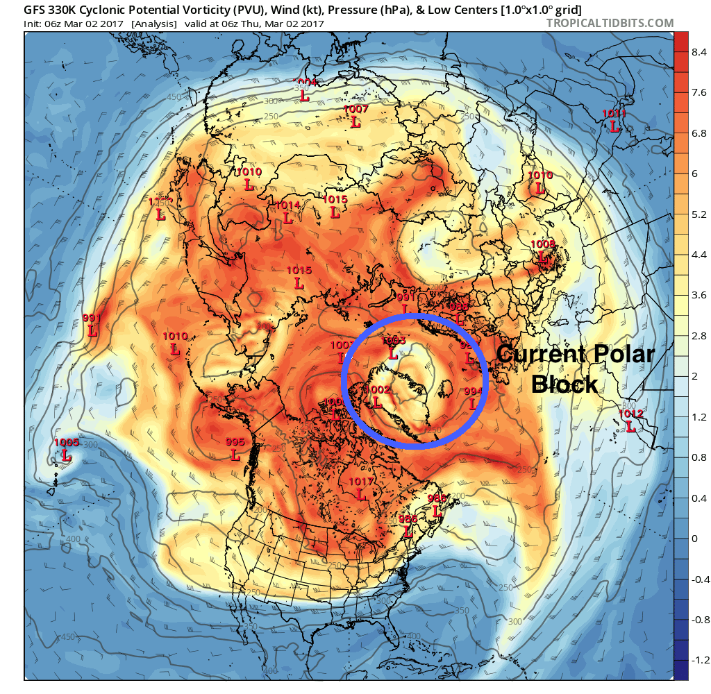
Much of what is occurring as we speak has a lot to say in regards to how things will evolve over the next few weeks. Blocking high pressures and ridging over Greenland, extending northward and encompassing the polar high latitudes, has already developed as of today. This is noteworthy and obvious polar block which is affecting the height pattern throughout the Northern Hemisphere. In fact, it helped to amplify/worsen the shot of cold air which is over the Northeast US today.
GFS model showing the block over Greenland currently.
This block will eventually weaken over the next few days. But its occurrence will have been the first step in a process that will encourage further high latitude blocking over the Atlantic and Canadian side of the pole. The initial block today helps to amplify a storm into Southeast Canada in a few days — and that storm being more amplified helps to bring higher heights back into Greenland and even westward towards the Davis Straight. This is significant because the entire height pattern in Canada is then dramatically adjusted yet again.
Here, forecast models begin to diverge on exactly how things will behave. But here’s the thing: It doesn’t necessarily matter at this juncture. NAO forecasts aren’t going to lead you in the right direction; they are just numbers which are derived from an algorithm. Of course there is going to be a huge spread in the numbers at this juncture with a high latitude ridge forecast to develop.
What we need to recognize, instead, is the idea that the forecast models are trying to convey to us. With ridging in Greenland and the Davis straight, the tropospheric polar vortex (cold air in the part of the atmosphere where our sensible weather occurs) is likely to be forced into Southeast Canada. This will leave plenty of cold air available to the north and allow for an active storm track into the Northeast Untied States. Additionally, it will slow the pattern down to allow multiple disturbances, from the northern and southern stream, to make their approach.
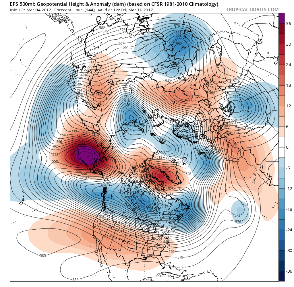
Euro Ensembles showing a block over Greenland and the Davis Straight in 5-7 days.
Exactly how things behave, where then blocking sets up, and how many disturbances actually approach our region? We still don’t know. But that’s not something we should be pushing to figure out at this juncture. Instead, it’s important to recognize and acknowledge the fact that the period of time near the middle of March looks increasingly likely to feature opportunities for cold and snow, especially in the Northeast United States. The details? We’ll start to figure them out as we get closer.
Now, one word of caution here: Don’t go gassing up your snowblower just yet. These types of patterns are fickle and can lead to many different types of evolution. Instead, take note that we are recognizing this period as one that holds higher potential than normal for snow and cold, especially for this time of year. And keep your eyes peeled for updates as we get closer.
Have a wonderful Saturday evening!